Area Overview for NR31 7AT
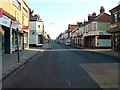
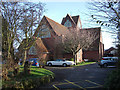
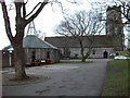
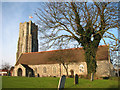
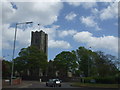
Photos of NR31 7AT


Area Information
Living in NR31 7AT offers a specific type of rural experience within a tightly defined residential cluster. This postcode covers an area of just 1.2 hectares, which explains why the local population stands at 1,589 people. Such a compact size means residents live quite close to one another, fostering a distinct sense of occasion for high-density living on a small scale. The community density reaches 132,656 people per square kilometre, indicating that every part of this small zone is actively occupied. You will find a neighbourhood where daily routines revolve around local footpaths and the immediate proximity of neighbouring homes. This specific cluster, identified by the NR31 7AT postcode, functions as a self-contained pocket of housing rather than a sprawling suburb. The limited land area creates a clear boundary between residential space and the wider countryside. Your daily life here is characterised by familiarity, as the small footprint ensures you never travel far for home. The area defines itself by its residential focus, avoiding commercial sprawl or industrial zones within its immediate perimeter. When you consider homes in NR31 7AT, you are choosing a location where the built environment is intensely concentrated within a very small geographical footprint.
- Area Type
- Postcode
- Area Size
- 1.2 hectares
- Population
- 1589
- Population Density
- 4910 people/km²
The housing stock in NR31 7AT is exclusively comprised of houses, with no apartments or flats available within this specific postcode. This uniformity suggests a market defined by single-family dwellings rather than multi-unit blocks. With 57% of the local population owning their homes, the area leans heavily towards an owner-occupied model rather than a private rental market. This statistic reinforces the idea that NR31 7AT is a residential zone where families establish permanent bases rather than temporary residences. When looking at homes in NR31 7AT, you should expect a traditional housing market where buying prices may compete with rental yield expectations in other parts of Norfolk. The small size of the overall estate limits the total supply of properties, which could influence availability and price fluctuations. Since the entire 1.2-hectare area is classified as houses, buyers seeking flats will need to expand their search to neighbouring postcodes. The high proportion of homeowners also hints at lower tenant turnover, potentially resulting in a quieter street life and greater neighbourly stability for prospective buyers viewing this area.
House Prices in NR31 7AT
Showing 54 properties
| Address | Type | Beds | Baths | Last Sale Price | Last Sale Date | |
|---|---|---|---|---|---|---|
| 59 Baliol Road, Gorleston, Great Yarmouth, NR31 7AT | Terraced | 3 | 1 | £90,000 | Jun 2025 | |
| 95 Baliol Road, Gorleston, Great Yarmouth, NR31 7AT | Terraced | 3 | 1 | £121,000 | Dec 2018 | |
| 112 Baliol Road, Gorleston, Great Yarmouth, NR31 7AT | Terraced | 3 | - | £102,995 | Oct 2015 | |
| 103 Baliol Road, Gorleston, Great Yarmouth, NR31 7AT | Terraced | - | - | £44,000 | Dec 2010 | |
| 72 Baliol Road, Gorleston, Great Yarmouth, NR31 7AT | Terraced | - | - | - | - | |
| 90 Baliol Road, Gorleston, Great Yarmouth, NR31 7AT | house | - | - | - | - | |
| 85 Baliol Road, Gorleston, Great Yarmouth, NR31 7AT | Terraced | - | - | - | - | |
| 76 Baliol Road, Gorleston, Great Yarmouth, NR31 7AT | Terraced | - | - | - | - | |
| 101 Baliol Road, Gorleston, Great Yarmouth, NR31 7AT | house | - | - | - | - | |
| 74 Baliol Road, Gorleston, Great Yarmouth, NR31 7AT | Terraced | - | - | - | - |
Energy Efficiency in NR31 7AT
Your daily convenience as a resident of NR31 7AT relies on a selection of retail and transport hubs located just outside the postcode boundary. For your weekly grocery shopping, you have access to Morrisons Daily, Tesco Lowestoft, and Iceland Gorleston on, all listed as nearby retail amenities within practical reach. These stores provide a comprehensive range of food and household goods without requiring a long journey into town. Transport links are supported by five nearby railway stations, including Great Yarmouth Railway Station, Berney Arms Railway Station, and Haddiscoe Railway Station. Connecting by rail allows you to access wider employment centres and leisure destinations beyond the local cluster. The combination of major supermarkets and multiple rail access points creates a lifestyle where you can enjoy rural living while maintaining easy access to services. You do not need to venture far to engage with the wider region or complete essential errands. This arrangement balances the quiet of a small residential area with the convenience of established commercial and transport networks nearby.
Amenities
Schools
Families residing in NR31 7AT have access to a mix of educational institutions tailored to different age groups. Primary education is provided by Stradbroke Primary School, which serves the younger children within the vicinity. For those requiring a second primary option, Stradbroke Primary Academy is available and holds a Ofsted rating of good. This rating offers reassurance regarding the quality of education provided at this specific academy. Once your children reach the later school years, East Norfolk Sixth Form College stands nearby to cater to older students seeking further education or vocational training. The presence of a sixth-form college close by means you do not need to travel far for post-GCSE education. This educational mix supports residents from early childhood through to adulthood, covering the gap between primary schooling and higher education. When evaluating schools near NR31 7AT, you find a functional network that includes both maintained primary schools and a larger sixth-form provider. The proximity of these facilities ensures that daily commuting to school is manageable for parents living in this postcode sector.
| Rank | School | Type | Entry gender | Ages |
|---|
Explore more schools in this area
Go to Schools tabDemographics
The community profile in NR31 7AT reflects an established demographic settled for the medium to long term. The median age across the area is 47 years, suggesting a population that has put down roots and is likely in the middle of their careers or retirement planning. Data shows that adults between 30 and 64 years old form the most common age range, creating a stable workforce and family unit base. House ownership plays a central role in this community, with 57% of residents owning their homes outright or with a mortgage. This majority ownership rate points towards a non-transient population less likely to move frequently compared to rental-dominated areas. The predominant ethnic group is White, which aligns with the broader patterns of many established English rural settlements. All accommodation in the NR31 7AT postcode consists of houses, meaning you will not find flats or apartments within this specific residential cluster. The area lacks significant deprivation metrics in the provided data, allowing you to focus on the solid demographic structure. This age profile and high homeownership rate indicate a neighbourhood where long-term planning and stability are the norms for living in this area.
Household Size
Accommodation Type
Tenure
Ethnic Group
Religion
Household Composition
Age
Household Deprivation
NS-SEC
Explore more demographic insights in this area
Go to Demographics tabPlanning
Planning Constraints
- Flood RiskPremium
- Ramsar Wetland SitesPremium
- Area of Outstanding Natural BeautyPremium
- Protected Nature ReservePremium
- Protected WoodlandPremium