Area Overview for NR31 7QJ
Photos of NR31 7QJ
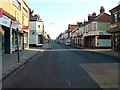
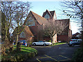
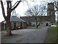
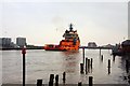
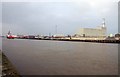
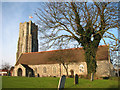
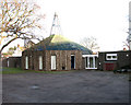
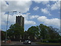


100 photos from this area
Area Information
Key information about the NR31 7QJ including its size, population, and administrative classification.
- Area Type
- Postcode
- Area Size
- 2.3 hectares
- Population
- 1588
- Population Density
- 6165 people/km²
House Prices in NR31 7QJ
53
Properties
£75,179
Average Sold Price
£37,500
Lowest Price
£120,000
Highest Price
Showing 53 properties
| Address | Type | Beds | Baths | Last Sale Price | Last Sale Date | |
|---|---|---|---|---|---|---|
| 38 University Crescent, Gorleston, Great Yarmouth, NR31 7QJ | Flat | - | - | £103,000 | Oct 2022 | |
| 57 University Crescent, Gorleston, Great Yarmouth, NR31 7QJ | Flat | 2 | 1 | £83,500 | Feb 2018 | |
| 59 University Crescent, Gorleston, Great Yarmouth, NR31 7QJ | Flat | 2 | 1 | £82,000 | Mar 2016 | |
| 22 University Crescent, Gorleston, Great Yarmouth, NR31 7QJ | Semi-detached | - | - | £120,000 | Jun 2011 | |
| 45 University Crescent, Gorleston, Great Yarmouth, NR31 7QJ | house | - | - | £110,000 | Jul 2004 | |
| 37 University Crescent, Gorleston, Great Yarmouth, NR31 7QJ | Semi-detached | - | - | £55,610 | Sep 2003 | |
| 36 University Crescent, Gorleston, Great Yarmouth, NR31 7QJ | Flat | - | - | £42,000 | Oct 2002 | |
| 71 University Crescent, Gorleston, Great Yarmouth, NR31 7QJ | Terraced | - | - | £37,500 | May 1996 | |
| 41 University Crescent, Gorleston, Great Yarmouth, NR31 7QJ | Semi-detached | 3 | 1 | £43,000 | Feb 1995 | |
| 73 University Crescent, Gorleston, Great Yarmouth, NR31 7QJ | Terraced | - | - | - | - |
Page 1 of 6
Energy Efficiency in NR31 7QJ
Amenities
Schools
| Rank | School | Type | Entry gender | Ages |
|---|
Explore more schools in this area
Go to Schools tabDemographics
Household Size
One person
most common
Accommodation Type
Houses
most common
Tenure
34
majority
Ethnic Group
White
most common
Religion
N/A
most common
Household Composition
N/A
most common
Age
47
median
Adults (30-64 years)
most common
Household Deprivation
N/A
with no deprivation
NS-SEC
15
in Lower managerial occupations
Explore more demographic insights in this area
Go to Demographics tabPlanning
Planning Constraints
- Flood RiskPremium
- Ramsar Wetland SitesPremium
- Area of Outstanding Natural BeautyPremium
- Protected Nature ReservePremium
- Protected WoodlandPremium