Area Overview for NR29 5FF
Photos of NR29 5FF
Area Information
NR29 5FF covers a small residential cluster spanning 1.6 hectares. You can expect a quiet neighbourhood with a population of 1553 people. This specific postcode represents a focused community rather than a sprawling district. Residents here enjoy lower density living compared to many urban centres. The area functions as a tight-knit environment where neighbours likely know each other by name. Daily life revolves around the immediate surroundings and nearby towns. This locality offers a distinct alternative to high-density housing markets. You are looking at a site where space and proximity coexist without urban chaos. The compact nature of this 1.6 hectare footprint means essential services are often just a short drive away.
- Area Type
- Postcode
- Area Size
- 1.6 hectares
- Population
- 1553
- Population Density
- 81 people/km²
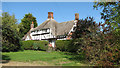
Property life in NR29 5FF is defined by stability. Eighty-two percent of the housing stock is owner-occupied. This statistic highlights a market dominated by homeowners rather than landlords or investors. Houses are the primary accommodation type found within this 1.6 hectare site. If you are seeking a traditional family home, this area aligns with your needs. The high ownership rate suggests residents have put down roots rather than renting temporarily. This environment supports buyers looking for permanent security rather than short-term rentals. You will not find student accommodation or large blocks of flats dominating the landscape. The market reflects a community that has invested significantly in their local properties.
House Prices in NR29 5FF
Showing 6 properties
| Address | Type | Beds | Baths | Last Sale Price | Last Sale Date | |
|---|---|---|---|---|---|---|
| 1, Warblers Yard, Back Lane, Rollesby, NR29 5FF | Detached | 4 | 3 | - | - | |
| Harriers Barn, Warblers Yard, Back Lane, Rollesby, NR29 5FF | barn | 4 | 2 | - | - | |
| Jenny Wren, Warblers Yard, 2 Back Lane, Rollesby, NR29 5FF | Bungalow | 4 | 3 | - | - | |
| Kemps Farm, Back Lane, Rollesby, NR29 5FF | house | - | - | - | - | |
| Caravan At Harriers Barn, Warblers Yard, Back Lane, Rollesby, NR29 5FF | Mobile Home | - | - | - | - | |
| 3, Warblers Yard, Back Lane, Rollesby, NR29 5FF | Bungalow | - | - | - | - |
Energy Efficiency in NR29 5FF
Daily convenience for residents of NR29 5FF centre on a small but functional set of amenities. Retail options include three Co-operative stores, specifically the East of England Co-operative and Co-op Kings. These three retail outlets satisfy basic shopping requirements without needing to travel far. A railway connection exists nearby through Acle Railway Station. This rail link provides access to wider transportation networks beyond the immediate residential cluster. This limited but specific amenity profile means your daily errands are manageable. You have essential goods and a transport hub within practical reach. The lifestyle here relies on the reliability of these established services rather than a wider variety of leisure or dining venues.
Amenities
Schools
Education options for children living in NR29 5FF are clear and established. Rollesby Primary School operates within the immediate vicinity of this postcode. This institution functions at the primary level. It holds a Good Ofsted rating. This single primary option dictates the school choice for families residing in this area. There are no secondary schools listed within the immediate data for this specific cluster. Residents sending their children to secondary education will likely need to look to neighbouring towns or larger clusters outside this 1.6 hectare boundary. The presence of a Good-rated primary school remains a significant practical factor for parents choosing homes in NR29 5FF.
| Rank | School | Type | Entry gender | Ages |
|---|
Explore more schools in this area
Go to Schools tabDemographics
The community within NR29 5FF reflects a mature demographic profile. The median age stands at 47 years. Most residents fall into the 30 to 64 year age range. This age distribution suggests a household composed of established adults rather than young families or retirees. Home ownership is high here, with 82% of homes occupied by owners. You will find very few private renters within this specific boundary. Houses form the predominant accommodation type in this zone. The ethnic composition is predominantly White. This demographic structure indicates stability and long-term settlement. People in their fifties and sixties make up the bulk of the current resident base.
Household Size
Accommodation Type
Tenure
Ethnic Group
Religion
Household Composition
Age
Household Deprivation
NS-SEC
Explore more demographic insights in this area
Go to Demographics tabPlanning
Planning Constraints
- Flood RiskPremium
- Ramsar Wetland SitesPremium
- Area of Outstanding Natural BeautyPremium
- Protected Nature ReservePremium
- Protected WoodlandPremium