Area Overview for NR29 5EA
Photos of NR29 5EA
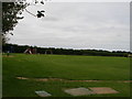
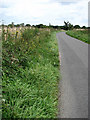
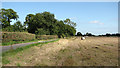
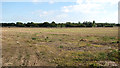
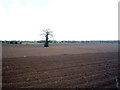
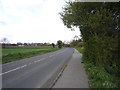
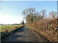
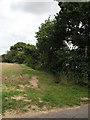
21 photos from this area
Area Information
Key information about the NR29 5EA including its size, population, and administrative classification.
- Area Type
- Postcode
- Area Size
- 2.8 hectares
- Population
- 1553
- Population Density
- 81 people/km²
House Prices in NR29 5EA
11
Properties
£182,550
Average Sold Price
£52,000
Lowest Price
£425,000
Highest Price
Showing 11 properties
| Address | Type | Beds | Baths | Last Sale Price | Last Sale Date | |
|---|---|---|---|---|---|---|
| Grassmere, 10 Back Lane, Rollesby, NR29 5EA | Retail | 2 | 1 | £255,000 | Jan 2023 | |
| Tivoli, 4 Back Lane, Rollesby, NR29 5EA | Bungalow | 3 | 1 | £425,000 | Jun 2022 | |
| Sowells Barn, Back Lane, Rollesby, NR29 5EA | house | 3 | 2 | £330,000 | Sep 2017 | |
| 8 Back Lane, Rollesby, NR29 5EA | Bungalow | 2 | 1 | £59,950 | Nov 1999 | |
| 18 Back Lane, Rollesby, NR29 5EA | Semi-detached | - | - | £64,500 | Oct 1999 | |
| Brook Cottage, Back Lane, Rollesby, NR29 5EA | Detached | - | - | £91,400 | Apr 1999 | |
| Erndor, 6 Back Lane, Rollesby, NR29 5EA | Detached | - | - | £52,000 | Nov 1996 | |
| Amboseli, 2 Back Lane, Rollesby, NR29 5EA | Semi-detached | - | - | - | - | |
| 16 Back Lane, Rollesby, NR29 5EA | Semi-detached | - | - | - | - | |
| Farmhouse, Sewells Farm, Back Lane, Rollesby, NR29 5EA | Detached | 3 | 1 | - | - |
Page 1 of 2
Energy Efficiency in NR29 5EA
Amenities
Schools
| Rank | School | Type | Entry gender | Ages |
|---|
Explore more schools in this area
Go to Schools tabDemographics
Household Size
Two person
most common
Accommodation Type
Houses
most common
Tenure
82
majority
Ethnic Group
White
most common
Religion
N/A
most common
Household Composition
N/A
most common
Age
47
median
Adults (30-64 years)
most common
Household Deprivation
N/A
with no deprivation
NS-SEC
27
in Lower managerial occupations
Explore more demographic insights in this area
Go to Demographics tabPlanning
Planning Constraints
- Flood RiskPremium
- Ramsar Wetland SitesPremium
- Area of Outstanding Natural BeautyPremium
- Protected Nature ReservePremium
- Protected WoodlandPremium