Area Overview for NR29 5DF
Photos of NR29 5DF
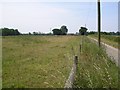
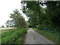
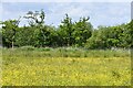
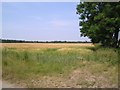
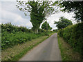
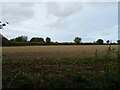
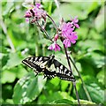
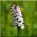
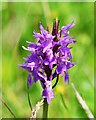
16 photos from this area
Area Information
Key information about the NR29 5DF including its size, population, and administrative classification.
- Area Type
- Postcode
- Area Size
- 4.2 km²
- Population
- 1703
- Population Density
- 214 people/km²
House Prices in NR29 5DF
29
Properties
£447,400
Average Sold Price
£80,000
Lowest Price
£925,000
Highest Price
Showing 29 properties
| Address | Type | Beds | Baths | Last Sale Price | Last Sale Date | |
|---|---|---|---|---|---|---|
| Latchetts, Wood Street, Catfield, NR29 5DF | Detached | 4 | 2 | £601,400 | May 2024 | |
| Old Hastings, Wood Street, Catfield, NR29 5DF | Detached | 5 | 3 | £925,000 | Oct 2023 | |
| Byfield, Wood Street, Catfield, NR29 5DF | Detached | 3 | 1 | £323,000 | Oct 2020 | |
| Plumsgate House, Wood Street, Catfield, NR29 5DF | Cottage | 3 | - | £625,000 | Sep 2018 | |
| 3, New Cottages, Wood Street, Catfield, NR29 5DF | Semi-detached | - | - | £80,000 | May 2002 | |
| Longmoor Point, Wood Street, Catfield, NR29 5DF | Bungalow | - | - | £130,000 | Oct 1997 | |
| Swallows Nest, Wood Street, Catfield, NR29 5DF | Detached | 2 | 2 | - | - | |
| Greenbanks, Wood Street, Catfield, NR29 5DF | Bungalow | 3 | 1 | - | - | |
| Broad Farm, Chapel Field, Chapel Field Road, Stalham, NR29 5DF | Detached | - | - | - | - | |
| Holly Farm House, Wood Street, Catfield, NR29 5DF | house | - | - | - | - |
Page 1 of 3
Energy Efficiency in NR29 5DF
Amenities
Schools
| Rank | School | Type | Entry gender | Ages |
|---|
Explore more schools in this area
Go to Schools tabDemographics
Household Size
Two person
most common
Accommodation Type
Houses
most common
Tenure
77
majority
Ethnic Group
White
most common
Religion
N/A
most common
Household Composition
N/A
most common
Age
47
median
Adults (30-64 years)
most common
Household Deprivation
N/A
with no deprivation
NS-SEC
27
in Lower managerial occupations
Explore more demographic insights in this area
Go to Demographics tabPlanning
Planning Constraints
- Flood RiskPremium
- Ramsar Wetland SitesPremium
- Area of Outstanding Natural BeautyPremium
- Protected Nature ReservePremium
- Protected WoodlandPremium