Area Overview for NR29 5BG
Photos of NR29 5BG


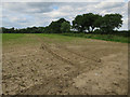
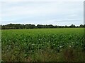
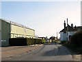
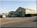

22 photos from this area
Area Information
Key information about the NR29 5BG including its size, population, and administrative classification.
- Area Type
- Postcode
- Area Size
- 60.8 hectares
- Population
- 1356
- Population Density
- 82 people/km²
House Prices in NR29 5BG
17
Properties
£260,833
Average Sold Price
£182,500
Lowest Price
£395,000
Highest Price
Showing 17 properties
| Address | Type | Beds | Baths | Last Sale Price | Last Sale Date | |
|---|---|---|---|---|---|---|
| Windflower, Sutton Road, Catfield, NR29 5BG | Bungalow | 2 | 1 | £395,000 | Jan 2021 | |
| Station House, Sutton Road, Catfield, NR29 5BG | Detached | 5 | 2 | £182,500 | Dec 2020 | |
| Three Gables, Sutton Road, Catfield, NR29 5BG | Detached | - | - | £205,000 | Feb 2012 | |
| Sherwood Cottage, Sutton Road, Catfield, NR29 5BG | Detached | 5 | 2 | - | - | |
| Mill View House, Sutton Road, Catfield, NR29 5BG | Detached | 5 | 2 | - | - | |
| Unit 10B, Horizon Industrial Estate, Sutton Road, Catfield, NR29 5BG | warehouse | - | - | - | - | |
| Unit 10A, Horizon Industrial Estate, Sutton Road, Catfield, NR29 5BG | Industrial | - | - | - | - | |
| Uk Next Day At Acro Precision Eng, Catfield Industrial Estate, Sutton Road, Catfield, NR29 5BG | Office | - | - | - | - | |
| Unit D, Catfield Industrial Estate, Sutton Road, Catfield, NR29 5BG | Industrial | - | - | - | - | |
| Unit F, Catfield Industrial Estate, Sutton Road, Catfield, NR29 5BG | Industrial | - | - | - | - |
Page 1 of 2
Energy Efficiency in NR29 5BG
Amenities
Schools
| Rank | School | Type | Entry gender | Ages |
|---|
Explore more schools in this area
Go to Schools tabDemographics
Household Size
Two person
most common
Accommodation Type
Houses
most common
Tenure
82
majority
Ethnic Group
White
most common
Religion
N/A
most common
Household Composition
N/A
most common
Age
47
median
Adults (30-64 years)
most common
Household Deprivation
N/A
with no deprivation
NS-SEC
30
in Lower managerial occupations
Explore more demographic insights in this area
Go to Demographics tabPlanning
Planning Constraints
- Flood RiskPremium
- Ramsar Wetland SitesPremium
- Area of Outstanding Natural BeautyPremium
- Protected Nature ReservePremium
- Protected WoodlandPremium