Area Overview for NR29 4RP
Photos of NR29 4RP
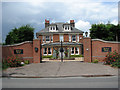
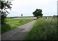
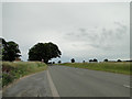
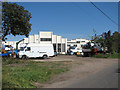
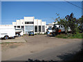
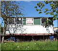
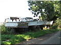
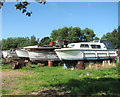
31 photos from this area
Area Information
Key information about the NR29 4RP including its size, population, and administrative classification.
- Area Type
- Postcode
- Area Size
- 9.3 hectares
- Population
- 2103
- Population Density
- 266 people/km²
House Prices in NR29 4RP
21
Properties
£105,679
Average Sold Price
£37,500
Lowest Price
£193,000
Highest Price
Showing 21 properties
| Address | Type | Beds | Baths | Last Sale Price | Last Sale Date | |
|---|---|---|---|---|---|---|
| 77 Repps Road, Martham, NR29 4RP | Retail | 3 | 1 | £193,000 | Aug 2022 | |
| 79 Repps Road, Martham, NR29 4RP | Bungalow | 3 | 1 | £170,000 | Nov 2019 | |
| 97 Repps Road, Martham, NR29 4RP | house | - | - | £135,000 | Jun 2019 | |
| 91 Repps Road, Martham, NR29 4RP | Terraced | 3 | - | £112,500 | Apr 2014 | |
| 89 Repps Road, Martham, NR29 4RP | Terraced | - | - | £60,000 | Jun 2012 | |
| 81 Repps Road, Martham, NR29 4RP | Terraced | - | - | £94,000 | Nov 2008 | |
| 83 Repps Road, Martham, NR29 4RP | Terraced | - | - | £147,500 | Mar 2008 | |
| 63 Repps Road, Martham, NR29 4RP | house | - | - | £132,500 | Dec 2006 | |
| 85 Repps Road, Martham, NR29 4RP | Terraced | - | - | £100,000 | Mar 2005 | |
| 87 Repps Road, Martham, NR29 4RP | Bungalow | 2 | 1 | £105,000 | Aug 2004 |
Page 1 of 3
Energy Efficiency in NR29 4RP
Amenities
Schools
| Rank | School | Type | Entry gender | Ages |
|---|
Explore more schools in this area
Go to Schools tabDemographics
Household Size
Two person
most common
Accommodation Type
Houses
most common
Tenure
87
majority
Ethnic Group
White
most common
Religion
N/A
most common
Household Composition
N/A
most common
Age
47
median
Adults (30-64 years)
most common
Household Deprivation
N/A
with no deprivation
NS-SEC
29
in Lower managerial occupations
Explore more demographic insights in this area
Go to Demographics tabPlanning
Planning Constraints
- Flood RiskPremium
- Ramsar Wetland SitesPremium
- Area of Outstanding Natural BeautyPremium
- Protected Nature ReservePremium
- Protected WoodlandPremium