Area Overview for NR29 4RN
Photos of NR29 4RN

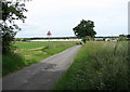
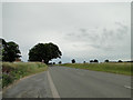
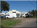
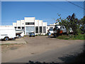
31 photos from this area
Area Information
Key information about the NR29 4RN including its size, population, and administrative classification.
- Area Type
- Postcode
- Area Size
- 6.0 hectares
- Population
- 2103
- Population Density
- 266 people/km²
House Prices in NR29 4RN
34
Properties
£140,711
Average Sold Price
£36,000
Lowest Price
£350,000
Highest Price
Showing 34 properties
| Address | Type | Beds | Baths | Last Sale Price | Last Sale Date | |
|---|---|---|---|---|---|---|
| 2 Rising Way, Martham, NR29 4RN | Bungalow | 2 | 1 | £190,000 | Jul 2025 | |
| 22 Rising Way, Martham, NR29 4RN | Detached | 2 | 1 | £82,500 | Mar 2023 | |
| 1 Rising Way, Martham, NR29 4RN | Semi-detached | 5 | 2 | £350,000 | Nov 2022 | |
| 11 Rising Way, Martham, NR29 4RN | house | - | - | £150,000 | Jul 2022 | |
| 6 Rising Way, Martham, NR29 4RN | Terraced | 3 | 1 | £175,000 | Aug 2020 | |
| 14 Rising Way, Martham, NR29 4RN | Terraced | 3 | 1 | £160,000 | Oct 2018 | |
| 3 Rising Way, Martham, NR29 4RN | Semi-detached | - | - | £68,950 | Feb 2001 | |
| 16 Rising Way, Martham, NR29 4RN | Terraced | - | - | £53,950 | May 1999 | |
| 12 Rising Way, Martham, NR29 4RN | Terraced | - | - | £36,000 | May 1997 | |
| 9 Rising Way, Martham, NR29 4RN | Detached | 2 | 1 | - | - |
Page 1 of 4
Energy Efficiency in NR29 4RN
Amenities
Schools
| Rank | School | Type | Entry gender | Ages |
|---|
Explore more schools in this area
Go to Schools tabDemographics
Household Size
Two person
most common
Accommodation Type
Houses
most common
Tenure
87
majority
Ethnic Group
White
most common
Religion
N/A
most common
Household Composition
N/A
most common
Age
47
median
Adults (30-64 years)
most common
Household Deprivation
N/A
with no deprivation
NS-SEC
29
in Lower managerial occupations
Explore more demographic insights in this area
Go to Demographics tabPlanning
Planning Constraints
- Flood RiskPremium
- Ramsar Wetland SitesPremium
- Area of Outstanding Natural BeautyPremium
- Protected Nature ReservePremium
- Protected WoodlandPremium