Area Overview for NR29 3JS
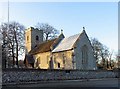
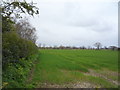
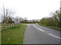
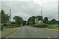
Photos of NR29 3JS


Area Information
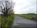
Postcode area NR29 3JS occupies a small residential cluster on the Suffolk coast, covering an area of 12.3 hectares. With a population of 1,491 people, this site offers a compact environment where daily routes cut quickly between home and destination. The average density stands at 245 people per square kilometre, ensuring you experience a quiet setting without the isolation common in remote rural locations. Living in NR29 3JS means relying on a network of nearby villages rather than cul-de-sacs within a large town. You are situated in a pocket of the North Norfolk district where character homes sit close to transport links. The area functions as a self-contained community hub where neighbours interact frequently due to the land size. Residents enjoy a balance of space and accessibility that defines this specific cluster. The physical footprint is large relative to the population, which reduces traffic congestion during peak hours. This layout supports a lifestyle where local needs are met without needing to travel far. The postcode represents a distinct choice for those seekingSolitude without sacrificing practical access to the wider region.
- Area Type
- Postcode
- Area Size
- 12.3 hectares
- Population
- 1491
- Population Density
- 245 people/km²
The property market in NR29 3JS is defined by a high rate of home ownership at 77 per cent. This figure indicates that the local housing stock consists mainly of owner-occupied residences rather than long-term rentals. You will primarily encounter houses when viewing homes in this postcode area, as flats or apartments are not common here. The low proportion of rental properties suggests a stable market where sellers often list directly rather than working through multiple tenancy cycles. Buying a home in NR29 3JS typically involves stepping into an established household rather than converting a landlord portfolio. The exclusive nature of single-family homes supports higher price points for extensions or renovations. You should expect to negotiate directly with owners who likely have equity built into their homes. The scarcity of new builds means significant renovations on existing houses are common. This market structure rewards buyers with cash reserves and those willing to adapt older properties. The focus on houses aligns with the preference of adults aged 30 to 64 who seek privacy and garden space.
House Prices in NR29 3JS
Showing 2 properties
| Address | Type | Beds | Baths | Last Sale Price | Last Sale Date | |
|---|---|---|---|---|---|---|
| Oak Lodge, Filby Lane, Ormesby St Margaret W Scratby, NR29 3JS | Detached | - | - | - | - | |
| Farmhouse, Filby Lane Farm, Filby Lane, Ormesby St Margaret W Scratby, NR29 3JS | Detached | - | - | - | - |
Energy Efficiency in NR29 3JS
Your daily life in NR29 3JS benefits from a practical selection of amenities within easy walking or driving distance. There are five retail outlets nearby, including Spar, Co-op Kings, and Lidl Caister-on. These shops provide essentials without requiring a trip into the main town centre. You can purchase groceries, household supplies, and basic goods without travelling more than a few miles. Three railway stations serve the broader region, with Great Yarmouth Railway Station, Berney Arms Railway Station, and Acle Railway Station nearby. Access to these stations means you can reach Norwich or other major cities using national rail services. The presence of Lidl Caister-on adds value for residents who prefer large-format shopping venues. You will find that daily errands take minutes rather than hours. This network of shops and trains supports a flexible lifestyle for the 1,491 residents scattered across the area.
Amenities
Schools
Families living in NR29 3JS have access to specific educational facilities within practical reach. Ormesby Village Infant School serves as the primary option for younger pupils. The school holds a good Ofsted rating, which confirms its standard of teaching and care. This single primary institution means that most local children attend one specific site for their early education. You should note that there are no secondary schools listed in the immediate vicinity of this cluster. This limitation means older children in NR29 3JS will require further travel or tele-supply arrangements for secondary education. The presence of a good-rated infant school removes initial concerns for parents with under-11s. You will not find a choice of infant schools, as only this one location operates in the data. The good rating suggests reliable educational outcomes despite the limited selection. Families must consider transport logistics if they have older children who need secondary education outside this postcode. The school mix is strictly primary focused for the local cluster.
| Rank | School | Type | Entry gender | Ages |
|---|
Explore more schools in this area
Go to Schools tabDemographics
The demographic profile in NR29 3JS reflects a mature community with a median age of 47 years. Most residents fall into the adults category, spanning from 30 to 64 years old. This distribution shapes a neighbourhood focused on stability rather than student housing or young professional rentals. Home ownership is a defining feature, with 77 per cent of households owning their property outright or with a mortgage. You will find very few private landlords in this cluster compared to larger urban areas. The accommodation type is predominantly houses, offering exterior space and traditional layouts suitable for families or empty nesters. The predominant ethnic group is White, consistent with broader rural Suffolk trends. You can expect a settled environment where long-term residents make up the core of the population. This stability often translates into lower turnover rates and quieter streets. The age range indicates a demand for well-maintained properties over flash new builds. Families here are likely to prioritise space and safety in their housing search. You will see a community that values tradition and established routines over transient culture.
Household Size
Accommodation Type
Tenure
Ethnic Group
Religion
Household Composition
Age
Household Deprivation
NS-SEC
Explore more demographic insights in this area
Go to Demographics tabPlanning
Planning Constraints
- Flood RiskPremium
- Ramsar Wetland SitesPremium
- Area of Outstanding Natural BeautyPremium
- Protected Nature ReservePremium
- Protected WoodlandPremium