Area Overview for NR29 3HX
Photos of NR29 3HX
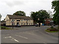
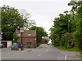
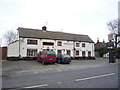
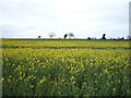
9 photos from this area
Area Information
Key information about the NR29 3HX including its size, population, and administrative classification.
- Area Type
- Postcode
- Area Size
- 20.4 hectares
- Population
- 1495
- Population Density
- 165 people/km²
House Prices in NR29 3HX
24
Properties
£356,295
Average Sold Price
£49,500
Lowest Price
£657,500
Highest Price
Showing 24 properties
| Address | Type | Beds | Baths | Last Sale Price | Last Sale Date | |
|---|---|---|---|---|---|---|
| Highfield House, Ormesby Lane, Filby, NR29 3HX | Detached | 4 | 3 | £375,000 | Apr 2023 | |
| Field Grange, Ormesby Lane, Filby, NR29 3HX | Retail | 4 | 2 | £657,500 | Jun 2022 | |
| The Gables, Ormesby Lane, Filby, NR29 3HX | house | - | - | £650,000 | Apr 2022 | |
| 6 Ormesby Lane, Filby, NR29 3HX | Semi-detached | 2 | 1 | £222,000 | Aug 2021 | |
| 2 Ormesby Lane, Filby, NR29 3HX | Semi-detached | 4 | 2 | £330,000 | May 2021 | |
| Gardeners Rest, Ormesby Lane, Filby, NR29 3HX | Bungalow | 3 | 2 | £395,000 | May 2021 | |
| Meadow View, Ormesby Lane, Filby, NR29 3HX | Detached | - | - | £600,000 | Jul 2020 | |
| 3 Ormesby Lane, Filby, NR29 3HX | Semi-detached | - | - | £164,950 | Sep 2005 | |
| 4 Ormesby Lane, Filby, NR29 3HX | Semi-detached | - | - | £119,000 | Jul 2005 | |
| 10 Ormesby Lane, Filby, NR29 3HX | Terraced | - | - | £49,500 | May 2003 |
Page 1 of 3
Energy Efficiency in NR29 3HX
Amenities
Schools
| Rank | School | Type | Entry gender | Ages |
|---|
Explore more schools in this area
Go to Schools tabDemographics
Household Size
Two person
most common
Accommodation Type
Houses
most common
Tenure
86
majority
Ethnic Group
White
most common
Religion
N/A
most common
Household Composition
N/A
most common
Age
47
median
Adults (30-64 years)
most common
Household Deprivation
N/A
with no deprivation
NS-SEC
34
in Lower managerial occupations
Explore more demographic insights in this area
Go to Demographics tabPlanning
Planning Constraints
- Flood RiskPremium
- Ramsar Wetland SitesPremium
- Area of Outstanding Natural BeautyPremium
- Protected Nature ReservePremium
- Protected WoodlandPremium