Area Overview for NR29 3JG
Photos of NR29 3JG
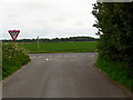

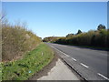
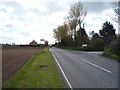

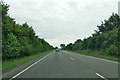
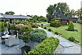
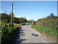
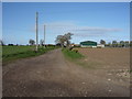
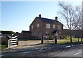
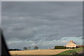
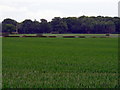
12 photos from this area
Area Information
Key information about the NR29 3JG including its size, population, and administrative classification.
- Area Type
- Postcode
- Area Size
- 44.2 hectares
- Population
- 1495
- Population Density
- 165 people/km²
House Prices in NR29 3JG
15
Properties
£248,125
Average Sold Price
£217,500
Lowest Price
£295,000
Highest Price
Showing 15 properties
| Address | Type | Beds | Baths | Last Sale Price | Last Sale Date | |
|---|---|---|---|---|---|---|
| 1 The Heath, Filby, NR29 3JG | Semi-detached | 3 | 1 | £240,000 | Nov 2024 | |
| Medehamstede, The Heath, Filby, NR29 3JG | Bungalow | 3 | 2 | £295,000 | Apr 2017 | |
| Poppy Farm, The Heath, Filby, NR29 3JG | Semi-detached | - | - | £240,000 | Feb 2005 | |
| Heathland Barn, The Heath, Filby, NR29 3JG | Detached | - | - | £217,500 | Jul 2001 | |
| Farmhouse, Hillcrest Farm, The Heath, Filby, NR29 3JG | Bungalow | 3 | 2 | - | - | |
| Hillcrest Farm, The Heath, Filby, NR29 3JG | Farm | - | - | - | - | |
| Sherwood, The Heath, Filby, NR29 3JG | Semi-detached | - | - | - | - | |
| Cherry Tree, 2 The Heath, Filby, NR29 3JG | Semi-detached | - | - | - | - | |
| Caravan 1 At Hillcrest Livery Centre, Hillcrest Farm, The Heath, Filby, NR29 3JG | Mobile Home | - | - | - | - | |
| A To Z At Hillcrest Livery Centre, Hillcrest Farm, The Heath, Filby, NR29 3JG | shop | - | - | - | - |
Page 1 of 2
Energy Efficiency in NR29 3JG
Amenities
Schools
| Rank | School | Type | Entry gender | Ages |
|---|
Explore more schools in this area
Go to Schools tabDemographics
Household Size
Two person
most common
Accommodation Type
Houses
most common
Tenure
86
majority
Ethnic Group
White
most common
Religion
N/A
most common
Household Composition
N/A
most common
Age
47
median
Adults (30-64 years)
most common
Household Deprivation
N/A
with no deprivation
NS-SEC
34
in Lower managerial occupations
Explore more demographic insights in this area
Go to Demographics tabPlanning
Planning Constraints
- Flood RiskPremium
- Ramsar Wetland SitesPremium
- Area of Outstanding Natural BeautyPremium
- Protected Nature ReservePremium
- Protected WoodlandPremium