Area Overview for NR29 3EQ
Photos of NR29 3EQ

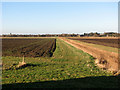
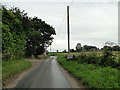
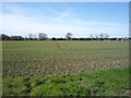
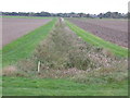
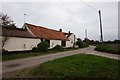
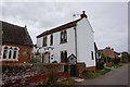
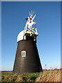
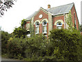
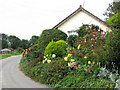
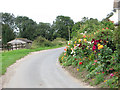
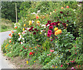
18 photos from this area
Area Information
Key information about the NR29 3EQ including its size, population, and administrative classification.
- Area Type
- Postcode
- Area Size
- 51.2 hectares
- Population
- 1201
- Population Density
- 36 people/km²
House Prices in NR29 3EQ
21
Properties
£225,325
Average Sold Price
£145,000
Lowest Price
£340,000
Highest Price
Showing 21 properties
| Address | Type | Beds | Baths | Last Sale Price | Last Sale Date | |
|---|---|---|---|---|---|---|
| Alder Barn, Low Road, Runham, Mautby, NR29 3EQ | house | 2 | 1 | £340,000 | Jul 2022 | |
| 2 Low Road, Runham, Mautby, NR29 3EQ | Semi-detached | - | - | £258,000 | Jun 2021 | |
| Mullona, 1 Low Road, Runham, Mautby, NR29 3EQ | house | - | - | £175,000 | Dec 2014 | |
| Bramble Barn, Low Road, Runham, Mautby, NR29 3EQ | Semi-detached | 2 | 2 | £184,000 | Jan 2007 | |
| Hilton House, Low Road, Runham, Mautby, NR29 3EQ | Semi-detached | - | - | £249,950 | Oct 2006 | |
| Mill View Cottage, Low Road, Runham, Mautby, NR29 3EQ | Cottage | 2 | 1 | £145,000 | Jun 2004 | |
| Farmhouse, Bounty Farm, Low Road, Runham, Mautby, NR29 3EQ | Farm | 4 | - | - | - | |
| Laurel Cottage, 5 Low Road, Runham, Mautby, NR29 3EQ | Retail | 2 | 2 | - | - | |
| The Cottage, Low Road, Runham, Mautby, NR29 3EQ | Detached | 3 | - | - | - | |
| Farmhouse, Whitegate Farm, Low Road, Runham, Mautby, NR29 3EQ | Detached | 3 | - | - | - |
Page 1 of 3
Energy Efficiency in NR29 3EQ
Amenities
Schools
| Rank | School | Type | Entry gender | Ages |
|---|
Explore more schools in this area
Go to Schools tabDemographics
Household Size
Two person
most common
Accommodation Type
Houses
most common
Tenure
71
majority
Ethnic Group
White
most common
Religion
N/A
most common
Household Composition
N/A
most common
Age
47
median
Adults (30-64 years)
most common
Household Deprivation
N/A
with no deprivation
NS-SEC
35
in Lower managerial occupations
Explore more demographic insights in this area
Go to Demographics tabPlanning
Planning Constraints
- Flood RiskPremium
- Ramsar Wetland SitesPremium
- Area of Outstanding Natural BeautyPremium
- Protected Nature ReservePremium
- Protected WoodlandPremium