Area Overview for NR29 3EL
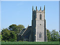
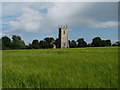
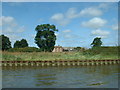
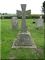
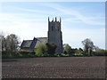
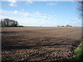
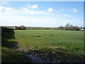
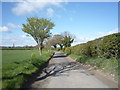
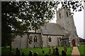
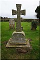
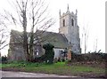
Photos of NR29 3EL

Area Information
NR29 3EL represents a specific residential cluster in Norfolk, England, covering a total area of 35.9 hectares. With a population of 1,201, this postcode serves a defined community rather than a large town centre. The low density is evident, with only 36 people per square kilometre, creating a quiet environment where properties stand with space between them. This small footprint ensures that the residential cluster maintains a manageable and intimate scale. Daily life here revolves around this distinct settlement within the broader Norfolk countryside. Residents experience a neighbourhood that functions as a self-contained pocket of housing within a larger landscape. The area lacks the sprawling infrastructure of major urban centres, offering instead a focused living experience. Prospective buyers will find that life in NR29 3EL is characterised by its compact nature and clear boundaries. The demographic profile suggests a mature community, as the median age is 47 years. This concentration of adults indicates a neighbourhood where established families and professionals, specifically those aged 30 to 64, form the core of the population. The small size means that local interactions can be frequent among neighbours, fostering a close-knit atmosphere typical of rural postcode sectors. You will live in a defined zone where every address is part of a small, cohesive group. The area does not rely on high-density sprawl but operates as a concentrated residential unit. This makes it ideal for those seeking a specific type of rural living with defined limits.
- Area Type
- Postcode
- Area Size
- 35.9 hectares
- Population
- 1201
- Population Density
- 36 people/km²
The property market in NR29 3EL is characterised by a strong focus on house ownership given the 71% home ownership rate. Most transactions and existing stock will consist of houses, as this is the predominant accommodation type recorded for the postcode. This means you are unlikely to find flats or apartments on the market here, which aligns with the housing statistics for this specific sector. The area functions primarily as an owner-occupied zone rather than a hub for private renters. When considering homes in NR29 3EL, expect a stock that suits individuals and families wishing to settle permanently. The small population of 1,201 individuals limits the volume of active listings, meaning the market is tight but stable. Location-specific factors, such as the area size of 35.9 hectares, dictate that supply is inherently limited. This scarcity often supports property values in rural clusters where land is a finite resource. Buyers should anticipate that competing for houses here requires competitive pricing, as the 71% ownership figure suggests most owners are happy to remain in their properties rather than sell immediately. The market does not show signs of a rental bubble; instead, it reflects a traditional housing pattern found in the English countryside. Your search for properties should focus exclusively on houses, as other dwelling types are not represented in the data. This clarity removes the complexity of comparing different property structures within the same tiny zone.
House Prices in NR29 3EL
Showing 3 properties
| Address | Type | Beds | Baths | Last Sale Price | Last Sale Date | |
|---|---|---|---|---|---|---|
| 1 Church Lane, Runham, Mautby, NR29 3EL | house | 4 | 1 | £547,000 | Mar 2025 | |
| Marsh House, 6 Church Lane, Runham, Mautby, NR29 3EL | Detached | 3 | 1 | £295,000 | Sep 2018 | |
| 2 Church Lane, Runham, Mautby, NR29 3EL | Terraced | - | - | - | - |
Energy Efficiency in NR29 3EL
Daily life in NR29 3EL revolves around practical amenities located within practical reach of the residential cluster. Residents have access to five railway stations nearby, including Berney Arms Railway Station, Acle Railway Station, and Great Yarmouth Railway Station. This rail connectivity links the area to broader transport networks, facilitating trips outside the immediate locality. Within a short distance, you will find essential retail options such as M&S Acle BP, Spar, and East of England Co-operative Co. These five retail outlets cover groceries, fuel, and general provisions, ensuring you do not need to travel far for daily necessities. The absence of larger shopping centres or entertainment venues within the immediate postcode means you rely on these nearby towns for leisure and major purchases. Berney Arms and Acle serve as the primary commercial and transport hubs for your daily commute. The area is not focused on nightlife or urban distractions, but rather on functional convenience combined with rural proximity. You will spend your shopping time at the three named supermarkets rather than local high streets. The five railway stations provide excellent opportunities for day trips, commuting, and seasonal escapes using the rail network. While live data on specific parks or restaurants is not included in the immediate amenity list, the presence of these transport and retail nodes defines the lifestyle. Your weekend might involve a train journey to the coast or countryside rather than a visit to a local leisure centre. The amenities listed, including M&S Acle BP and the Co-operative, form the backbone of local convenience. This setup suits a lifestyle that values simplicity and direct access to essential services without the sprawl of a city.
Amenities
Schools
| Rank | School | Type | Entry gender | Ages |
|---|
Explore more schools in this area
Go to Schools tabDemographics
The community within NR29 3EL is defined by a clear age profile and strong local ownership. The median age stands at 47 years, reflecting a predominantly adult populace. The most common age range is adults between 30 and 64 years, suggesting the area attracts families in their prime working years or empty nesters. Home ownership is the norm, with 71% of residents owning their property outright or with a mortgage. This high ownership rate contrasts sharply with areas dominated by private rentals, indicating long-term residents who have established roots in the neighbourhood. The accommodation type is exclusively houses, which aligns with the demographic tendency for ownership and family stability. There is no data suggesting the presence of flats or high-rise apartments, reinforcing the suburban or rural character of the zone. Ethnically, the area is predominantly White, mirroring the broader trends seen in rural Norfolk communities. During your research into schools near NR29 3EL, you will find that the local school catchment likely captures these families of working-age adults. The demographic makeup indicates a stable environment where established households form the majority. This stability is supported by the fact that three-quarters of homes are owner-occupied, reducing the turnover associated with a student or rental market. You will find a community built by people who intend to stay. The lack of young children or extreme elderly demographics suggests a balanced household structure focused on the 30 to 64 age bracket. This profile offers certainty for buyers seeking a permanent home base rather than a transient location.
Household Size
Accommodation Type
Tenure
Ethnic Group
Religion
Household Composition
Age
Household Deprivation
NS-SEC
Explore more demographic insights in this area
Go to Demographics tabPlanning
Planning Constraints
- Flood RiskPremium
- Ramsar Wetland SitesPremium
- Area of Outstanding Natural BeautyPremium
- Protected Nature ReservePremium
- Protected WoodlandPremium