Area Overview for NR28 0JG
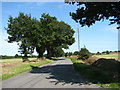
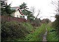
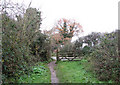
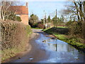
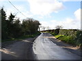
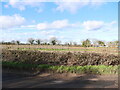
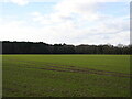
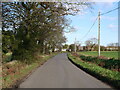
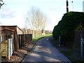
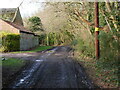
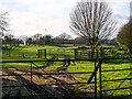
Photos of NR28 0JG
Area Information
Living in NR28 0JG offers a defined residential experience centred around a small cluster of homes. This postcode sits within a 47.5-hectare area, housing a population of 1,424 people. You will find a density of approximately 250 people per square kilometre, creating a setting that feels established yet uncrowded. The location functions as a quiet residential backdrop rather than a bustling town centre. Daily life here revolves around the specific needs of a settled community rather than high-energy urban activity. The area provides a structured environment where residents have immediate access to local services while maintaining a distinct separation from larger commercial hubs. You can expect a neighbourhood character shaped by its compact size and clear boundaries. The residential nature of NR28 0JG means your evenings are likely to be peaceful, away from the noise of heavy traffic or large gatherings. This specific postcode serves as a clear marker for those seeking a homes in a predictable setting. The total population figure brings stability to the area, ensuring that local amenities serve a consistent group of people. When you choose NR28 0JG, you select a location with a known footprint and a resident count that prevents overcrowding. It is a space where proximity to local rail stations and shops balances comfort with accessibility.
- Area Type
- Postcode
- Area Size
- 47.5 hectares
- Population
- 1424
- Population Density
- 250 people/km²
The property market in NR28 0JG is overwhelmingly characterised by owner-occupied housing. Statistics show that 61 per cent of residents own their homes outright or with a mortgage, creating a stable environment distinct from rental-dominated neighbourhoods. The accommodation type is exclusively houses, as confirmed by the local data. You will not find shopping centres or urban apartment blocks typical of high-density city suburbs here. This housing profile suggests a market where buyers seek a permanent foothold in a specific location. The presence of houses supports a quiet street life with traditional front gardens and private driveways. For a buyer looking at this small area, the market dynamics favour long-term residents. The low density of 250 people per square kilometre means less pressure on scarce housing stock. The 47.5-hectare footprint limits the volume of new development, maintaining the integrity of the existing housing stock. If you are considering homes in NR28 0JG, you are entering a market where the majority of transactions involve existing owners selling to new owners rather than landlords finding tenants. This structure often implies stronger community bonds and fewer transient neighbours. The lack of flats removes the urban hustle, keeping focus on the successful maintenance and upkeep of individual family properties.
House Prices in NR28 0JG
Showing 7 properties
| Address | Type | Beds | Baths | Last Sale Price | Last Sale Date | |
|---|---|---|---|---|---|---|
| 49 Skeyton Road, North Walsham, NR28 0JG | Detached | 4 | 1 | £365,000 | May 2025 | |
| Orchard House, Skeyton Road, North Walsham, NR28 0JG | Detached | 4 | 2 | £355,000 | Dec 2024 | |
| 47 Skeyton Road, North Walsham, NR28 0JG | house | 4 | 2 | £315,000 | Jul 2024 | |
| 45 Skeyton Road, North Walsham, NR28 0JG | Detached | 4 | 2 | £241,000 | Jul 2004 | |
| Barton House, Skeyton Road, North Walsham, NR28 0JG | house | - | - | £156,000 | Apr 2000 | |
| Redundant Agricultural Building, Skeyton Road, North Walsham, NR28 0JG | Farm | - | - | - | - | |
| Wayside Farm, Skeyton Road, North Walsham, NR28 0JG | Detached | - | - | - | - |
Energy Efficiency in NR28 0JG
Life in NR28 0JG centres on practical convenience and accessible local trade. You will find five major retail outlets within practical reach of the postcode. Shopping at Lidl North, Waitrose North, and Morrisons Daily North covers your weekly food shopping requirements. These supermarkets provide a wide range of products without the need to travel to the city centre. The presence of a metro connection to Aylsham adds an extra layer of shopping depth if you require specialist items. Beyond retail, your lifestyle depends on accessing these three railway stations. North Walsham Railway Station, Worstead Railway Station, and Gunton Railway Station serve as your main public transport gateways. While there are no parks or leisure centres listed in the immediate data, the area size of 47.5 hectares suggests open space. The residential nature of the area means less noise from heavy traffic or nightlife. Your daily routine will likely involve walking to one of the three railway stations or driving to the five nearby supermarkets. The area is designed for functional living rather than entertainment. If you value quiet evenings, this lifestyle fits your needs perfectly.
Amenities
Schools
Families in NR28 0JG rely on Millfield Primary School for their children's education. This institution is situated close to the residential cluster and serves as the primary learning hub for local pupils. The school is a primary institution, fitting the need for early childhood education in this small community. As you consider living in NR28 0JG, you must plan for childcare arrangements as there are no secondary or high schools listed within the immediate data scope. The presence of Millfield Primary School ensures that you have a dedicated educational facility nearby. The reliance on a single primary school indicates a compact catchment area. Parents living in this postcode likely need to look further afield for secondary education, though the primary option provides a solid foundation. There is no data on private schools or special needs facilities within this specific snapshot, but the public provision of Millfield Primary School meets the core needs of the 1,424 local population. When evaluating homes in NR28 0JG, proximity to Millfield Primary School becomes a key factor for parents in the under-11 age group. The school type is clearly primary, focusing on the younger years before students transition elsewhere.
| Rank | School | Type | Entry gender | Ages |
|---|
Explore more schools in this area
Go to Schools tabDemographics
The community in NR28 0JG reflects the life stage of older adults and established families. The median age stands at 47 years, indicating a mature population. Most residents fall within the 30 to 64-year age range, suggesting a lack of very young children or elderly retirees dominating the street scenes. This age profile aligns with a home ownership rate of 61 per cent. You are significantly more likely to buy and stay in your property here than in other comparative areas. This high level of ownership points to long-term settling and investment in the neighbourhood rather than short-term renting. Accommodation types in NR28 0JG consist primarily of houses. There are very few flats, meaning the streetscape will feature terraced or semi-detached structures rather than high-density apartment blocks. This housing stock supports the older median age typical of such domestic arrangements. The predominant ethnic group is White, which mirrors the broader demographic makeup of similar rural and suburban environments in Norfolk. With an area size of 47.5 hectares, the land use focuses heavily on private gardens and private roads rather than public housing estates. The population density of 250 people per square kilometre supports this house-focused model, providing green space between properties that enhances privacy. Living in NR28 0JG means joining a crowd of homeowners who have purchased stability in a specific postcode.
Household Size
Accommodation Type
Tenure
Ethnic Group
Religion
Household Composition
Age
Household Deprivation
NS-SEC
Explore more demographic insights in this area
Go to Demographics tabPlanning
Planning Constraints
- Flood RiskPremium
- Ramsar Wetland SitesPremium
- Area of Outstanding Natural BeautyPremium
- Protected Nature ReservePremium
- Protected WoodlandPremium