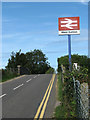
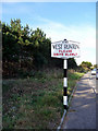
Area Overview for NR27 9LT
Photos of NR27 9LT


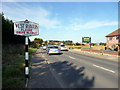
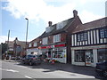
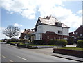
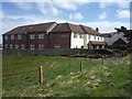

104 photos from this area
Area Information
Key information about the NR27 9LT including its size, population, and administrative classification.
- Area Type
- Postcode
- Area Size
- 3.3 hectares
- Population
- 2015
- Population Density
- 170 people/km²
House Prices in NR27 9LT
24
Properties
£261,462
Average Sold Price
£67,000
Lowest Price
£870,000
Highest Price
Showing 24 properties
| Address | Type | Beds | Baths | Last Sale Price | Last Sale Date | |
|---|---|---|---|---|---|---|
| Woodleigh, Sandy Lane, West Runton, NR27 9LT | Terraced | - | - | £155,500 | Jul 2025 | |
| White Gates, Sandy Lane, West Runton, NR27 9LT | Detached | 3 | 1 | £395,000 | Jan 2025 | |
| The Grange, Sandy Lane, West Runton, NR27 9LT | Semi-detached | 5 | 3 | £870,000 | Jul 2022 | |
| The Ferns, Sandy Lane, West Runton, NR27 9LT | house | - | - | £400,000 | Jun 2021 | |
| 3, Spring Cottages, Sandy Lane, West Runton, NR27 9LT | Cottage | 2 | - | £210,500 | Mar 2021 | |
| 6, Spring Cottages, Sandy Lane, West Runton, NR27 9LT | house | 2 | 1 | £153,000 | Sep 2017 | |
| The Anchorage, Sandy Lane, West Runton, NR27 9LT | house | - | - | £245,000 | Sep 2015 | |
| Applegarth, Sandy Lane, West Runton, NR27 9LT | house | - | - | £335,000 | Aug 2013 | |
| Cornerways, Sandy Lane, West Runton, NR27 9LT | Bungalow | - | - | £195,000 | Oct 2011 | |
| 4, Spring Cottage, Sandy Lane, West Runton, NR27 9LT | Terraced | - | - | £163,000 | Mar 2007 |
Page 1 of 3
Energy Efficiency in NR27 9LT
Amenities
Schools
| Rank | School | Type | Entry gender | Ages |
|---|
Explore more schools in this area
Go to Schools tabDemographics
Household Size
Two person
most common
Accommodation Type
Houses
most common
Tenure
80
majority
Ethnic Group
White
most common
Religion
N/A
most common
Household Composition
N/A
most common
Age
47
median
Adults (30-64 years)
most common
Household Deprivation
N/A
with no deprivation
NS-SEC
35
in Lower managerial occupations
Explore more demographic insights in this area
Go to Demographics tabPlanning
Planning Constraints
- Flood RiskPremium
- Ramsar Wetland SitesPremium
- Area of Outstanding Natural BeautyPremium
- Protected Nature ReservePremium
- Protected WoodlandPremium