Area Overview for NR26 8UQ
Photos of NR26 8UQ

Area Information
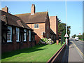
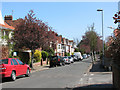
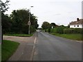
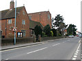
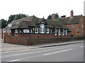
Living in NR26 8UQ means settling into a tightly knit residential cluster within Norfolk. This specific postcode covers a very small footprint of 7,418 square metres, creating an exclusive feeling despite a population of 2,058 people. The density is high at 277,425 people per square kilometre, which reflects the concentrated nature of homes in this cluster rather than sprawl. You are buying into a mature settlement where daily life revolves around close proximity to neighbours and local stations. The area functions as a self-contained community rather than a sprawling suburb. Its character is defined by this compactness, where every street represents a significant portion of the total local population. Whether you want a short walk to a railway station or a quick trip to a supermarket, the scale of this postcode ensures everything is manageable. The identity of the area stems from being a specific residential unit within the broader NR26 postcode region. It does not share the vast geographical scope of larger towns but focuses purely on housing. This distinction is crucial for anyone considering homes in NR26 8UQ, as the amenities and transport links are defined by their immediate practical reach rather than distant city centres. You buy a stake in this distinct cluster where the boundaries are clear and the community focus is sharp. The small area size ensures that travel times are short and the environment remains intimate.
- Area Type
- Postcode
- Area Size
- 7418 m²
- Population
- 2058
- Population Density
- 2277 people/km²
Looking at the property market in NR26 8UQ, you are entering a space defined by established stock. Houses are the predominant accommodation type, meaning you will find detached or semi-detached home designs rather than purpose-built blocks or conversions. This preference aligns with the local planning history and the existing infrastructure. The small area size of 7,418 square metres means land is scarce, and new builds are unlikely to expand the footprint far beyond current structures. Home ownership stands at 75%. This statistical reality confirms that the area is primarily owner-occupied rather than a student letting stock or shared living zone. Buyers here seek security and control over their property. The high ownership rate often drives up prices and reduces vacancy rates, making competition strong for suitable homes. If you are looking for homes in NR26 8UQ, do not expect a wide selection of rental options. The market reflects a traditional model where sellers pass titles to long-term tenants. This stability can be bought into by those who value established communities. However, the demand for these houses matches the steady construction of the local population. You are not looking at a developing zone where value is speculative. The properties represent a long-term investment in a functioning residential cluster. The inventory reflects the needs of the local age group, focusing on spacious layouts suitable for an older demographic rather than compact urban spaces.
House Prices in NR26 8UQ
Showing 27 properties
| Address | Type | Beds | Baths | Last Sale Price | Last Sale Date | |
|---|---|---|---|---|---|---|
| 7 Knights Green, Sheringham, NR26 8UQ | house | - | - | £185,000 | Jul 2018 | |
| 14 Knights Green, Sheringham, NR26 8UQ | Flat | - | - | £97,500 | Jun 2018 | |
| 18 Knights Green, Sheringham, NR26 8UQ | house | - | - | £160,000 | Feb 2013 | |
| 20 Knights Green, Sheringham, NR26 8UQ | Terraced | - | - | £99,950 | Jul 2002 | |
| 17 Knights Green, Sheringham, NR26 8UQ | Terraced | 3 | - | - | - | |
| 1 Knights Green, Sheringham, NR26 8UQ | Semi-detached | - | - | - | - | |
| 11 Knights Green, Sheringham, NR26 8UQ | Flat | - | - | - | - | |
| 13 Knights Green, Sheringham, NR26 8UQ | Flat | - | - | - | - | |
| 12 Knights Green, Sheringham, NR26 8UQ | Flat | - | - | - | - | |
| 24 Knights Green, Sheringham, NR26 8UQ | Terraced | - | - | - | - |
Energy Efficiency in NR26 8UQ
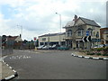
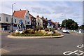
Your daily routine in NR26 8UQ centres on a handful of specific, accessible amenities. Retail options are concentrated, with Tesco Sheringham, Budgens Sheringham, and Sainsburys Sheringham located nearby. These three supermarkets range from a mere five athletics events away to slightly further, but all fall well within a short drive or bike ride. You do not need a car to stock your weekly groceries if you plan ahead. Rail travel remains the backbone of local leisure and commuting. Sheringham Railway Station acts as your main hub for train journeys. West Runton Railway Station and Cromer Railway Station provide additional nodes for exploring the coast or deeper Norfolk. These stations put the wider region within reach of your daily schedule. For those who value public transit, the presence of four clear rail links ensures you are not landlocked in the countryside. Narrower transport choices exist via metro services at Weybourne and Holt. These two locations serve as secondary transit points for regional bus networks. While the metro count is low at just two stations, they provide connectivity to towns that lack their own railway lines. This network supports a lifestyle where you can walk to shops and drive or bus to wider destinations. The area is designed for residents who know their routines and prefer direct, predictable travel over complex city grids.
Amenities
Schools
| Rank | School | Type | Entry gender | Ages |
|---|
Explore more schools in this area
Go to Schools tabDemographics
The community in NR26 8UQ is older, with a median age of 47 years. This figure indicates a neighbourhood where families are often past the child-rearing stage or retiring couples live together. The most common age group is the elderly, specifically those aged 65 years and over. This demographic skew influences the local services and the pace of life. Many households here consist of people who have built wealth over decades rather than young professionals or students. Home ownership is stable and strong at 75%. This high rate suggests that residents have stayed put, raising their mortgages and building roots over long periods. The remaining quarter likely rents or maintains shared ownership, but the majority are owners. Houses dominate the accommodation type in NR26 8UQ, reflecting a preference for traditional Norfolk-style properties over flats or modern apartments. The predominant ethnic group is White, which aligns with the historical settlement patterns of the region. There is no data provided regarding deprivation levels, but the high ownership rate and older age profile suggest a settled, financially independent population. You are not entering an area of transient living. The people buying and selling in NR26 8UQ are looking for permanence. This demographic consistency creates a predictable social environment where neighbours often know each other's routines.
Household Size
Accommodation Type
Tenure
Ethnic Group
Religion
Household Composition
Age
Household Deprivation
NS-SEC
Explore more demographic insights in this area
Go to Demographics tabPlanning
Planning Constraints
- Flood RiskPremium
- Ramsar Wetland SitesPremium
- Area of Outstanding Natural BeautyPremium
- Protected Nature ReservePremium
- Protected WoodlandPremium