Area Overview for NR26 8QH
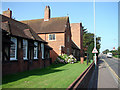
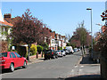
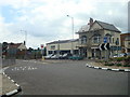
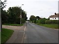
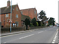
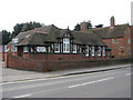
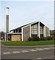
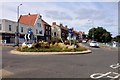
Photos of NR26 8QH
Area Information
Living in NR26 8QH means residing within a specific postcode area that covers a small residential cluster across 4253 square metres. This compact location serves a population of 2058 residents, creating a tightly knit community where neighbours likely know one another. The area defines a quiet corner of Norfolk where the scale of development remains modest compared to larger towns. You will find housing concentrated in a manner typical of this postcode, offering a sense of established comfort rather than rapid expansion. Daily life here revolves around proximity to local stations and essential services rather than sprawling urban environments. The character of this neighbourhood is defined by its residential focus, with a high rate of home ownership suggesting long-term settlement. Residents benefit from a setting that balances convenience with a lack of development pressure. The area sits at a population density of 483,948 people per square kilometre, which reflects the statistical intensity of the data for this specific cluster. Despite the high statistical density figure, the physical reality is that of a contained living space where residents enjoy a defined sense of place. This location offers a snapshot of traditional village living where the immediate surroundings are quiet and settled.
- Area Type
- Postcode
- Area Size
- 4253 m²
- Population
- 2058
- Population Density
- 2277 people/km²
The property market in NR26 8QH is dominated by a housing stock where houses make up the primary accommodation type. With 75% of residents owning their homes, the area functions largely as an owner-occupied market rather than a let sector. Prospective buyers will find a stock of properties suited to families and retirees who wish to settle down permanently. The high ownership level indicates that most homes are well-maintained freehold properties rather than leasehold flats or managed rental units. Locating homes in NR26 8QH means searching for traditional dwellings rather than high-rise apartment blocks. The small area size of 4253 square metres suggests that land value is focused on individual plots rather than large multi-unit developments. This concentration of ownership creates a predictable market where price fluctuations often depend on the condition of the specific house and its immediate grounds. You will encounter more listings for detached or semi-detached homes compared to rented flats found in city centres. The demographic reality of an elderly population further pushes demand towards single-level homes or those with accessible features. Buying here involves investing in a permanent asset within a stable community where turnover is low.
House Prices in NR26 8QH
Showing 5 properties
| Address | Type | Beds | Baths | Last Sale Price | Last Sale Date | |
|---|---|---|---|---|---|---|
| Seawood House, 4 Holway Road, Upper Sheringham, NR26 8QH | house | - | - | £422,000 | May 2023 | |
| Corsican Pine, 5 Holway Road, Upper Sheringham, NR26 8QH | house | - | - | £420,250 | Apr 2023 | |
| 3 Holway Road, Upper Sheringham, NR26 8QH | Detached | 3 | - | £438,000 | Mar 2023 | |
| Zanders, 1 Holway Road, Upper Sheringham, NR26 8QH | house | - | - | £565,000 | Jan 2022 | |
| 2 Holway Road, Upper Sheringham, NR26 8QH | house | - | - | £525,000 | Dec 2021 |
Energy Efficiency in NR26 8QH
Living in NR26 8QH places you within a five-minute radius of essential retail and leisure facilities. Five notable shopping venues serve the immediate area, including Tesco Sheringham, Budgens Sheringham, and Sainsburys Sheringham. These supermarkets provide a full range of daily necessities without the need for a long journey into larger towns. You can also utilise Budgens Sheringham for convenience items and groceries. Dining options are accessible at these same locations, allowing residents to cook or grab a quick meal nearby. Railway transport forms the backbone of your connection to the wider county, with four stations readily available. Sheringham Railway Station offers the most direct link, while West Runton and Cromer Railway Station provide additional choices for different destinations. For those preferring Bus Services, two Metro stations exist at Weybourne and Holt. These transport nodes integrate seamlessly with your daily routine. The combination of local supermarkets and regional rail hubs means you can handle your weekly shop or plan a weekend trip without leaving the general vicinity. Your access to popular shopping destinations like these keeps your lifestyle convenient and self-sufficient. The density of these amenities within the postcode area ensures that day-to-day errands remain efficient and stress-free.
Amenities
Schools
| Rank | School | Type | Entry gender | Ages |
|---|
Explore more schools in this area
Go to Schools tabDemographics
The community in NR26 8QH is defined by an older population profile with a median age of 47 years. The most common age range consists of elderly residents aged 65 and over, indicating that the area appeals established buyers seeking mature surroundings. Three-quarters of households own their homes, with a 75% ownership rate that far exceeds regional rental markets. This high level of tenure suggests residents prioritise stability over moving quickly. The area consists almost entirely of houses, reflecting a preference for independent living over flats or shared accommodation. Ethnic diversity is low, with White residents forming the predominant group, a pattern consistent with many historic parts of rural England. The demographic profile paints a picture of a settled community where families often stay in one property for decades. A high home ownership rate typically correlates with financial security and a desire to improve your own garden or home rather than renovating rentals. You will find fewer transient tenants and more people who view their local address as a permanent home. This stability contributes to a neighbourhood where local schools and community groups remain constant throughout the years. The age structure also influences demand, with retirees valuing safety, quiet streets, and proximity to medical facilities over tall buildings or dense urban noise.
Household Size
Accommodation Type
Tenure
Ethnic Group
Religion
Household Composition
Age
Household Deprivation
NS-SEC
Explore more demographic insights in this area
Go to Demographics tabPlanning
Planning Constraints
- Flood RiskPremium
- Ramsar Wetland SitesPremium
- Area of Outstanding Natural BeautyPremium
- Protected Nature ReservePremium
- Protected WoodlandPremium