Area Overview for NR26 8TX
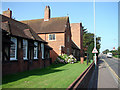
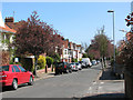
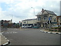
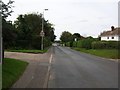
Photos of NR26 8TX
Area Information
Living in NR26 8TX offers a specific residential experience within this small postcode cluster. The area covers just three hectares and holds a population of 1771 residents. This concentrated size creates a compact community where daily life moves at a manageable pace. You will find yourself part of a tightly knit neighbourhood where the scale remains intimate despite the proximity to larger towns. The demographic profile suggests a mature community. Residents here enjoy a setting defined by its residential focus rather than commercial hubs. You can expect a environment suited for those seeking stability over rapid urban change. The population density stands at 58493 people per square kilometre, a figure derived from the total population divided by the specific land area of this postcode. While high, this density reflects a small geographic footprint typical of established rural or coastal settlements in Norfolk. This location provides a stable base for families and individuals. The area sits away from the loudest centers yet remains accessible to wider Norfolk networks. Your daily routine involves navigating a specific cluster of homes rather than sprawling suburbs. This arrangement means you likely spend less time commuting between housing estates and more time engaging with your immediate streets. The combination of limited physical space and a defined population creates a predictable neighbourhood dynamic. You know the area well because the boundaries are clear and the community is settled.
- Area Type
- Postcode
- Area Size
- 3.0 hectares
- Population
- 1771
- Population Density
- 1773 people/km²
The property market in NR26 8TX functions differently than in urban centers due to its specific housing stock. Almost all homes in NR26 8TX are houses. This configuration excludes multi-unit developments such as apartments or flats. You will predominantly encounter detached or semi-detached properties suitable for private outdoor space. Ownership dynamics reinforce this quiet market structure. With 81% home ownership, the area is overwhelmingly occupied by owner-occupiers rather than landlords managing rental stock. This high ratio of owned homes suggests property values are driven by local buyers seeking stability rather than investment portfolios flippng assets. The market focuses on existing stock rather than new build rentals. For buyers looking at homes in NR26 8TX, the options are limited by the small geographic size of just three hectares. Inventory turnover remains relatively low because owner-occupied residents are less likely to move frequently. If you wish to buy, you should target specific private listings within the immediate cluster. The lack of flats means families seeking a single-story solution or those requiring a garden find their niche here. Renters will find fewer options compared to a town center full of social housing. Understanding that this is an owner-occupied area of mostly houses helps you gauge pricing trends and negotiation leverage correctly.
House Prices in NR26 8TX
Showing 72 properties
| Address | Type | Beds | Baths | Last Sale Price | Last Sale Date | |
|---|---|---|---|---|---|---|
| 39 Childs Way, Sheringham, NR26 8TX | Terraced | 1 | 1 | £160,000 | Nov 2025 | |
| 79 Childs Way, Sheringham, NR26 8TX | Detached | 4 | 2 | £415,000 | Sep 2025 | |
| 10 Childs Way, Sheringham, NR26 8TX | Bungalow | 2 | 1 | £289,440 | Apr 2025 | |
| 46 Childs Way, Sheringham, NR26 8TX | Bungalow | 3 | 2 | £442,500 | Jan 2025 | |
| 47 Childs Way, Sheringham, NR26 8TX | Terraced | 1 | 1 | £180,000 | Apr 2024 | |
| 81 Childs Way, Sheringham, NR26 8TX | house | - | - | £320,500 | Dec 2023 | |
| 65 Childs Way, Sheringham, NR26 8TX | Semi-detached | 4 | 2 | £326,000 | Nov 2023 | |
| 8 Childs Way, Sheringham, NR26 8TX | Bungalow | - | - | £300,000 | Aug 2023 | |
| 2 Childs Way, Sheringham, NR26 8TX | Semi-detached | 2 | 1 | £254,000 | Aug 2023 | |
| 32 Childs Way, Sheringham, NR26 8TX | house | - | - | £398,000 | Apr 2023 |
Energy Efficiency in NR26 8TX
Amenities
Schools
Education options for families living near NR26 8TX include a mix of state and private institutions. Sheringham Community Primary School operates right on the doorstep as a state primary academy. The school holds a good Ofsted rating. Its proximity makes it a convenient choice for young families without a vehicle needed to get to class daily. Further along, Sheringham High School and Sixth Form Centre serves the upper age groups. Sheringham High School also stands as an academy with a good Ofsted rating. You will find this institution offers comprehensive education alongside its sixth form provision. For families with complex or specific educational needs, Sheringham Woodfields School provides special education support nearby. This ensures every child in the catchment has access to appropriate learning environments regardless of individual requirements. Independent options exist for those outside the state system. Hilbre School offers an independent education choice for pupils in the broader area. The presence of both state academies and independent schools gives parents multiple pathways. You can select based on Ofsted ratings, curriculum preferences, or proximity to your home. The availability of Sheringham High School and Sheringham Community Primary School means daily commutes are short. This setup supports a balanced lifestyle where learning happens close to home.
| Rank | School | Type | Entry gender | Ages |
|---|
Explore more schools in this area
Go to Schools tabDemographics
The community in NR26 8TX is defined by a distinct age profile and high levels of stability. The median age stands at 47 years, placing the neighbourhood slightly older than the national average. The most common age range comprises elderly residents aged 65 years and older. This demographic shift influences the daily rhythm of the streets and the types of services required locally. Home ownership remains the dominant housing arrangement here. Approximately 81% of households own their homes outright or with a mortgage. This high ownership figure indicates a settled population with fewer short-term renters moving through the streets annually. The presence of owners often correlates with lower turnover rates and a stronger sense of local stewardship among residents. Accommodation types exclusively consist of houses. There are no flats or apartments within this postcode. This structure ensures that garden space and single-story living are standard features of the area. The predominant ethnic group within the community is White. You will encounter a homogenous population in terms of broad ethnic categorisation. These factors combine to create a quiet, established residential zone. The data points to a neighbourhood where residents have deep roots and long-term plans rather than transient lifestyles.
Household Size
Accommodation Type
Tenure
Ethnic Group
Religion
Household Composition
Age
Household Deprivation
NS-SEC
Explore more demographic insights in this area
Go to Demographics tabPlanning
Planning Constraints
- Flood RiskPremium
- Ramsar Wetland SitesPremium
- Area of Outstanding Natural BeautyPremium
- Protected Nature ReservePremium
- Protected WoodlandPremium