Area Overview for NR26 8NE
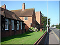
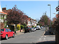
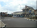
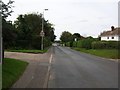
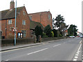
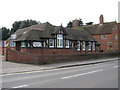
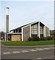
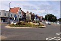
Photos of NR26 8NE
Area Information
Living in NR26 8NE offers a very specific residential experience defined by high density within a compact footprint. This postcode covers a cluster of just 6.2 hectares, yet it accommodates 1,771 residents. That configuration translates to a population density of 28,543 people per square kilometre, creating a tightly packed environment. You are stepping into a neighbourhood where space at ground level is limited but community presence is intense. The area functions as a distinct residential hub rather than a sprawling suburb. When you shop or commute, distances are short because the footprint is so small. The character here is shaped entirely by this concentration of households. Prospective buyers must weigh the convenience of this compact layout against the potential for noise and proximity to neighbours. There is no room for error in property selection within a zone of less than 0.06 square kilometres. Daily life revolves around this central cluster where every building feels close to another. The architecture and street design support this dense arrangement. You cannot find a more concentrated residential cluster in the Sheringham region. The sheer number of people in such a small area defines the rhythm of the community.
- Area Type
- Postcode
- Area Size
- 6.2 hectares
- Population
- 1771
- Population Density
- 1773 people/km²
The property market in NR26 8NE is characterised by a near-total absence of the rental sector within this specific postcode. With 81% home ownership, the vast majority of these 1,771 residents are living in properties they own. This ownership model creates a stable market where values tend to be driven by local demand rather than short-term lets. All accommodation in this cluster consists of houses. You will not find purpose-built flats or high-rise blocks here. The housing stock reflects the historical development of the area as a traditional residential zone. When you consider homes in NR26 8NE, you are purchasing a standalone or semi-detached property typical of the North Norfolk coast. The high ownership rate of 81% means the local surveyor will likely encounter families or retirees who have lived here for decades. This long tenure often correlates with well-maintained properties and a slower turnover rate. If you are looking at this area, expect competition between purchasers rather than a surplus of landlords seeking tenants. The inventory consists primarily of period cottages or Victorian-era homes that match the house definition found across the cluster. This market characteristics allows for a more predictable buying process compared to volatile rental-heavy districts.
House Prices in NR26 8NE
Showing 41 properties
| Address | Type | Beds | Baths | Last Sale Price | Last Sale Date | |
|---|---|---|---|---|---|---|
| 11 Uplands Park, Sheringham, NR26 8NE | Detached | 4 | 1 | £650,000 | Jul 2025 | |
| Pinecroft, 23 Uplands Park, Sheringham, NR26 8NE | house | 3 | 1 | £618,500 | Apr 2024 | |
| 13 Uplands Park, Sheringham, NR26 8NE | Bungalow | - | - | £690,000 | Jun 2023 | |
| 24 Uplands Park, Sheringham, NR26 8NE | Bungalow | - | - | £585,000 | Mar 2022 | |
| 20 Uplands Park, Sheringham, NR26 8NE | Bungalow | - | - | £605,000 | Sep 2021 | |
| 28 Uplands Park, Sheringham, NR26 8NE | Bungalow | - | - | £435,000 | Nov 2020 | |
| 3 Uplands Park, Sheringham, NR26 8NE | Bungalow | 4 | 2 | £500,000 | Dec 2019 | |
| 9 Uplands Park, Sheringham, NR26 8NE | Bungalow | 4 | 2 | £635,000 | Aug 2019 | |
| 21 Uplands Park, Sheringham, NR26 8NE | Bungalow | - | - | £410,000 | Sep 2018 | |
| 33 Uplands Park, Sheringham, NR26 8NE | Bungalow | 3 | 1 | £420,000 | Apr 2018 |
Energy Efficiency in NR26 8NE
Your daily routine in NR26 8NE includes easy access to three major retail chains. Budgens Sheringham, Tesco Sheringham, and Sainsburys Sheringham are all within reasonable distance. You do not need private transport to access groceries or household essentials. For travel further afield, four railway stations are nearby, including Sheringham Railway Station. Sheringham Station offers the most direct connection to Norwich and London. West Runton and Cromer stations provide additional rail options for holiday travel or business trips. You can also access Weybourne and Holt via metro services, expanding your commuting radius. These transport nodes mean you are never truly isolated despite the residential focus of the area. The presence of these major supermarkets supports self-sufficient living where you can shop for everything from vegetables to furniture without a long drive. The station network integrates well with the local road system. Your lifestyle benefits from a blend of quiet residential living and immediate access to commercial services. You have the convenience of village amenities combined with the connectivity of a town rail network.
Amenities
Schools
Families in NR26 8NE have access to a varied selection of educational institutions nearby. The closest state-funded primary education is provided by Sheringham Community Primary School, which holds a good Ofsted rating. For older children, Sheringham High School operates as an academy and also carries a good Ofsted rating provision. You should distinguish this from the other entry called Sheringham High School and Sixth Form Centre, which appears in local records but lacks a specified Ofsted grade in the current dataset. Special educational needs are catered for by Sheringham Woodfields School, designated as a special school. For those seeking private education, Hilbre School offers an independent alternative. The presence of Sheringham Community Primary School and Sheringham High School ensures that state-educated children have two options within the immediate vicinity. The good ratings attached to the community primary and the academy high school indicate a standard of education that meets national benchmarks. You have choices ranging from state-focused environments to independent private education if budget allows. The range of institutions means parents do not need to travel far for schooling. Each school serves a specific function within the local educational ecosystem.
| Rank | School | Type | Entry gender | Ages |
|---|
Explore more schools in this area
Go to Schools tabDemographics
The community in NR26 8NE is heavily weighted towards older age groups. The median age stands at 47 years. More specifically, the most common age range is the elderly demographic, defined as people over 65 years old. This demographic skew suggests a neighbourhood settled by established homeowners rather than young families or students. House ownership is the dominant model, with 81% of residents owning their homes outright or with a mortgage. This figure indicates a strong sense of permanence within the area. Nearly four out of every five households are owner-occupied. Accommodation types are exclusively houses, meaning you will not find flats or terraced properties linked to modern high-density housing blocks. The predominant ethnic group is White, reflecting the traditional demographic makeup of the broader coastal region. There is no data suggesting a significant influx of modern migrants or international students in this specific cluster. The social fabric appears anchored by long-term residents who have roots in the locality. You are buying into an area where the majority of neighbours are likely to be retired or semi-retired individuals seeking stability. The age profile points directly to a quiet, settled environment suited to those who value consistency over change.
Household Size
Accommodation Type
Tenure
Ethnic Group
Religion
Household Composition
Age
Household Deprivation
NS-SEC
Explore more demographic insights in this area
Go to Demographics tabPlanning
Planning Constraints
- Flood RiskPremium
- Ramsar Wetland SitesPremium
- Area of Outstanding Natural BeautyPremium
- Protected Nature ReservePremium
- Protected WoodlandPremium