Area Overview for NR26 8QQ
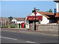
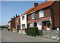
Photos of NR26 8QQ


Area Information
Living in NR26 8QQ offers a distinct coastal experience defined by its compact residential nature. This postcode covers a precise area of just 5,132 square metres, making it an intimate cluster rather than a sprawling suburb. Despite its small physical footprint, the location supports a population of 1,506 people, resulting in a population density of 293,448 people per square kilometre. This high density creates a close-knit environment where neighbours are inevitably aware of one another. The area functions as a focused residential hub within the wider Norfolk landscape. Daily life here is characterised by a sense of proximity to all necessities without the noise of a major city. Residents enjoy a setting that blends the quiet of a small settlement with the convenience of being close to significant transport links and major retailers. You will find that life in this postcode revolves around a tight community grid where every shop and station is within a short journey. The area avoids the sprawl of larger towns, providing a rooted experience where the community feels contained and manageable. This specific postcode represents a slice of Norfolk life that prioritises local connection over expansive space.
- Area Type
- Postcode
- Area Size
- 5132 m²
- Population
- Not available
- Population Density
- Not available
The housing stock in NR26 8QQ is defined by a clear owner-occupier bias, with homeowners accounting for 70% of all households. This statistic remains the single most significant indicator of the local market character. The accommodation type is almost entirely houses, meaning you will rarely encounter high-rise flats or purpose-built rental estates within this postcode. This configuration shapes the daily reality for those living in NR26 8QQ and renders the area ideal for families or couples seeking a traditional property. The high rate of ownership implies that many homes have been bought and lived in for decades. This long-term holding patterns typically results in properties that are well maintained and attuned to the specific needs of their occupants. Buyers looking at homes in NR26 8QQ will find a market that values tradition and consistency. Because the stock consists of houses rather than shared flats, the noise levels and social dynamics differ from larger urban zones. This concentration of owner-occupied houses creates a stable demand environment. The small size of the postcode area limits the total number of available properties, which keeps the local market tight. Understanding these figures is essential when assessing the availability and nature of properties available for purchase in this specific location.
House Prices in NR26 8QQ
Showing 24 properties
| Address | Type | Beds | Baths | Last Sale Price | Last Sale Date | |
|---|---|---|---|---|---|---|
| 28 Huntley Crescent, Sheringham, NR26 8QQ | Semi-detached | 2 | 1 | - | - | |
| Garden Cottage, 17A Huntley Crescent, Sheringham, NR26 8QQ | house | - | - | - | - | |
| 1 Huntley Crescent, Sheringham, NR26 8QQ | house | - | - | - | - | |
| 16 Huntley Crescent, Sheringham, NR26 8QQ | Flat | - | - | - | - | |
| 24 Huntley Crescent, Sheringham, NR26 8QQ | Flat | - | - | - | - | |
| 2 Huntley Crescent, Sheringham, NR26 8QQ | Flat | - | - | - | - | |
| 20 Huntley Crescent, Sheringham, NR26 8QQ | Flat | - | - | - | - | |
| 22 Huntley Crescent, Sheringham, NR26 8QQ | Maisonette | - | - | - | - | |
| 12 Huntley Crescent, Sheringham, NR26 8QQ | Terraced | - | - | - | - | |
| 11 Huntley Crescent, Sheringham, NR26 8QQ | Bungalow | - | - | - | - |
Energy Efficiency in NR26 8QQ
Your daily lifestyle in NR26 8QQ benefits from a dense concentration of practical amenities and transport hubs. You have immediate access to five major retail outlets, including Tesco Sheringham, Sainsburys Sheringham, and Budgens Sheringham. These venues provide everything from groceries to household essentials without requiring a long drive. For commuting, four rail stations are within practical reach, including Suggesting that you do not rely solely on your car for travel. Sourcing transit options at Sheringham Railway Station, West Runton Railway Station, and Cromer Railway Station gives you flexibility when planning journeys. You can also use two metro connections located at Weybourne and Holt to reach nearby towns quickly. This proximity to specific venues like the Sheringham Railway Station makes NR26 8QQ a convenient base for exploring the Norfolk coast. The presence of multiple supermarkets and easy rail access defines the character of life here as balanced and convenient. You can walk to a shop or catch a train when the weather turns bad. The lifestyle is one of efficient planning rather than deprivation of options.
Amenities
Schools
| Rank | School | Type | Entry gender | Ages |
|---|
Explore more schools in this area
Go to Schools tabDemographics
The community in NR26 8QQ is dominated by residents in the 30 to 64 age range, with a median age of 47 years. This demographic profile indicates a neighbourhood mature enough to value stability and security. Seventy per cent of households in this area own their homes, suggesting a strong commitment to long-term residency rather than transient housing. Almost exclusively, the accommodation type consists of houses, reflecting a preference for detached or semi-detached living arrangements over flats. The predominant ethnic group is White, with other groups forming a smaller minority within the local population. You can expect a community where family traditions and established neighbourhood bonds are common themes. The age structure supports a stable environment where children often attend local schools near NR26 8QQ and where grandchildren may grow up playing in local parks. The high level of home ownership fuels a sense of permanence and investment in the local area. This demographic data points towards a settled lifestyle where investors and young professionals are less common than those seeking a permanent home. The concentration of adults in the middle years creates a neighbourhood dynamic focused on community engagement and local governance rather than youthful nightlife.
Household Size
Accommodation Type
Tenure
Ethnic Group
Religion
Household Composition
Age
Household Deprivation
NS-SEC
Explore more demographic insights in this area
Go to Demographics tabPlanning
Planning Constraints
- Flood RiskPremium
- Ramsar Wetland SitesPremium
- Area of Outstanding Natural BeautyPremium
- Protected Nature ReservePremium
- Protected WoodlandPremium