Area Overview for NR26 8QD
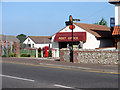
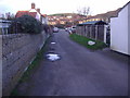
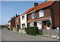
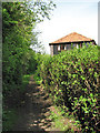
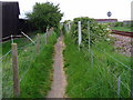
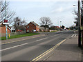
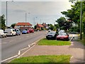
Photos of NR26 8QD


Area Information
Living in NR26 8QD means settling into a specific residential cluster surrounded by Sandringham. This postcode covers 6.5 hectares, creating a tight-knit environment within the broader North Norfolk travel network. The small footprint translates to a population of 1,506 residents who rely on immediate local connections. Life here is defined by its compact nature; the area is a distinct residential pocket rather than a sprawling village. You will find yourself in a setting where the community relies on established infrastructure rather than new developments. The location sits comfortably within the Norfolk Constabulary jurisdiction, benefitting from the rural character of the wider Sheringham and West Runton region. Proximity to railway hubs like Sheringham and Cromer defines the daily rhythm for many households in this cluster. The area avoids major planning constraints such as protected woodlands or Ramsar wetlands, allowing development to focus on residential needs. However, the presence of protected nature reserves nearby suggests an environment where green spaces are legally safeguarded. Security is a priority, with the area recording a below-average crime rate. Daily life involves navigating a defined estate where neighbours know one another, supported by easy access to Sainsburys and the Sheringham railway station. The postcode offers a grounded existence free from industrial planning restrictions.
- Area Type
- Postcode
- Area Size
- 6.5 hectares
- Population
- Not available
- Population Density
- Not available
The property market in NR26 8QD is characterised by a stable, owner-occupied segment. With 70% of the population owning their homes, buy-to-let investors play a minimal role in this specific cluster. The accommodation stock consists primarily of houses, meaning you will not find a high concentration of apartments or detached bungalows. This homogeneity suggests that buyers looking for consistency will find it here. The market is driven by local families and those relocating to the Sheringham area for work or retirement. Prices in such dense residential clusters often reflect the scarcity of land. The 6.5-hectare size limits new supply, keeping the secondary market active for those moving from larger estates. You will compete with other homeowners rather than landlords when purchasing a property. The high ownership rate correlates with a community that values stability over rapid turnover. House prices will depend heavily on proximity to the nearest railway station at Sheringham and Cromer. Looking at immediate surroundings, the market remains tight due to the small footprint of the postcode.
House Prices in NR26 8QD
Showing 13 properties
| Address | Type | Beds | Baths | Last Sale Price | Last Sale Date | |
|---|---|---|---|---|---|---|
| 11 Havelock Road, Sheringham, NR26 8QD | house | - | - | £235,000 | Feb 2017 | |
| 3 Havelock Road, Sheringham, NR26 8QD | house | - | - | £305,000 | Jan 2016 | |
| 7 Havelock Road, Sheringham, NR26 8QD | house | - | - | £330,000 | Dec 2013 | |
| Silverwood, 1A Havelock Road, Sheringham, NR26 8QD | house | - | - | £395,000 | Aug 2013 | |
| Sunpatch, 9 Havelock Road, Sheringham, NR26 8QD | house | - | - | £205,000 | May 2011 | |
| 12 Havelock Road, Sheringham, NR26 8QD | Detached | 4 | 2 | £94,000 | Feb 2002 | |
| 10 Havelock Road, Sheringham, NR26 8QD | Detached | - | - | £155,000 | Aug 2000 | |
| 4 Havelock Road, Sheringham, NR26 8QD | Detached | - | - | £125,000 | Jul 1999 | |
| 8 Havelock Road, Sheringham, NR26 8QD | Detached | - | - | £78,000 | Jul 1995 | |
| 6 Havelock Road, Sheringham, NR26 8QD | Detached | - | - | - | - |
Energy Efficiency in NR26 8QD
Your daily lifestyle centres around local retail and transport hubs. Within a short distance, you can visit Tesco Sheringham, Sainsburys Sheringham, and Budgens Sheringham for all grocery needs. These supermarkets form the backbone of your shopping routine. The presence of these chains eliminates the need for long drives. For travel, Sheringham Railway Station provides direct links to wider Norfolk and national networks. Rail access also extends to West Runton and Cromer, expanding your travel options significantly. You have easy metro access to Weybourne and Holt, which offer additional leisure opportunities. The nearby protected nature reserves are a key feature of local life, encouraging outdoor exploration. You will enjoy the tranquillity of the coast without being too far from town centres. Sheringham serves as your primary commercial hub, offering dining and essential services. The lifestyle here balances rural remoteness with urban convenience. You gain the quiet of a small postcode while maintaining access to major retailers. The layout ensures that essential trips are short and stress-free.
Amenities
Schools
| Rank | School | Type | Entry gender | Ages |
|---|
Explore more schools in this area
Go to Schools tabDemographics
The community in NR26 8QD is dominated by adults between the ages of 30 and 64 years old. The median age stands at 47, confirming that the area attracts families and mid-career professionals. Home ownership defines the neighbourhood, with 70% of residents owning their homes outright or with a mortgage. This high ownership rate indicates stability and a lack of transient populations. Accommodation types are almost exclusively houses, reflecting the traditional family-oriented approach of the residents. The demographic makes this a quiet neighbourhood suitable for those seeking a settled lifestyle. Ethnic diversity is not a primary characteristic here, as the predominant group identifies as White. The population density reaches 23,149 people per square kilometre, which seems high for the 6.5-hectare size but reflects the compact clustering of the postcode. You will find a mature demographic where long-term residents hold significant sway over local affairs. The absence of young children or elderly residents as the primary demographic group influences local spending and community activities. Families are the core demographic, likely driven by the presence of nearby schools near Sheringham and the desire for stability. The area does not show signs of significant demographic shifting.
Household Size
Accommodation Type
Tenure
Ethnic Group
Religion
Household Composition
Age
Household Deprivation
NS-SEC
Explore more demographic insights in this area
Go to Demographics tabPlanning
Planning Constraints
- Flood RiskPremium
- Ramsar Wetland SitesPremium
- Area of Outstanding Natural BeautyPremium
- Protected Nature ReservePremium
- Protected WoodlandPremium