Area Overview for NR26 8JS
Photos of NR26 8JS
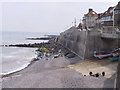
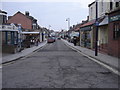
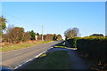
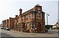
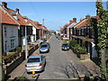
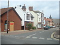
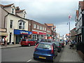
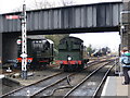
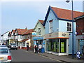
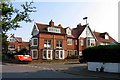
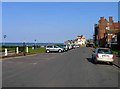
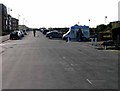
100 photos from this area
Area Information
Key information about the NR26 8JS including its size, population, and administrative classification.
- Area Type
- Postcode
- Area Size
- 1091 m²
- Population
- 1752
- Population Density
- 1503 people/km²
House Prices in NR26 8JS
7
Properties
£146,450
Average Sold Price
£36,750
Lowest Price
£181,000
Highest Price
Showing 7 properties
| Address | Type | Beds | Baths | Last Sale Price | Last Sale Date | |
|---|---|---|---|---|---|---|
| 10, Barchams Yard, High Street, Sheringham, NR26 8JS | Terraced | 2 | 1 | £181,000 | Sep 2025 | |
| 11, Barchams Yard, High Street, Sheringham, NR26 8JS | Terraced | 2 | 1 | £165,500 | Nov 2019 | |
| 8, Barchams Yard, High Street, Sheringham, NR26 8JS | house | 2 | 1 | £175,000 | Mar 2016 | |
| 1, Barchams Yard, High Street, Sheringham, NR26 8JS | house | - | - | £174,000 | Jan 2012 | |
| 5, Barchams Yard, High Street, Sheringham, NR26 8JS | Cottage | 2 | 1 | £36,750 | Jan 1999 | |
| 7, Barchams Yard, High Street, Sheringham, NR26 8JS | Terraced | - | - | - | - | |
| 2-3, Barchams Yard, High Street, Sheringham, NR26 8JS | Terraced | 3 | 2 | - | - |
Energy Efficiency in NR26 8JS
Amenities
Schools
| Rank | School | Type | Entry gender | Ages |
|---|
Explore more schools in this area
Go to Schools tabDemographics
Household Size
One person
most common
Accommodation Type
Houses
most common
Tenure
61
majority
Ethnic Group
White
most common
Religion
N/A
most common
Household Composition
N/A
most common
Age
47
median
Elderly (65+ years)
most common
Household Deprivation
N/A
with no deprivation
NS-SEC
31
in Lower managerial occupations
Explore more demographic insights in this area
Go to Demographics tabPlanning
Planning Constraints
- Flood RiskPremium
- Ramsar Wetland SitesPremium
- Area of Outstanding Natural BeautyPremium
- Protected Nature ReservePremium
- Protected WoodlandPremium