Area Overview for NR26 8ET
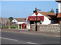
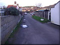
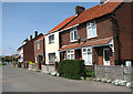
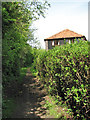
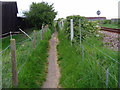
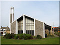
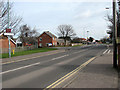
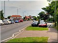
Photos of NR26 8ET


Area Information
Living in NR26 8ET offers a settled residential experience within a small cluster of homes. This specific postcode covers an area of 3,277 m² and supports a population of 1,506 residents. The community is compact yet self-contained, providing a quiet environment for those seeking a residential atmosphere away from larger urban sprawls. You will find that daily life revolves around local convenience rather than long commutes to distant city centres. The area functions as a tight-knit neighbourhood where residents enjoy a sense of place without overcrowding. Moving to NR26 8ET means choosing stability and a home in a location defined by its residential focus. The small scale of the area ensures that it remains manageable for families and retirees alike. You can access nearby towns while maintaining a distinct local identity. The character of NR26 8ET is shaped by its housing stock and the people who call it home. It is a straightforward choice for buyers who value a defined, non-metropolitan lifestyle. The location balances isolation with practical access to services just outside your doorstep.
- Area Type
- Postcode
- Area Size
- 3277 m²
- Population
- Not available
- Population Density
- Not available
The property market in NR26 8ET is characterised by stability and a strong preference for ownership. Seventy per cent of residents own their homes, which indicates a low level of vacancy and turnover. This high ownership rate suggests that properties in NR26 8ET are primarily owned by people who intend to live there for a significant period. The accommodation type is overwhelmingly houses, meaning you will find detached, semi-detached, or terraced properties rather than high-rise flats or modern apartment blocks. This stock caters to those who value garden space and traditional architectural styles. The market is not driven by speculative buying but by genuine residential demand from the local population. When searching for homes in NR26 8ET, you will encounter a limited but consistent selection of real estate options. The lack of rental-dominated housing means that buyers can often negotiate from a position of strength regarding long-term occupancy. You do not need to compete with short-term lets or corporate landlords in this area. The housing stock serves a clear purpose: providing permanent, comfortable residences for the 1,506 people currently living here.
House Prices in NR26 8ET
Showing 8 properties
| Address | Type | Beds | Baths | Last Sale Price | Last Sale Date | |
|---|---|---|---|---|---|---|
| 39 Beeston Common, Sheringham, NR26 8ET | Semi-detached | 3 | 2 | £422,500 | Apr 2024 | |
| 43 Beeston Common, Sheringham, NR26 8ET | house | - | - | £448,500 | Sep 2022 | |
| 40 Beeston Common, Sheringham, NR26 8ET | house | - | - | £150,000 | Aug 2012 | |
| 46 Beeston Common, Sheringham, NR26 8ET | house | - | - | £175,000 | Jul 2012 | |
| 45 Beeston Common, Sheringham, NR26 8ET | Semi-detached | - | - | £189,950 | Jan 2007 | |
| 44 Beeston Common, Sheringham, NR26 8ET | Semi-detached | - | - | £144,000 | Oct 2003 | |
| 41 Beeston Common, Sheringham, NR26 8ET | Semi-detached | - | - | - | - | |
| 42 Beeston Common, Sheringham, NR26 8ET | Semi-detached | - | - | - | - |
Energy Efficiency in NR26 8ET
Daily life in NR26 8ET is enhanced by proximity to essential amenities within practical reach. You have immediate access to three notable retail locations: Tesco Sheringham, Sainsburys Sheringham, and Budgens Sheringham. These supermarkets ensure you can stock your home with groceries without needing a long car journey. For commuters, rail transport is accessible via Sheringham Railway Station, West Runton Railway Station, and Cromer Railway Station. This network connects you to wider transport routes and regional hubs. Additionally, metro services are available at Weybourne and Holt, offering further travel links for those who need to go beyond the immediate daily commute. The presence of these facilities means you do not have to travel far for shopping, dining, or transit. Retail options in Sheringham provide variety for both everyday essentials and planned shopping trips. Train stations offer regular services to nearby towns, expanding your world for leisure and work. You can walk to local stores or drive a short distance to catch a train. This accessibility makes NR26 8ET a practical base for living, balancing a quiet home environment with the conveniences of nearby high-street life.
Amenities
Schools
| Rank | School | Type | Entry gender | Ages |
|---|
Explore more schools in this area
Go to Schools tabDemographics
The community in NR26 8ET reflects a mature demographic profile. The median age is 47 years, with adults between 30 and 64 years forming the most common age range. This indicates that the neighbourhood attracts established households rather than young singles or families with very small children. Home ownership stands at 70% within this postcode area, suggesting a long-term settled population rather than a transient rental market. Most of the accommodation consists of houses, which aligns with the preference for family living or independent living for older residents. The predominant ethnic group is White, reflecting a heterogeneous but traditional community makeup typical of many English coastal or market-town fringes. These figures paint a picture of residents who have put down roots and built their lives locally. A 70% ownership rate means you are likely to encounter neighbours who have lived here for decades. The age mix suggests a quiet evening atmosphere with fewer late-night disturbances. You will find a community focused on stability, leisure activities, and domestic life rather than rapid growth or development cycles.
Household Size
Accommodation Type
Tenure
Ethnic Group
Religion
Household Composition
Age
Household Deprivation
NS-SEC
Explore more demographic insights in this area
Go to Demographics tabPlanning
Planning Constraints
- Flood RiskPremium
- Ramsar Wetland SitesPremium
- Area of Outstanding Natural BeautyPremium
- Protected Nature ReservePremium
- Protected WoodlandPremium