Area Overview for NR26 8AX
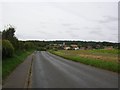
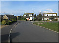
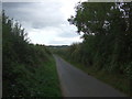
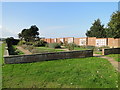
Photos of NR26 8AX


Area Information
Living in NR26 8AX means residing within a small residential cluster defined by postcode NR26 8AX. This area occupies just 1.8 hectares, creating a compact environment where neighbours are often close at hand. You are part of a community with a total population of 1771 residents, which fosters a tight-knit atmosphere rather than the anonymity of larger towns. Although the density figure of 99,033 people per square kilometre appears high due to the tiny geographic footprint, this reflects a concentrated settlement pattern common in coastal villages. Daily life here revolves around this specific postcode area, offering a distinct alternative to the sprawl of major cities. The setting is intimate, with housing spread across a limited landmass rather than expanding outward. For those seeking a defined locality with clear boundaries, NR26 8AX provides a contained living experience. You do not traverse vast distances to find your home here; everything is centred around this small but significant slice of Norfolk. The area exists as a functional residential hub, prioritising established neighbours over new developments. It is a place where the layout supports familiarity and where the physical scale of the neighbourhood matches its historical roots. Prospective buyers should appreciate that life in NR26 8AX is characterised by proximity and a lack of urban sprawl.
- Area Type
- Postcode
- Area Size
- 1.8 hectares
- Population
- 1771
- Population Density
- 1773 people/km²
The property market in NR26 8AX is heavily skewed toward owner-occupied homes. With 81 per cent of the population owning their homes, you are entering a market where rental properties are a minority. The predominant accommodation type is houses, which reinforces the image of a traditional, family-centric neighbourhood rather than a student or investment hub. This ownership level implies that most residents are entrenched in the local area, likely having purchased properties many years ago. When buying homes in NR26 8AX, you should expect to compete with solid owners who value stability over quick sales. The small area size of 1.8 hectares constrains the number of available homes, making NR26 8AX an exclusive locality in terms of housing supply. There are no high-rise developments or flats within this specific postcode, ensuring a consistent architectural style suited to a village setting. If you are looking to relocate to this coastal region, your options will focus on houses rather than modern apartment complexes. The market logic here follows a different rhythm than urban centres, prioritising established ownership over transient tenancy. Understanding these dynamics helps you navigate the local sphere of NR26 8AX with realistic expectations about availability and price competition.
House Prices in NR26 8AX
Showing 35 properties
| Address | Type | Beds | Baths | Last Sale Price | Last Sale Date | |
|---|---|---|---|---|---|---|
| 8 Woodhouse Close, Sheringham, NR26 8AX | Semi-detached | 3 | 1 | £295,000 | Sep 2025 | |
| 33 Woodhouse Close, Sheringham, NR26 8AX | house | - | - | £195,000 | May 2018 | |
| 35 Woodhouse Close, Sheringham, NR26 8AX | house | - | - | £195,000 | Apr 2018 | |
| 36 Woodhouse Close, Sheringham, NR26 8AX | house | - | - | £235,000 | Mar 2018 | |
| 34 Woodhouse Close, Sheringham, NR26 8AX | house | - | - | £236,000 | Mar 2018 | |
| 31 Woodhouse Close, Sheringham, NR26 8AX | house | - | - | £245,000 | Mar 2018 | |
| 6 Woodhouse Close, Sheringham, NR26 8AX | house | - | - | £160,000 | Apr 2014 | |
| 30 Woodhouse Close, Sheringham, NR26 8AX | Semi-detached | - | - | £184,000 | Aug 2007 | |
| 29 Woodhouse Close, Sheringham, NR26 8AX | Detached | - | - | £124,000 | Nov 2002 | |
| 23 Woodhouse Close, Sheringham, NR26 8AX | Terraced | - | - | £54,950 | Sep 1995 |
Energy Efficiency in NR26 8AX
Your daily access to amenities in NR26 8AX is supported by several key venues within practical reach. Retail options include shop locations at Budgens Sheringham, Tesco Sheringham, and Sainsburys Sheringham, ensuring you can purchase groceries and goods without travelling far. For rail travel, four stations serve the area, including Sheringham Railway Station, West Runton Railway Station, and Cromer Railway Station. These links connect you to broader transport networks. Additionally, two motorway services are accessible at Weybourne and Holt, providing road access for longer journeys. You will find a balance between local convenience and regional connectivity right from your doorstep. The presence of multiple supermarket branches means you do not need to drive long distances for weekly shopping. Rail and motorway options offer flexibility should you need to visit other parts of the UK. This mix of retail and transport hubs forms the backbone of life in NR26 8AX. You can enjoy the quiet of a village while retaining easy access to modern conveniences and regional travel.
Amenities
Schools
The educational landscape surrounding NR26 8AX offers a range of institutions catering to different needs. Sheringham Community Primary School operates as a primary school with a good Ofsted rating, providing an option for younger children within the immediate vicinity. For secondary education, families consider Sheringham High School, which is an academy with a good Ofsted rating. If your children have special educational needs, Sheringham Woodfields School serves as a special school nearby. There is also access to independent education via Hilbre School, which stands as an independent option in the wider area. For older students, Sheringham High School and Sixth Form Centre represents another educational pathway in Sheringham. You will note a mix of publicly funded academies and schools alongside private options. This variety allows you to choose based on specific educational philosophies or specialist requirements. The presence of a school rated 'good' by Ofsted provides a clear, positive marker for educational quality in the region. When evaluating schools near NR26 8AX, these names appear consistently in local records, offering a stable framework for family planning.
| Rank | School | Type | Entry gender | Ages |
|---|
Explore more schools in this area
Go to Schools tabDemographics
The community in NR26 8AX is defined by an older demographic structure. Every claim about age must reference the median age of 47, which signals a shift away from young families toward mature residents. The most common age range is elderly people aged 65 years and over, indicating a significant number of retirees or long-term residents in this English postcode. You are looking at a neighbourhood where the rhythm of life often aligns with quieter, later years rather than active parenting schedules. Home ownership stands at 81 per cent, a figure that dominates the social fabric of NR26 8AX. This high rate of ownership suggests that most buildings here are lived in by people who have stayed for decades. The predominant accommodation type is houses, meaning you will not find apartment blocks or flats within this 1.8-hectare cluster. Regarding diversity, the predominant ethnic group recorded is White, reflecting the traditional composition of the Norfolk region. With these demographic facts in hand, the area presents a stable environment where long-term residents form the majority. The low rental segment correlates with the high ownership rate, creating a community where property value retention often takes precedence over market speculation. You are entering a well-established settlement where the population profile remains consistent rather than fluctuating with economic cycles.
Household Size
Accommodation Type
Tenure
Ethnic Group
Religion
Household Composition
Age
Household Deprivation
NS-SEC
Explore more demographic insights in this area
Go to Demographics tabPlanning
Planning Constraints
- Flood RiskPremium
- Ramsar Wetland SitesPremium
- Area of Outstanding Natural BeautyPremium
- Protected Nature ReservePremium
- Protected WoodlandPremium