Area Overview for NR26 8AS
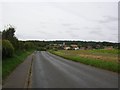
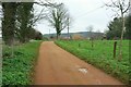
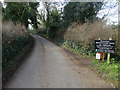
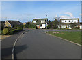
Photos of NR26 8AS


Area Information
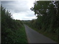
Living in NR26 8AS offers a specific residential experience within a compact cluster of just nine thousand three hundred twenty-two square metres. This postcode serves a defined population of 1,771 people, creating a tight-knit environment where neighbours are close by. The area sits in England, characterised by its small geographic footprint which intensifies the community feel. Residents here manage daily life within a very contained zone, meaning local journeys are short. The low density compared to the high population figure per square kilometre indicates intense land usage within this specific stretch. You are looking at a location where every service access is measured in rather than minutes, reflecting the precise nature of this residential pocket. The setting avoids the sprawl typical of larger towns, focusing instead on a concentrated living arrangement. Prospective homebuyers consider this area when they value proximity to established infrastructure found nearby in Sheringham and beyond. The physical limits of the postcode mean you engage deeply with the immediate surroundings rather than exploring distant suburbs. Buying a home here means joining a group defined by specific boundaries and a shared reliance on the local transport and retail network.
- Area Type
- Postcode
- Area Size
- 9322 m²
- Population
- 1771
- Population Density
- 1773 people/km²
The housing market in NR26 8AS is defined by a significant prevalence of owner-occupied properties, with evidence showing that 81 per cent of residents own their homes. This high tenure rate indicates a lack of long-term rental properties within the immediate cluster of this postcode. You can expect the housing stock to consist almost entirely of houses, distinguishing this area from urban centres where flats dominate the accommodation landscape. The majority of homes are in private ownership, which often reflects lower turnover rates and stable neighbourhoods where families stay for extended periods. Because this is a small residential cluster covering just 9,322 square metres, the total number of available properties is limited. Buyers looking at homes in this area must act quickly when opportunities arise, as the market is tightly constrained by the physical size of the postcode. The accommodation type data confirms a focus on single-family dwellings rather than multi-unit developments. This composition makes the area suitable for those seeking traditional houses rather than apartment living. When considering a purchase, you are entering a market where supply is determined by the existing houses rather than new builds or rental conversions. The high ownership percentage suggests that many current owners did not lease these properties initially but settled down and stayed.
House Prices in NR26 8AS
Showing 17 properties
| Address | Type | Beds | Baths | Last Sale Price | Last Sale Date | |
|---|---|---|---|---|---|---|
| 8 Shepherd Close, Sheringham, NR26 8AS | Bungalow | - | - | £285,000 | Apr 2019 | |
| 11 Shepherd Close, Sheringham, NR26 8AS | Bungalow | - | - | £315,000 | Mar 2018 | |
| 12 Shepherd Close, Sheringham, NR26 8AS | Bungalow | 3 | 2 | £425,000 | Dec 2017 | |
| 1 Shepherd Close, Sheringham, NR26 8AS | Bungalow | - | - | £285,000 | Oct 2016 | |
| 7 Shepherd Close, Sheringham, NR26 8AS | Bungalow | 2 | - | £285,000 | Aug 2016 | |
| 16 Shepherd Close, Sheringham, NR26 8AS | Bungalow | 3 | - | £385,000 | Jun 2016 | |
| 4 Shepherd Close, Sheringham, NR26 8AS | Bungalow | - | - | £250,000 | Feb 2011 | |
| 2 Shepherd Close, Sheringham, NR26 8AS | Bungalow | - | - | £272,500 | Jan 2011 | |
| 6 Shepherd Close, Sheringham, NR26 8AS | Detached | - | - | £239,950 | Nov 2005 | |
| 5 Shepherd Close, Sheringham, NR26 8AS | Detached | - | - | £214,595 | Nov 2005 |
Energy Efficiency in NR26 8AS
Your daily life in NR26 8AS benefits from immediate access to practical retail and transport hubs within Sheringham. You can visit Budgens Sheringham, Tesco Sheringham, and Sainsburys Sheringham for your weekly grocery shopping, as these three notable retailers are within practical reach. These supermarkets provide the essential convenience of stocking your home without needing to travel to larger towns. The local transport network includes four nearby rail stations, ensuring you can access Sheringham Railway Station, West Runton Railway Station, and Cromer Railway Station easily. You also benefit from proximity to Weybourne and Holt, which serve as notable hubs for further travel and local commerce. This variety of retail and rail options means you have reliable routes for both daily essentials and longer journeys. The presence of these specific stations and shops creates a convenient landscape where you do not need a car for all your errands. Living in this postcode puts you in a position to utilise the established infrastructure of the wider Sheringham area. The combination of major supermarket chains and frequent rail services ensures that lifestyle needs are met without excessive travel time.
Amenities
Schools
Families considering NR26 8AS have access to a range of educational establishments, including both state and independent options. Sheringham Community Primary School operates as a primary school with a good Ofsted rating, providing a recognised standard of education for younger children. You also have the option of Sheringham High School and Sixth Form Centre, which appears in the list of nearby schools alongside Sheringham High School. Sheringham High School is an academy that holds a good Ofsted rating, offering secondary education with a verified quality standard. Additionally, residents can access Sheringham Woodfields School, which serves as a special school, and Hilbre School, an independent institution. This mix allows you to choose between the state sector, which includes maintained primary and secondary provisions, or the independent choice represented by Hilbre School. The presence of multiple educational facilities means you do not need to commute far to find schooling for your children. The inclusion of a special school and an academy alongside primary provision creates a comprehensive local ecosystem. When planning your move, you can rely on the proximity of these named institutions to support your children's education within the Sheringham vicinity. The good ratings on key schools like the Community Primary and the High School provide a solid foundation for your family's future.
| Rank | School | Type | Entry gender | Ages |
|---|
Explore more schools in this area
Go to Schools tabDemographics
The community profile in NR26 8AS reflects an older demographic structure with a median age of 47 years. The most common age range consists of elderly residents aged 65 years and over, suggesting this area attracts retirees or residents seeking a quieter phase of life. Eighty-one per cent of households in this postcode own their homes, indicating a stable, long-term resident base rather than a transient rental population. Almost all residents live in houses, with flats being absent from the primary accommodation type for this location. The predominant ethnic group is White, mirroring broader national patterns for this region of England. These specific figures define the social fabric you would enter as a new buyer. The dominance of homeownership correlates with the age profile, as older residents often stay in their properties for decades. When you evaluate living in NR26 8AS, the data confirms a community built on tenure and permanence. The lack of significant youth or young family cohorts in the statistical breakdown suggests a mature neighbourhood atmosphere. This demographic reality influences local demand, meaning properties tend to suit established residents over first-time buyers. Understanding these numbers helps you gauge whether the area matches your intended lifestyle and social circle.
Household Size
Accommodation Type
Tenure
Ethnic Group
Religion
Household Composition
Age
Household Deprivation
NS-SEC
Explore more demographic insights in this area
Go to Demographics tabPlanning
Planning Constraints
- Flood RiskPremium
- Ramsar Wetland SitesPremium
- Area of Outstanding Natural BeautyPremium
- Protected Nature ReservePremium
- Protected WoodlandPremium