Area Overview for NR25 6DP
Photos of NR25 6DP
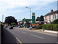
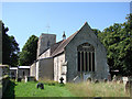
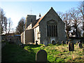
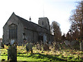
66 photos from this area
Area Information
Key information about the NR25 6DP including its size, population, and administrative classification.
- Area Type
- Postcode
- Area Size
- 1.4 hectares
- Population
- 1823
- Population Density
- 466 people/km²
House Prices in NR25 6DP
29
Properties
£148,042
Average Sold Price
£27,500
Lowest Price
£321,500
Highest Price
Showing 29 properties
| Address | Type | Beds | Baths | Last Sale Price | Last Sale Date | |
|---|---|---|---|---|---|---|
| 18 Swann Grove, Holt, NR25 6DP | Flat | - | - | £102,000 | Jan 2025 | |
| 29 Swann Grove, Holt, NR25 6DP | Detached | 3 | 1 | £277,500 | Sep 2023 | |
| 23 Swann Grove, Holt, NR25 6DP | Semi-detached | 3 | 1 | £257,500 | Jun 2023 | |
| 5 Swann Grove, Holt, NR25 6DP | Semi-detached | 2 | 1 | £230,000 | Jun 2023 | |
| 8 Swann Grove, Holt, NR25 6DP | Flat | - | - | £150,000 | Jul 2022 | |
| 26 Swann Grove, Holt, NR25 6DP | Semi-detached | 2 | - | £185,000 | Mar 2019 | |
| 28 Swann Grove, Holt, NR25 6DP | Semi-detached | 2 | 1 | £178,000 | Jun 2018 | |
| 25 Swann Grove, Holt, NR25 6DP | house | - | - | £166,000 | Jun 2018 | |
| 6 Swann Grove, Holt, NR25 6DP | Semi-detached | 3 | - | £188,000 | Sep 2017 | |
| 1 Swann Grove, Holt, NR25 6DP | Semi-detached | 3 | - | £321,500 | Jun 2016 |
Page 1 of 3
Energy Efficiency in NR25 6DP
Amenities
Schools
| Rank | School | Type | Entry gender | Ages |
|---|
Explore more schools in this area
Go to Schools tabDemographics
Household Size
Two person
most common
Accommodation Type
Houses
most common
Tenure
84
majority
Ethnic Group
White
most common
Religion
N/A
most common
Household Composition
N/A
most common
Age
47
median
Elderly (65+ years)
most common
Household Deprivation
N/A
with no deprivation
NS-SEC
43
in Lower managerial occupations
Explore more demographic insights in this area
Go to Demographics tabPlanning
Planning Constraints
- Flood RiskPremium
- Ramsar Wetland SitesPremium
- Area of Outstanding Natural BeautyPremium
- Protected Nature ReservePremium
- Protected WoodlandPremium