Area Overview for NR21 7EJ
Photos of NR21 7EJ
Area Information
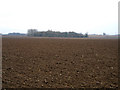
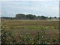
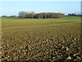
You are entering a residential cluster defined by postcode NR21 7EJ, a specific location covering 12.6 hectares just outside Fakenham. This tiny footprint houses a population of 2,734 people, resulting in a very low density of 47 people per square kilometre. You should expect a quiet, low-key environment rather than a busy high street scene. The area feels distinctly local because it is built for residents to live close to their neighbours and their immediate surroundings. It is not a large post code sector but a focused collection of homes in the wider Fakenham neighbourhood. When you consider living in NR21 7EJ, you are choosing stability and space. The small scale means traffic is generally light and the community is tightly knit. You will find the character here is defined by the ease of moving between front doors and gardens. This postcode serves as a solid base for those who prioritise peace of mind over city-centre proximity.
- Area Type
- Postcode
- Area Size
- 12.6 hectares
- Population
- 2734
- Population Density
- 47 people/km²
The property market in NR21 7EJ is overwhelmingly dominated by owner-occupied housing. With a home ownership rate of 67%, you are looking at an area where most residents have secured their own property and are unlikely to be in the process of selling. The accommodation type listed is Houses, which means you will not find terraced townhouses, semi-detached bungalows, or purpose-built flats within this specific postcode. The housing stock consists primarily of detached or semi-detached family homes, typical of the rural and suburban fringe surrounding Fakenham. Because the area is only 12.6 hectares, the variety of properties is naturally limited. You will find consistency in property style and age. There is very little rental turnover, as evidenced by the high ownership percentage. If you are looking to buy, competition might be lower than in more dynamic city centres. The market feels insular and stable. You cannot expect high-rise developments or frequent new builds in NR21 7EJ.
House Prices in NR21 7EJ
Showing 1 properties
| Address | Type | Beds | Baths | Last Sale Price | Last Sale Date | |
|---|---|---|---|---|---|---|
| Clebar, Colkirk Road, East Raynham, NR21 7EJ | Detached | - | - | £305,000 | Aug 2008 |
Energy Efficiency in NR21 7EJ
Your daily life in NR21 7EJ revolves around practical necessities located within a short drive to Fakenham town centre. You have access to major supermarkets including Tesco Fakenham, Morrisons Daily, and Aldi Fakenham. These three retail outlets provide you with ample choices for grocery shopping, ensuring you do not need to travel far for daily essentials. There are five notable retail venues in fact within practical reach, covering a range of food and household needs. You will find that the immediate surroundings of NR21 7EJ lack a high street, so all significant shopping trips take place in Fakenham. This setup offers convenience for routine purchases while reserving major leisure activities for the nearby town. You do not have pub ratings, cinema listings, or specific park names in the local data, so your leisure options depend on trips to the wider area. The lifestyle is functional and husband-and-wife friendly rather than adventurous or fringe-hipster. You buy your food at Tesco or Aldi and you drive to Fakenham for cinema. It is a standard, reliable routine.
Amenities
Schools
You have access to four specific schools near NR21 7EJ, separated by type and educational phase. In the primary sector, you have Blenheim Park Primary School, which serves younger children. You also have West Raynham Church of England Voluntary Aided Primary School and West Raynham Church of England Primary Academy, both offering primary education. For secondary education, the area feeds into Blenheim Park Academy. This academy holds a "good" Ofsted rating, which is a crucial metric for parents. You will notice a heavy concentration of primary options, suggesting that many families reside here with primary-school-aged children. The mix includes state-funded Church of England schools and a non-denominational academy. You do not have a standalone secondary school within this immediate postcode boundary, so teenagers likely travel to Blenheim Park Academy for their later years of education. The presence of both a voluntary aided school and an academy provides options for families with different educational values.
| Rank | School | Type | Entry gender | Ages |
|---|
Explore more schools in this area
Go to Schools tabDemographics
The community in NR21 7EJ is firmly established with a median age of 47 years. You will find that Adults aged between 30 and 64 years form the most common age range within this locality. This demographic profile suggests a neighbourhood dominated by mature families or couples who have settled for the long term. Career-established professionals and parents with school-age children represent the core resident base. You will see a high level of commitment to the area as 67% of households own their homes outright. This significant majority indicates deep roots and a reluctance to move frequently. The accommodation type is strictly Houses, meaning there are no apartments or flats in this specific cluster. While the predominant ethnic group is White, the area reflects the standard composition of the wider region without notable deviation. You are looking at a stable population where the child-to-parent ratio likely supports local school catchments well.
Household Size
Accommodation Type
Tenure
Ethnic Group
Religion
Household Composition
Age
Household Deprivation
NS-SEC
Explore more demographic insights in this area
Go to Demographics tabPlanning
Planning Constraints
- Flood RiskPremium
- Ramsar Wetland SitesPremium
- Area of Outstanding Natural BeautyPremium
- Protected Nature ReservePremium
- Protected WoodlandPremium