Area Overview for NR20 4RJ
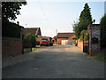
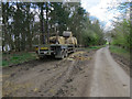
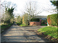
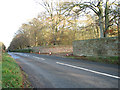
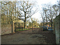
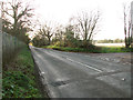
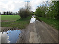
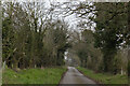
Photos of NR20 4RJ
Area Information
Living in NR20 4RJ means residing in a compact residential cluster defined by postcode NR20 4RJ. This specific area spans 49.6 hectares and accommodates 2,468 people, resulting in a population density of 74 people per square kilometre. You will find this postcode area in England, characterised by a quiet, low-density living environment. The small size of the cluster means distances between your home and local services are generally short. Daily life centres on the immediate neighbourhood rather than distant urban hubs. The environment offers a distinct sense of space because of the low population density figure. Homebuyers looking at this locale should consider the rural feel that comes with such sparse settlement patterns. You gain peace and quiet, but you must plan your commute to nearby towns carefully. The area functions as a self-contained community within the broader Norfolk landscape. Your neighbours will likely be other residents who have chosen a similar lifestyle away from the noise of the city. The physical layout supports a pace of life that prioritises outdoor access and local familiarity over rapid urban interaction.
- Area Type
- Postcode
- Area Size
- 49.6 hectares
- Population
- 2468
- Population Density
- 74 people/km²
The property market in NR20 4RJ is defined by a predominantly owner-occupied landscape. With 78% of residents owning their homes, the area functions as a settlement for those who have secured housing rather than a rental hotspot. Houses make up the accommodation type, meaning you will find single-family dwellings rather than flats or apartments. This housing mix suits families looking for space and gardens, which aligns with the low population density of 74 people per square kilometre. Buyers considering this postcode should note that the market is driven by existing homeowners trying to upsize, downsize, or relocate locally. The small size of the residential cluster means inventory levels may be limited compared to larger towns. Competition often comes from well-established families seeking stability in a known community. You will not find luxury apartments here; instead, you encounter traditional homes suited to the local climate and landscape. The high ownership rate implies that new builds are rare, and the stock likely consists of properties that have lived in for decades. When searching for homes in NR20 4RJ, your focus must be on these established houses within the 49.6-hectare boundary.
House Prices in NR20 4RJ
Showing 10 properties
| Address | Type | Beds | Baths | Last Sale Price | Last Sale Date | |
|---|---|---|---|---|---|---|
| Swanton Lodge, Dereham Road, Bylaugh, NR20 4RJ | Detached | 3 | 1 | £450,000 | Sep 2021 | |
| 4, The Oaks, Dereham Road, Bylaugh, NR20 4RJ | house | 2 | 1 | - | - | |
| Bylaugh Hall Farm, Access Roads In And Around Bylaugh Park, Bylaugh, NR20 4RJ | Farm | - | - | - | - | |
| Flat 2, Bylaugh Hall Farm, Access Roads In And Around Bylaugh Park, Bylaugh, NR20 4RJ | Flat | - | - | - | - | |
| Flat 1, Bylaugh Hall Farm, Access Roads In And Around Bylaugh Park, Bylaugh, NR20 4RJ | Flat | - | - | - | - | |
| 5, The Oaks, Dereham Road, Bylaugh, NR20 4RJ | Detached | - | - | - | - | |
| 1, The Oaks, Dereham Road, Bylaugh, NR20 4RJ | Semi-detached | - | - | - | - | |
| Bawdeswell Lodge, Access Roads In And Around Bylaugh Park, Bylaugh, NR20 4RJ | Detached | - | - | - | - | |
| 2, The Oaks, Dereham Road, Bylaugh, NR20 4RJ | Semi-detached | - | - | - | - | |
| 3, The Oaks, Dereham Road, Bylaugh, NR20 4RJ | house | - | - | - | - |
Energy Efficiency in NR20 4RJ
Your daily life in NR20 4RJ revolves around a limited but sufficient selection of amenities located nearby. For essential shopping, you can visit Morrisons Daily, Budgens Lenwade, and Iceland East, providing basic grocery needs without a long journey. These three outlets fall under the retail category and are within practical reach of residents in the postcode area. Beyond food, the metro category lists one notable destination: Dereham. This town likely serves as your main hub for larger supermarkets, cinemas, or leisure activities not found locally. The scarcity of amenities reinforces the rural, quiet character of living in NR20 4RJ. You will shop frequently at local stores but travel for周末 entertainment or specialised goods. The layout of the area separates daily necessities from major leisure destinations, requiring car ownership for flexibility. While the immediate surroundings of NR20 4RJ are sparse, the named amenities ensure you are not entirely dependent on national roads for basic supplies. Your lifestyle will balance the tranquility of the home with planned trips to these specific service points.
Amenities
Schools
Families living in NR20 4RJ have access to several educational institutions within practical reach. The local options include Bawdeswell Community Primary School, which holds an Ofsted rating of good, and Lyng Church of England Primary Academy. These primary schools serve the younger children in the community alongside Tutorial Centre, an educational facility listed for the area. Lyng Church of England Primary School also appears as a nearby option for families in the postcode sector. This mix of schools offers parents variety in their choices for early education. The presence of a primary academy suggests a commitment to quality standards for younger pupils. You do not find secondary schools listed in the immediate vicinity of NR20 4RJ, so older children may require travel to find their education. The geographic spread of these institutions indicates that the area supports early schooling without needing long commutes for parents of young children. When evaluating schools near NR20 4RJ, the good rating at Bawdeswell Community Primary School is a key factor for prospective parents. The variety of school types ensures that different educational philosophies are represented close to your doorstep.
| Rank | School | Type | Entry gender | Ages |
|---|
Explore more schools in this area
Go to Schools tabDemographics
The community within NR20 4RJ reflects a mature demographic profile. The median age is 47 years, placing the population squarely in the adult bracket between 30 and 64 years. You will encounter a neighbourhood where adults form the dominant age group, suggesting stability and established households. Home ownership stands at 78%, indicating a strong sense of permanence among residents. This high percentage confirms that most people in this postcode area have purchased their properties rather than renting. The predominant housing stock consists of houses, fitting the profile of families and older couples seeking garden properties. The predominant ethnic group is White, mirroring the broader demographic trends of rural England. Deprivation indicators are minimal in this specific dataset. The high ownership rate suggests financial security and long-term investment in the location. You should expect to live among neighbours who have been in the area for an extended period. This stability creates a predictable environment for children and retirees alike. The age profile means local shops and services cater to practical family and adult needs rather than transient trends.
Household Size
Accommodation Type
Tenure
Ethnic Group
Religion
Household Composition
Age
Household Deprivation
NS-SEC
Explore more demographic insights in this area
Go to Demographics tabPlanning
Planning Constraints
- Flood RiskPremium
- Ramsar Wetland SitesPremium
- Area of Outstanding Natural BeautyPremium
- Protected WoodlandPremium