Area Overview for NR20 4PZ
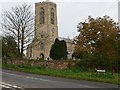
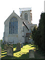
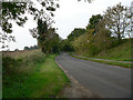
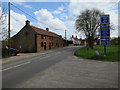
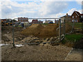
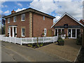
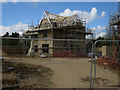
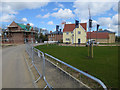
Photos of NR20 4PZ


Area Information
Living in NR20 4PZ means residing within a compact residential cluster covering just 2.3 hectares. This specific postcode area houses a population of 1,608 people, creating a neighbourhood with a very low population density of only 103 people per square kilometre. The character of NR20 4PZ is defined by its small scale and distinct separation from larger urban centres. You will find a quiet environment where properties are spaced out, offering a sense of privacy that many urban dwellers seek. The area serves as a settled community rather than a bustling transit point, fostering a lifestyle centred on local familiarity and reduced traffic noise. Prospective homebuyers looking for homes in NR20 4PZ are entering a space that prioritises space and calm over the immediacy of city amenities. The physical size of the postcode boundary limits sprawl and maintains a tight-knit atmosphere. While the small footprint restricts the variety of immediate surroundings, it guarantees that the majority of daily life revolves around a stable, defined locale. Residents appreciate the managed pace of life that comes with such a confined settlement.
- Area Type
- Postcode
- Area Size
- 2.3 hectares
- Population
- 1608
- Population Density
- 103 people/km²
The property market in NR20 4PZ is heavily skewed towards owner-occupied residences. With 82% of homes fully owned, the area functions primarily as an established housing market rather than a letting zone. Homes in NR20 4PZ consist almost entirely of houses, which aligns with the preference for single-family dwellings in this part of Norfolk. The low population density of 103 people per square kilometre ensures that properties are not tightly packed. This configuration typically supports higher-priced transactions per unit due to increased privacy and land availability. Buyers expecting a vibrant rental economy will find limited opportunity here. Instead, the market caters to those seeking to settle down or expand upon existing properties. The 82% ownership figure indicates that inheritance and trade-down trades rather than student urban influx drive supply. You should expect to compete for freehold titles rather than secure a tenancy. The housing stock remains consistent with the area's classification as a residential cluster within the NR postcode district.
House Prices in NR20 4PZ
Showing 11 properties
| Address | Type | Beds | Baths | Last Sale Price | Last Sale Date | |
|---|---|---|---|---|---|---|
| 5 Hoe Road East, Swanton Morley, NR20 4PZ | Bungalow | 3 | 2 | £475,000 | Apr 2025 | |
| 1 Hoe Road East, Swanton Morley, NR20 4PZ | Semi-detached | 4 | 3 | £385,000 | Sep 2022 | |
| 9 Hoe Road East, Swanton Morley, NR20 4PZ | Bungalow | - | - | £450,000 | Sep 2022 | |
| 3 Hoe Road East, Swanton Morley, NR20 4PZ | Semi-detached | 4 | 2 | £375,000 | Aug 2022 | |
| 11 Hoe Road East, Swanton Morley, NR20 4PZ | Bungalow | - | - | £425,000 | May 2022 | |
| 7 Hoe Road East, Swanton Morley, NR20 4PZ | Bungalow | - | - | £440,000 | Apr 2022 | |
| The Old Rectory, Hoe Road East, Swanton Morley, NR20 4PZ | Detached | 4 | 4 | £760,000 | Sep 2018 | |
| Plastic Repair Plus, Hoe Road East, Swanton Morley, NR20 4PZ | warehouse | - | - | - | - | |
| Coach House Cottage, Hoe Road East, Swanton Morley, NR20 4PZ | Bungalow | - | - | - | - | |
| Cartwheel Cottage, Hoe Road East, Swanton Morley, NR20 4PZ | Bungalow | - | - | - | - |
Energy Efficiency in NR20 4PZ
Residents of NR20 4PZ access a specific set of amenities within practical reach. Retail convenience is supported by five key stores, including Morrisons Daily, Iceland East, and Co-op East. These locations allow you to purchase fresh food and household essentials without travelling far. Public transport links are sparse but available through one nearby railway station in Dereham. This metro connection serves as the main gateway for commuters wishing to access further destinations. The dining and leisure options are limited to the immediate retail provisions. Life here is functional rather than sophisticated, focused on practical needs over leisurely exploration. You will find that daily shopping requires a short drive or walk to the neighbouring village shops. The reliance on named retailers like Iceland East and Morrisons Daily means your weekly shop is predictable and reliable. There are no broad shopping centres or finish cinemas in the immediate vicinity. Your lifestyle revolves around these specific retail anchors and the quiet atmosphere of the surrounding 2.3 hectares.
Amenities
Schools
Families considering NR20 4PZ have access to secondary education at Swanton Morley VC Primary School. This specific educational institution is located near the postcode boundary and holds an Ofsted rating of good. As a primary school, it caters to children aged four to eleven, serving the early years need for the local community. The presence of a single listed school highlights the close-knit nature of the educational catchment for this small postcode. Parents relying on schools near NR20 4PZ must plan carefully regarding secondary school arrangements, as this specific facility covers only the primary stage. However, the good rating provides a strong foundation for primary education. The limited number of schools emphasises that families in this area often look to the wider South Norfolk district for high school options. Swanton Morley VC Primary School remains the key local institution for young children living within this 2.3-hectare zone.
| Rank | School | Type | Entry gender | Ages |
|---|
Explore more schools in this area
Go to Schools tabDemographics
The community in NR20 4PZ is dominated by adults, with the most common age range falling between 30 and 64 years. The overall median age for residents is recorded at 47 years, indicating a mature demographic profile. This age distribution suggests a population composed largely of established households rather than young professionals or students. Home ownership stands at an impressive 82% within this cluster, reflecting a stable long-term residence pattern. The predominant accommodation type consists of detached or semi-detached houses, consistent with the suburban nature of the locality. The predominant ethnic group is White, which mirrors the wider demographic trends of rural Norfolk. An 82% ownership rate means the majority of people here have purchased their freehold rather than renting. This high level of equity often correlates with lower tenant turnover and more predictable neighbourhood dynamics. You are joining an area where residents have likely built deep roots over decades. The demographic data paints a picture of a settled community where families and empty nesters coexist peacefully under the same roof or in adjacent homes.
Household Size
Accommodation Type
Tenure
Ethnic Group
Religion
Household Composition
Age
Household Deprivation
NS-SEC
Explore more demographic insights in this area
Go to Demographics tabPlanning
Planning Constraints
- Flood RiskPremium
- Ramsar Wetland SitesPremium
- Area of Outstanding Natural BeautyPremium
- Protected Nature ReservePremium
- Protected WoodlandPremium