Area Overview for NR20 4PA
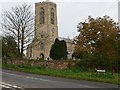
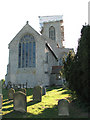
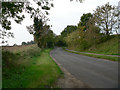
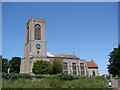
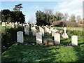
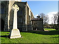
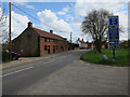
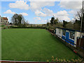
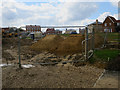
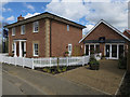
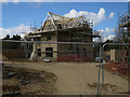
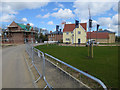
Photos of NR20 4PA
Area Information
Living in NR20 4PA represents a choice for those seeking a quiet residential cluster defined by its scale and established character. This specific postcode covers an area of 8.4 hectares, a small footprint designed to support a resident population of 1,608 people. You will find yourself in a setting where density is moderate, with a population density of just 103 people per square kilometre. This low density offers a pace of life that contrasts with busier urban centres, providing a sense of space around your home while maintaining access to the surrounding Norfolk landscape. The area functions as a self-contained community unit, typical of the rural settlements found in this region. Your days here will be shaped by the rhythms of local life rather than the commute-heavy schedule of the city. With a population concentrated in this small geographical space, you will encounter neighbours who likely share similar values regarding privacy and tranquility. The layout supports a lifestyle where quietude is the default setting. Whether you are planning a retirement move or looking for a peaceful family home, the physical constraints of this 8.4-hectare zone dictate a living experience focused on stillness and local rather than global connectivity. The community feels intimate, with everyone likely knowing everyone else within this defined boundary.
- Area Type
- Postcode
- Area Size
- 8.4 hectares
- Population
- 1608
- Population Density
- 103 people/km²
The property landscape in NR20 4PA is specialised and clearly skewed towards the traditional house buyer. With houses as the sole recorded accommodation type, potential buyers here should expect single-family dwellings without the mix of flats often found in larger UK towns. This uniformity suggests a market driven by those seeking a standalone property rather than a condo or apartment. Homeownership stands as the dominant factor in this housing market, with 82 per cent of all homes owned by their residents. This figure creates a distinctly owner-occupied environment where speculative buy-to-let portfolios have very limited presence. If you are looking to purchase, you are entering a market where long-term wealth building is the primary motivation for most transactions. The population density of 103 people per square kilometre confirms that there is no high-rise development or townhouse clusters altering the character of the streets. For first-time buyers, this snapshot indicates that entry might involve competition with seasoned owners who have lived their whole lives in the area. The low rental market penetration implies that tenants are rare; most people buy because they intend to stay. You will find no luxury apartments or urban-style conversions. Every property is a house, set on land within this 8.4-hectare cluster, catering to those who value garden space and privacy over urban convenience.
House Prices in NR20 4PA
Showing 8 properties
| Address | Type | Beds | Baths | Last Sale Price | Last Sale Date | |
|---|---|---|---|---|---|---|
| Freshfield Barn, Harkers Lane, Swanton Morley, NR20 4PA | Detached | - | - | £385,000 | Nov 2005 | |
| Freshfields, Harkers Lane, Swanton Morley, NR20 4PA | Detached | 4 | 2 | - | - | |
| Development Plot At Mill Bakery, Harkers Lane, Swanton Morley, NR20 4PA | Detached | - | - | - | - | |
| 2, Old Bakery, Harkers Lane, Swanton Morley, NR20 4PA | Flat | - | - | - | - | |
| Teutoburge, Harkers Lane, Swanton Morley, NR20 4PA | Bungalow | - | - | - | - | |
| The Cottage, Harkers Lane, Swanton Morley, NR20 4PA | house | - | - | - | - | |
| 1, Old Bakery, Harkers Lane, Swanton Morley, NR20 4PA | Flat | - | - | - | - | |
| Greenfields, Harkers Lane, Swanton Morley, NR20 4PA | house | 2 | - | - | - |
Energy Efficiency in NR20 4PA
Lifestyle conveniences in NR20 4PA are manageable within a practical radius, offering essential retail and travel links without the chaos of a city centre. Residents benefit from a selection of five notable retail venues within easy reach, providing daily necessities. Iceland East, Co-op East, and Morrisons Scurning are the key supermarkets you can visit for groceries and household needs. These major chains ensure that you do not need to travel far for fresh food or everyday items. Travel connectivity is anchored by one metro station in the near vicinity: Dereham. This railway station provides the primary public transport link for residents needing to commute to Norwich or Great Yarmouth. Public transport options are limited, making your personal vehicle essential for daily activities. The lack of a train station within the immediate postcode area means Dereham is your gateway to the wider rail network. Beyond shopping and trains, the area offers a self-sufficient routine. You can shop for fresh produce at Morrisons or Iceland and catch a train from Dereham for a weekend away or a work meeting. The combination of these amenities supports a practical, car-dependent lifestyle. Living in NR20 4PA means enjoying straightforward access to essential services without the noise and congestion of urban retail parks. The town centre of Dereham remains your main hub for anything beyond basic groceries and public transport.
Amenities
Schools
If you are a family considering NR20 4PA, you have access to Swanton Morley VC Primary School nearby. This institution serves as the primary educational option for young children residing in the area. It currently holds an Ofsted rating of Good, indicating that it meets the government's standards for quality education and care. This singular entry in your local education landscape means the community relies on one key provider for early schooling. Primary education is the only level mentioned in immediate proximity, suggesting that secondary education requires a longer commute to a larger town or city. For parents with children under the school-leaving age, this means the school is a central pillar of local life. The presence of a primary school with a Good rating offers reassurance regarding the quality of schooling available at this doorstep. Families moving to this area must be prepared for their older children to travel further for secondary education, as no high schools are listed in the immediate vicinity. Swanton Morley VC Primary School is the confirmed destination for younger pupils. The school's status as a voluntary-aided institution may be relevant for those understanding the governance structure of local education. Living in NR20 4PA means your children will start their academic journey within walking distance or a short drive of this established primary institution.
| Rank | School | Type | Entry gender | Ages |
|---|
Explore more schools in this area
Go to Schools tabDemographics
The community residing within NR20 4PA reflects a mature demographic profile, anchored by a median age of 47 years. Adults between the ages of 30 and 64 constitute the most common age range in this neighbourhood. This statistical profile suggests an area populated by established families, mature professionals, and those approaching retirement. You will find few young children or university students dominating the street scenes here. Homeownership is the defining feature of this locality, with 82 per cent of residents owning their homes outright or with a mortgage. This high ownership rate indicates a stable community where people have chosen to plant their roots locally. The sole accommodation type recorded for this area is houses, meaning you will not encounter any flats or high-density apartment blocks. If density or multi-unit living appeals to you, NR20 4PA is not the location for that lifestyle. The ethnicity of the population is predominantly White, reflecting a traditional demographic makeup common in many rural English settlements. Living here means joining a community where long-term residency is the norm rather than transient living arrangements. The low population density of 103 people per square kilometre further reinforces the quiet, non-transient nature of this neighbourhood. You are entering a market where people stay because they have invested significantly in their local environment.
Household Size
Accommodation Type
Tenure
Ethnic Group
Religion
Household Composition
Age
Household Deprivation
NS-SEC
Explore more demographic insights in this area
Go to Demographics tabPlanning
Planning Constraints
- Flood RiskPremium
- Ramsar Wetland SitesPremium
- Area of Outstanding Natural BeautyPremium
- Protected Nature ReservePremium
- Protected WoodlandPremium