Area Overview for NR20 4BD
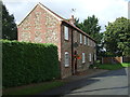
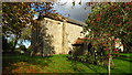
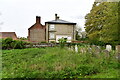
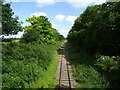
Photos of NR20 4BD
Area Information
NR20 4BD represents a small residential cluster covering an area of 1.1 km². This specific postcode forms a compact community where daily life unfolds at a manageable scale. The neighbourhood currently sustains a residential population of 2,291 people, creating an environment where residents share common local spaces. With 85 people per square kilometre, the population density ensures habitable distances between homes without overcrowding. You will find this postcode offers a contained lifestyle suitable for those wishing to settle in a defined locality. The area functions as a distinct residential zone rather than a sprawling town centre. Living here means accessing a settled environment where the immediate surroundings are finite and well understood. Prospective buyers seeking a specific cluster rather than a broad neighbourhood will recognise NR20 4BD as a precise location. The small size of the estate means local dynamics are tight-knit. Daily routines involve navigating a limited footprint of streets and communal areas. This compactness allows for straightforward access to the built environment within the postcode boundary. You can expect a stable, residential atmosphere characteristic of a fixed cluster. Homes in NR20 4BD sit within a predictable physical framework that supports quiet living.
- Area Type
- Postcode
- Area Size
- 1.1 km²
- Population
- 2291
- Population Density
- 85 people/km²
Homes in NR20 4BD consist almost exclusively of houses, with no recorded flats or apartments in the immediate cluster. This accommodation type suits自有 homes and families requiring dedicated outdoor space or private entrances. The area boasts a home ownership rate of 69 per cent, a figure that places it well above the national average for rental markets. You will find very few tenanted properties compared to owner-occupied stock in this postcode. This market structure indicates a desire for permanence and asset accumulation among current residents. Buyers looking at NR20 4BD are entering a predominantly owner-driven sector where transaction types differ from private renting zones. The absence of flats within the 1.1 km² boundary means lifestyle choices centre on detached or semi-detached living. High ownership levels suggest stable values driven by equity retention rather than speculative tenancy turnover. When you purchase a property here, you join a cohort of 69 per cent of neighbours who are also owners. This dynamic creates a market where sellers prioritize long-term value over short-term gains. The housing stock reflects a preference for traditional housing forms suitable for established households.
House Prices in NR20 4BD
Showing 19 properties
| Address | Type | Beds | Baths | Last Sale Price | Last Sale Date | |
|---|---|---|---|---|---|---|
| Willow Cottage, Hall Road, Hoe, NR20 4BD | Detached | - | - | £250,000 | Nov 2004 | |
| Angel Farm, Hall Road, Hoe, NR20 4BD | Detached | - | - | £615,000 | Jun 2004 | |
| Crossways, Hall Road, Hoe, NR20 4BD | Detached | - | - | £312,500 | Feb 2004 | |
| Five Cat Cottage, 15 Hall Road, Hoe, NR20 4BD | Semi-detached | 2 | - | - | - | |
| Hoe Parish Meeting Room, Hall Road, Hoe, NR20 4BD | commercial | - | - | - | - | |
| Keepers Cottage, Hall Road, Hoe, NR20 4BD | house | - | - | - | - | |
| Spring Farm, Hall Road, Hoe, NR20 4BD | Detached | - | - | - | - | |
| Tennis 37M From Hoe Hall Bungalow, Hall Road 54M From Unnamed Road, Hall Road, Hoe, NR20 4BD | Leisure | - | - | - | - | |
| Flint House, Hall Road, Hoe, NR20 4BD | Detached | - | - | - | - | |
| The Chestnuts, Hall Road, Hoe, NR20 4BD | house | - | - | - | - |
Energy Efficiency in NR20 4BD
Residents of NR20 4BD benefit from practical access to retail and transport hubs within reasonable walking or driving distance. Five specific retail locations operate within practical reach, providing essential shopping options. Notable venues include the East of England Co-operative Co, Co-op East, and Iceland East. These outlets cover groceries and daily necessities without requiring a city centre excursion. One Metro station named Dereham serves the vicinity, offering rail connectivity for those needing to travel further afield. Daily life in NR20 4BD balances local convenience with regional transport links. You can stock up at a Co-op before commuting from Dereham or returning home after work. The presence of Iceland East ensures fresh food availability directly alongside the housing cluster. Living in NR20 4BD means avoiding significant travel friction for routine purchases. The cluster sits between these amenities, forming a convenient corridor for domestic errands. Homes in NR20 4BD thus enjoy a lifestyle supported by established local trade enterprises.
Amenities
Schools
| Rank | School | Type | Entry gender | Ages |
|---|
Explore more schools in this area
Go to Schools tabDemographics
The community in NR20 4BD reflects a mature demographic profile with a median age of 47 years. Adults between 30 and 64 years represent the most common age range within the neighbourhood. This distribution suggests a population dominated by working elites or retired individuals nearing their final years. Home ownership stands at a solid 69 per cent of all households in the area. This high rate indicates a settled community where most residents own their property outright or have significant equity. Houses remain the predominant form of accommodation, shaping the street scene and garden culture. The ethnic composition is primarily White, aligning with broader regional trends in this part of England. You can expect a neighbourhood where long-term residents form the backbone of the community structure. The age profile supports stable family units alongside older residents seeking low-maintenance homes. A high ownership rate often correlates with lower tenant turnover and stronger local investment in maintenance. Living in NR20 4BD means joining a community defined by longevity and stability rather than transient populations. The demographic makeup provides a clear picture of who occupies these homes every day.
Household Size
Accommodation Type
Tenure
Ethnic Group
Religion
Household Composition
Age
Household Deprivation
NS-SEC
Explore more demographic insights in this area
Go to Demographics tabPlanning
Planning Constraints
- Flood RiskPremium
- Ramsar Wetland SitesPremium
- Area of Outstanding Natural BeautyPremium
- Protected Nature ReservePremium
- Protected WoodlandPremium