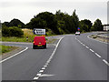
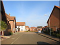
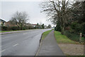
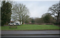
Area Overview for NR20 3FX
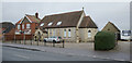
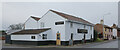
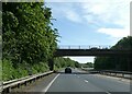
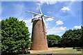
Photos of NR20 3FX
Area Information
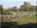
Living in NR20 3FX means settling in a specific postcode area that covers a small residential cluster in the heart of Norfolk. This locality spans 1444 square metres, which supports a population of 2348 residents. The density stands at 223 people per square kilometre, creating a compact community where neighbours are close by. You will find that daily life here is defined by a blend of suburban convenience and rural proximity. The area functions as a settled neighbourhood rather than a bustling city centre, offering a quieter pace while remaining accessible to local services. The character of NR20 3FX is shaped by its residential focus, hosting homes that cater to the local population. You are notüberg in an empty zone but within a defined postal boundary that encompasses a distinct group of households. The size of the area ensures that distances to key amenities remain short, yet the layout maintains a sense of separation typical of dedicated residential clusters. When you visit or move to this postcode, you enter an environment where the balance between privacy and community access has been carefully maintained. The setting provides a grounded experience, away from the noise of larger towns but without the isolation of remote countryside.
- Area Type
- Postcode
- Area Size
- 1444 m²
- Population
- 2348
- Population Density
- 223 people/km²
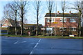
The property market in NR20 3FX is heavily weighted towards owner-occupation, with 75% of households owning their homes. This statistic signals that the area serves as a stable home for families rather than a hub for short-term tenancies or student housing. The housing stock consists primarily of houses, which are the main accommodation type recorded for this postcode. This predominance of houses influences the character of the streets, creating environments suited for families requiring space. For buyers looking at this small area, the market presents a distinct opportunity to enter a established residential zone. The high ownership rate often implies well-maintained properties, as owners tend to invest in upkeep to protect their asset value. You are less likely to find high-rise developments or dense apartment blocks here, which aligns with the rural and suburban feel of the surrounding region. The focus on houses means that any property you view will likely offer traditional layouts and a degree of privacy. When considering homes in NR20 3FX, you should expect a portfolio geared towards permanence and comfort rather than transient living arrangements. The local market reflects the needs of those who plan to settle down in a specific community for the long term.
House Prices in NR20 3FX
Showing 3 properties
| Address | Type | Beds | Baths | Last Sale Price | Last Sale Date | |
|---|---|---|---|---|---|---|
| 5 Aspen Walk, Dereham, NR20 3FX | house | - | - | £225,000 | Oct 2025 | |
| 1 Aspen Walk, Dereham, NR20 3FX | house | 3 | - | £235,000 | Jun 2025 | |
| 3 Aspen Walk, Dereham, NR20 3FX | Terraced | 2 | 2 | £174,000 | Oct 2017 |
Energy Efficiency in NR20 3FX
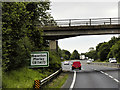
Residents of NR20 3FX enjoy access to a practical range of amenities within a short walking or driving distance. The local retail offering includes five major stores, with Tesco Dereham, Morrisons Scarning, and Lidl Toftwood standing out as notable options. These supermarkets provide comprehensive grocery shopping, allowing you to stock up on essentials without leaving the region. There is also a metro station in Dereham, which offers one connection point for wider travel requirements. This blend of retail and transport links defines the daily convenience of living here. You can handle most weekly shopping needs at the nearby Tesco Dereham or Morrisons Scarning locations. The presence of Lidl Toftwood adds variety to your food shopping choices, particularly for budget-conscious buyers. While the area is residential, the proximity to these major chains ensures that you are not isolated from everyday commerce. The metro facility in Dereham connects you to broader networks if you need to travel for work or leisure. Dining and leisure options are anchored by these large retailers, which often host cafes and additional services. This setup provides a balanced lifestyle where community life does not interfere with practical needs.
Amenities
Schools
Families living in NR20 3FX have two primary educational options located immediately nearby: Dereham Neatherd High School. This institution operates both as a primary school and as an academy, serving different stages of early education under the same name. The presence of these schools means that children in the area have local educational facilities without needing to travel far for their initial years of learning. You will find that the school landscape is dominated by this single named provider, which covers both primary and academy functions. This structure allows for a coordinated educational approach for students within the catchment area. While common to see a variety of institutions in larger towns, NR20 3FX relies on this specific establishment to meet the academic needs of local children. Parents looking at schools near NR20 3FX should note that Dereham Neatherd High School is the designated provider for this locality. The academy status indicates a degree of independence in how the school is managed and funded, which can influence the curriculum and resources available to pupils. These educational facilities form the backbone of community life for young residents, ensuring that schooling remains a local priority.
| Rank | School | Type | Entry gender | Ages |
|---|
Explore more schools in this area
Go to Schools tabDemographics
The community in NR20 3FX reflects a settled population with a median age of 47 years. Most residents fall into the adult category, specifically those aged between 30 and 64 years. This demographic profile indicates a neighbourhood dominated by working-age adults and established families rather than young students or retirees. With a home ownership rate of 75%, the majority of households own their properties outright or with a mortgage, suggesting long-term stability within the community. Houses form the predominant accommodation type across this cluster, distinguishing it from areas where flats or apartments are common. This housing stock aligns with the preferences of families and individuals seeking standalone properties with potential garden space. The demographic makeup is predominantly White, reflecting the traditional settlement patterns of this part of Norfolk. The high level of ownership suggests that many families have remained in this postcode for significant periods, fostering strong local ties. You are joining an area where residents are likely invested in the long-term development and maintenance of their local streets. The age distribution means you will encounter a neighbourly mix of parents, professionals, and mature homeowners.
Household Size
Accommodation Type
Tenure
Ethnic Group
Religion
Household Composition
Age
Household Deprivation
NS-SEC
Explore more demographic insights in this area
Go to Demographics tabPlanning
Planning Constraints
- Flood RiskPremium
- Ramsar Wetland SitesPremium
- Area of Outstanding Natural BeautyPremium
- Protected Nature ReservePremium
- Protected WoodlandPremium