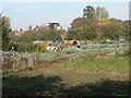
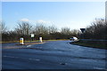
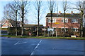
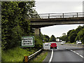
Area Overview for NR20 3FS
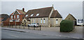
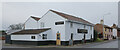
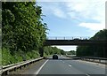
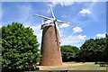
Photos of NR20 3FS
Area Information
NR20 3FS represents a small residential cluster in Dereham that spans just 1.2 hectares. This compact area houses a population of 2348 people, resulting in a density of 223 people per square kilometre. Living in NR20 3FS means accessing a tightly knit community where daily interactions are common but manageable. The low population density contributes to a quieter environment compared to larger urban districts, making it suitable for those who value space without sacrificing convenience. Residents find themselves situated close to the town centre, ensuring that essential services remain within easy reach. The area serves as a practical base for families and professionals alike, offering a balance between suburban peace and urban accessibility. You will notice that the community feels established rather than transient, with a clear sense of locality. The specific postcode covers a defined group of homes that benefit from shared infrastructure and neighbourhood cohesion. This setting provides a defined living environment where the scale of the settlement enhances the sense of belonging. Prospective buyers should appreciate that the small footprint of the area allows for efficient use of local resources. The layout supports a lifestyle where mobility is straightforward and reliance on long commutes to essentials is unnecessary.
- Area Type
- Postcode
- Area Size
- 1.2 hectares
- Population
- 2348
- Population Density
- 223 people/km²
Homes in NR20 3FS are characterised by a single accommodation type: houses. This uniformity in property style offers a consistent architectural character across the residential cluster. With 75% of homes being owner-occupied, the market is heavily skewed towards families and professionals who have purchased their residences rather than renting. This high ownership figure indicates a stable property market where residents have a vested interest in maintaining their local streets. For buyers looking at this small area, the dominance of houses means you will not find a mix of high-rise flats or shared housing properties. The property stock is designed for independent living with private exterior spaces. The low rental proportion suggests that the area attracts those seeking long-term security rather than transient housing solutions. You will find that the housing market here operates with the dynamics of a neighbourhood where owners modify and maintain their properties over decades. This environment often translates to better-preserved stock and established gardens. The specific focus on houses aligns with the demographic needs of the adult population aged between 30 and 64 years. When considering homes in NR20 3FS, expect a traditional residential experience without the density or variety of mixed-use developments. The limited size of the cluster at 1.2 hectares further reinforces the exclusive feel of the available housing.
House Prices in NR20 3FS
Showing 14 properties
| Address | Type | Beds | Baths | Last Sale Price | Last Sale Date | |
|---|---|---|---|---|---|---|
| 14 Poplar Place, Dereham, NR20 3FS | Semi-detached | 3 | 2 | £238,000 | Sep 2018 | |
| 4 Poplar Place, Dereham, NR20 3FS | house | - | - | £180,000 | Oct 2013 | |
| 10 Poplar Place, Dereham, NR20 3FS | house | - | - | £209,995 | Jun 2013 | |
| 6 Poplar Place, Dereham, NR20 3FS | house | - | - | £159,995 | Jun 2013 | |
| 2 Poplar Place, Dereham, NR20 3FS | house | - | - | £159,995 | Mar 2013 | |
| 8 Poplar Place, Dereham, NR20 3FS | Detached | 4 | 2 | - | - | |
| 11 Poplar Place, Dereham, NR20 3FS | house | - | - | - | - | |
| 13 Poplar Place, Dereham, NR20 3FS | house | - | - | - | - | |
| 3 Poplar Place, Dereham, NR20 3FS | house | - | - | - | - | |
| 7 Poplar Place, Dereham, NR20 3FS | house | - | - | - | - |
Energy Efficiency in NR20 3FS
Lifestyle in NR20 3FS revolves around practical convenience with essential amenities nearby. Residents have access to five retail outlets, including Tesco Dereham, Lidl Toftwood, and Morrisons Scarning. These supermarkets provide a complete range of groceries and household necessities within practical reach for daily shopping. For transport, the area is serviced by Dereham railway station, which offers one metro link connection to wider regional transport networks. This station allows residents to travel to Norwich or other major UK cities without needing a private vehicle for long-distance trips. Living in NR20 3FS means having your daily needs met by local stores and having travel options for weekends or holidays. The proximity to Tesco and Morrisons saves time on errands, while the railway station ensures connectivity beyond the immediate neighbourhood. You will find that the retail density is sufficient for casual weekly shopping without the need to travel far. The combination of local food stores and public transport creates a balanced lifestyle that reduces car dependency. Meals, household supplies, and occasional leisure outings are all manageable from this postcode. The infrastructure supports a car-light existence where key amenities are steps away rather than hours from your door.
Amenities
Schools
Education options for residents of NR20 3FS focus on two local institutions sharing a similar name and structure. Dereham Neatherd High School operates as a free school and functions as an academy. This dual status means the school functions independently from local authority control while providing secondary education. There are no primary schools explicitly listed in the immediate vicinity data, meaning families may need to travel to the wider Dereham area for younger children. Living in NR20 3FS places you directly in the catchment for this academies that serves the broader local population. The presence of an academy suggests a focus on modern educational frameworks and curriculum delivery. While specific Ofsted ratings are not provided in the source data, the existence of a designated secondary school ensures that school-age children have access to formal education nearby. The school listed serves the needs of students in the older age brackets prevalent in the area. Buyers with school-aged children should verify the specific catchment boundaries for Dereham Neatherd High School to confirm eligibility for their specific address. The availability of this single institution in the immediate data set indicates a reliance on one main hub for secondary schooling in this postcode.
| Rank | School | Type | Entry gender | Ages |
|---|
Explore more schools in this area
Go to Schools tabDemographics
The community in NR20 3FS reflects a mature demographic profile with a median age of 47 years. Adults between the ages of 30 and 64 years form the most common age range, indicating a population established in their careers and families. Three quarters of households, or 75%, are owner-occupied, demonstrating strong stability within the local home buying market. This high ownership rate suggests that residents view their homes as long-term investments rather than temporary accommodations. Houses dominate the accommodation type in this postcode, offering the privacy and garden space typically associated with detached or semi-detached properties. The predominant ethnic group is White, aligning with broader regional trends in East Anglia. Living in NR20 3FS means joining a community where home ownership is the norm and the population has settled locally. The age structure implies a neighbourhood where children and teenagers are present but the primary householders are experienced adults. This demographic makes sense for an area with schools and family-friendly amenities nearby. The consistency of the age range suggests a shared life stage among neighbours, which often fosters specific community dynamics. Buyers should note that the high percentage of homeowners correlates with the prevalence of house ownership over rental arrangements. The demographic data paints a picture of a settled, family-oriented sector of Dereham.
Household Size
Accommodation Type
Tenure
Ethnic Group
Religion
Household Composition
Age
Household Deprivation
NS-SEC
Explore more demographic insights in this area
Go to Demographics tabPlanning
Planning Constraints
- Flood RiskPremium
- Ramsar Wetland SitesPremium
- Area of Outstanding Natural BeautyPremium
- Protected Nature ReservePremium
- Protected WoodlandPremium