Area Overview for NR20 3AQ
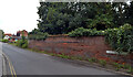
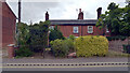
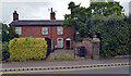
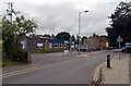
Photos of NR20 3AQ
Area Information
Living in NR20 3AQ means residing within a specific residential cluster defined by the postcode, covering an area of just 2.1 hectares. This small footprint supports a population of 2,320 people, creating a high-density environment with 2,139 residents per square kilometre. The location functions as a tight-knit neighbourhood where everyday life revolves around proximity. You will find a substantial number of households in this designated zone, shaped entirely by the accommodation type prescribed for the area. While the exact street names are not provided in the available records, the structure of the community is clear: it is a concentrated residential space rather than a sprawling district. Residents here experience a compact daily routine where destinations are close at hand. The area serves as a distinct living option for those seeking a defined, contained environment. There is no separate administrative name besides the postcode itself, so the identity of the place is firmly tied to this specific NR20 lineage. Whether you are visiting or considering a move, the scale of the neighbourhood remains consistent and manageable.
- Area Type
- Postcode
- Area Size
- 2.1 hectares
- Population
- 2320
- Population Density
- 2139 people/km²
Homes in NR20 3AQ are defined by a specific accommodation type, which consists solely of houses. There is no data on flats or apartments within this postcode, indicating a traditional housing stock appropriate for a rural or semi-rural cluster. The market is characterised by a 43 per cent home ownership rate, suggesting a balance between owner-occupiers and renters. This rate implies that just under half of the residents hold deeds to their properties. The area hosts a population of 2,320 people across this small 2.1-hectare footprint, resulting in a population density of 2,139 people per square kilometre. Such density often correlates with houses that are built relatively close together or in clusters rather than isolated estates. Buyers looking at this location should expect a stock dominated by family-sized properties rather than purpose-built rentals. The absence of flats from the data simplifies the market for those specifically seeking detached or semi-detached living. Understanding the mix of owners and tenants is key to appreciating the nature of local transactions here.
House Prices in NR20 3AQ
Showing 16 properties
| Address | Type | Beds | Baths | Last Sale Price | Last Sale Date | |
|---|---|---|---|---|---|---|
| 1, Nursery Buildings, Norwich Road, Dereham, NR20 3AQ | Terraced | 2 | 1 | £210,000 | Sep 2022 | |
| 8, Nursery Buildings, Norwich Road, Dereham, NR20 3AQ | Terraced | 2 | 1 | £175,000 | May 2021 | |
| 11, Nursery Buildings, Norwich Road, Dereham, NR20 3AQ | Cottage | 2 | - | £173,000 | Sep 2020 | |
| 13, Nursery Buildings, Norwich Road, Dereham, NR20 3AQ | Terraced | 2 | 1 | £164,000 | Jul 2020 | |
| The Hollies, Norwich Road, Dereham, NR20 3AQ | Bungalow | 3 | - | £350,000 | Jan 2018 | |
| 12, Nursery Buildings, Norwich Road, Dereham, NR20 3AQ | Terraced | 2 | 1 | £160,000 | Aug 2017 | |
| 4, Nursery Buildings, Norwich Road, Dereham, NR20 3AQ | house | - | - | £160,000 | May 2017 | |
| 16, Nursery Buildings, Norwich Road, Dereham, NR20 3AQ | Detached | 3 | - | £192,000 | Oct 2016 | |
| 3, Nursery Buildings, Norwich Road, Dereham, NR20 3AQ | house | - | - | £92,471 | Oct 2005 | |
| 9, Nursery Buildings, Norwich Road, Dereham, NR20 3AQ | house | 2 | - | £27,700 | Oct 2000 |
Energy Efficiency in NR20 3AQ
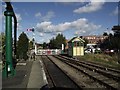
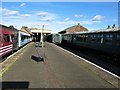
Your daily life in NR20 3AQ requires short trips for essential shopping and leisure, yet local options are close at hand. Within practical reach, you have access to one metro facility in Dereham. For retail needs, five stores serve the immediate vicinity, including Morrisons Scarning, M&S Lynn Hill BP, and Iceland East. These venues handle your weekly food shopping and household essentials without the need to travel far. The retail density ensures you can buy groceries from a major supermarket chain like Morrisons while also accessing convenience items at Iceland East. The presence of a Morrisons store nearby is particularly useful for families needing one-stop shopping for fresh produce and packaged goods. While playgrounds, bars, and large leisure complexes are not listed in the nearby amenities, the existing supermarkets provide a solid foundation for daily errands. You will find your core retail requirements met by these five local businesses.
Amenities
Schools
| Rank | School | Type | Entry gender | Ages |
|---|
Explore more schools in this area
Go to Schools tabDemographics
The community profile in NR20 3AQ reflects a mature demographic, with a median age of 47 years. Adults between 30 and 64 years old form the most common age range within this group. This indicates a neighbourhood stabilised by families who established roots years ago or professionals settling down in their prime working years. Home ownership stands at 43 per cent, showing that nearly half of the residents own their property outright or with a mortgage. The remaining residents likely rent or hold other interests in their homes. Houses remain the predominant accommodation type throughout this postcode sector. The population is predominantly White, reflecting the broader demographic trend for Norfolk. There is no data on deprivation levels available for this specific area, so an exact picture of economic disparity remains undefined. Instead, the focus is on the stable age profile and the majority ownership of homes. The residential character is driven by this clear population structure. You can expect a quiet, settled atmosphere typical of communities where the median age sits well past the conventional retirement line or early career stage.
Household Size
Accommodation Type
Tenure
Ethnic Group
Religion
Household Composition
Age
Household Deprivation
NS-SEC
Explore more demographic insights in this area
Go to Demographics tabPlanning
Planning Constraints
- Flood RiskPremium
- Ramsar Wetland SitesPremium
- Area of Outstanding Natural BeautyPremium
- Protected Nature ReservePremium
- Protected WoodlandPremium