Area Overview for NR19 2PS
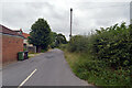
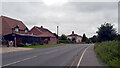
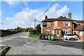
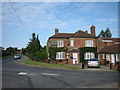
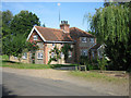
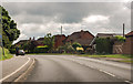
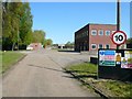
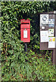
Photos of NR19 2PS
Area Information
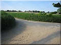
Living in NR19 2PS offers a residential experience defined by its quiet scale and settled character. This specific postcode covers a small cluster occupying just 8.8 hectares, creating an intimate neighbourhood where residents are likely to know one another. The area hosts 1,711 people, resulting in a population density of 148 people per square kilometre. This figure reflects a spread-out environment rather than a dense urban setting. Daily life here revolves around low-traffic streets and house-based living rather than high-rise blocks or apartments. The community feels distinct from typical urban sprawl because of its concentration in a very limited geographical footprint. You will find a setting that prioritises space and privacy over urban convenience. The area is part of the NR19 postcode system surrounding Dereham, meaning you access town facilities while retaining a rural feel. Visitors noting the layout will observe a balance between private gardens and shared open space. This specific location provides a base for those seeking calm surroundings without complete remoteness. The compact nature of the 8.8-hectare zone means driving distances to local spots are short, yet the residential character remains intact.
- Area Type
- Postcode
- Area Size
- 8.8 hectares
- Population
- 1711
- Population Density
- 148 people/km²
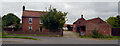
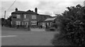
You will find the property market in NR19 2PS dominated entirely by individual houses and owner-occupiers. With a home ownership level of 74 per cent, the area functions as a traditional residential market rather than a rental hub. The accommodation type data confirms that flats are absent from this postcode, ensuring that all homes are substantial family dwellings. This structure suggests a market where buyers look for detached or semi-detached properties with private gardens and driveways. The density of 148 people per square kilometre over 8.8 hectares indicates that plots are spaced relatively far apart. Buyers seeking urban-style living or the option of a flat should look elsewhere, as NR19 2PS offers only house-based living. The high ownership statistic means that many current owners may have been in the area for years, potentially limiting the number of frequent sales compared to high-turnover rental zones. If you are looking to buy, expect to compete with other settled families who view this specific postcode as a permanent home base. The lack of rental inventory simplifies the market but requires a larger commitment to property.
House Prices in NR19 2PS
Showing 4 properties
| Address | Type | Beds | Baths | Last Sale Price | Last Sale Date | |
|---|---|---|---|---|---|---|
| Grove House, Dereham Road, Scarning, NR19 2PS | Bungalow | 3 | 2 | £690,999 | Jun 2021 | |
| Chestnut Lodge, Dereham Road, Scarning, NR19 2PS | Semi-detached | 3 | 2 | £365,000 | Aug 2020 | |
| Chestnut Farm, Dereham Road, Scarning, NR19 2PS | Detached | 5 | 1 | £390,000 | Aug 2017 | |
| Middle Barn, 84 Dereham Road, Scarning, NR19 2PS | Bungalow | 3 | 2 | - | - |
Energy Efficiency in NR19 2PS
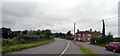
Daily life for residents of NR19 2PS is shaped by a mix of essential local retail and nearby town amenities. Within practical reach of your home are five notable retail outlets, including the East of England Co-operative Co, Co-op East, and Iceland East. These venues provide access to food, household goods, and daily necessities without needing to travel far. Beyond local shops, the village of Dereham acts as a major transport hub offering one metro station for train services. You can use Dereham for further shopping, professional services, and socialising beyond the immediate neighbourhood. While the immediate area lacks named parks or leisure centres in the provided data, the proximity to Dereham extends your options for recreation. Local shops support the community feel by providing first-hand service interactions which larger chains often lack. Living here means balancing the quiet of the 8.8-hectare residential zone with the convenience of nearby supermarkets and public transport links. This combination allows for a lifestyle that is both peaceful and practically connected to wider infrastructure.
Amenities
Schools
Families considering NR19 2PS will find Scarning Voluntary Controlled Primary School as their nearest educational option. This institution holds an Ofsted rating of "good", a standard classification for primary education in the UK. Since only one primary school appears in the immediate vicinity, you should verify secondary school catchment areas if you have teenagers. The school type is voluntary controlled, which places it under the local education authority rather than being voluntary aided or academy-led. For parents relying on NR19 2PS as a home base, this school represents the first educational step for children in the area. The absence of listed secondary or infant schools within the data suggests that older children may travel further for their education. While Scarning Primary offers a solid foundation, the limited school data means you cannot assume a full range of educational stages is immediately on your doorstep. You must check local council maps to determine which secondary school students attending Scarning Primary will transfer to later in their schooling.
| Rank | School | Type | Entry gender | Ages |
|---|
Explore more schools in this area
Go to Schools tabDemographics
The community in NR19 2PS reflects a mature population with deep roots and long-term residency. Hallmark of this area is a median age of 47 years, indicating that families here have settled for considerable periods. Most residents fall into the adult age range of 30 to 64 years, suggesting a workforce-dominated demographic rather than a youthful or elderly-heavy population. This age profile often correlates with stability and established household patterns. Home ownership stands at 74 per cent, a high figure that points to an area where people purchase rather than rent their dwellings. You are unlikely to encounter transient tenants or short-term lets as primary housing models. The predominant ethnic group is White, aligning with the broader demographic trends of this part of Norfolk. Accommodation almost exclusively consists of houses, making this unsuitable for those specifically seeking flats or apartments. This housing stock caters to families forming permanence in the region. The high ownership rate implies that most families have purchased in the local market, fostering a sense of investment in the immediate environment. Living here typically means dealing with the practicalities of maintaining a property rather than managing rental agreements.
Household Size
Accommodation Type
Tenure
Ethnic Group
Religion
Household Composition
Age
Household Deprivation
NS-SEC
Explore more demographic insights in this area
Go to Demographics tabPlanning
Planning Constraints
- Flood RiskPremium
- Ramsar Wetland SitesPremium
- Area of Outstanding Natural BeautyPremium
- Protected Nature ReservePremium
- Protected WoodlandPremium