Area Overview for NR19 2NW
Photos of NR19 2NW
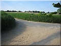
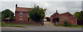
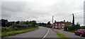
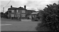
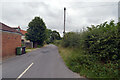
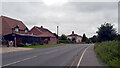
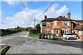
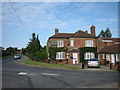
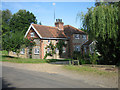
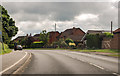
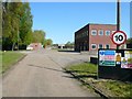
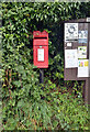
12 photos from this area
Area Information
Key information about the NR19 2NW including its size, population, and administrative classification.
- Area Type
- Postcode
- Area Size
- 24.5 hectares
- Population
- 1711
- Population Density
- 148 people/km²
House Prices in NR19 2NW
15
Properties
£386,050
Average Sold Price
£141,000
Lowest Price
£595,000
Highest Price
Showing 15 properties
| Address | Type | Beds | Baths | Last Sale Price | Last Sale Date | |
|---|---|---|---|---|---|---|
| The Woodlands, Rushmeadow Road, Scarning, NR19 2NW | Bungalow | 3 | 2 | £477,500 | Aug 2023 | |
| Baytrees, Rushmeadow Road, Scarning, NR19 2NW | Bungalow | - | - | £430,000 | Apr 2023 | |
| Fair View, Rushmeadow Road, Scarning, NR19 2NW | Bungalow | 3 | 2 | £575,000 | Nov 2022 | |
| Willow Croft, Rushmeadow Road, Scarning, NR19 2NW | Detached | 3 | 1 | £575,000 | Jan 2022 | |
| Jubilee Cottage, Rushmeadow Road, Scarning, NR19 2NW | Bungalow | 3 | 1 | £314,000 | Dec 2020 | |
| Meadow House, Rushmeadow Road, Scarning, NR19 2NW | Detached | 5 | 2 | £595,000 | Oct 2018 | |
| Greenbanks, Rushmeadow Road, Scarning, NR19 2NW | Detached | - | - | £300,000 | Apr 2016 | |
| Portswood, Rushmeadow Road, Scarning, NR19 2NW | Detached | - | - | £295,000 | Apr 2008 | |
| Chaliz, Rushmeadow Road, Scarning, NR19 2NW | Bungalow | - | - | £158,000 | Jun 2001 | |
| Blackdown Cottage, Rushmeadow Road, Scarning, NR19 2NW | Semi-detached | 5 | 2 | £141,000 | Aug 1999 |
Page 1 of 2
Energy Efficiency in NR19 2NW
Amenities
Schools
| Rank | School | Type | Entry gender | Ages |
|---|
Explore more schools in this area
Go to Schools tabDemographics
Household Size
Two person
most common
Accommodation Type
Houses
most common
Tenure
74
majority
Ethnic Group
White
most common
Religion
N/A
most common
Household Composition
N/A
most common
Age
47
median
Adults (30-64 years)
most common
Household Deprivation
N/A
with no deprivation
NS-SEC
33
in Lower managerial occupations
Explore more demographic insights in this area
Go to Demographics tabPlanning
Planning Constraints
- Flood RiskPremium
- Ramsar Wetland SitesPremium
- Area of Outstanding Natural BeautyPremium
- Protected Nature ReservePremium
- Protected WoodlandPremium