Area Overview for NR19 2ND
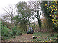
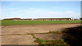
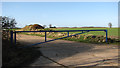
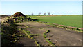
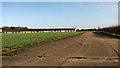
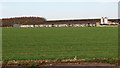
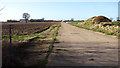
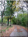
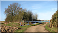
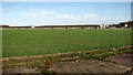
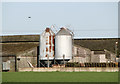
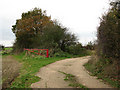
Photos of NR19 2ND
Area Information
Living in NR19 2ND offers a quiet residential experience within a specific postcode cluster covering 63.7 hectares. This small neighbourhood has a population of 1,552 people, creating a low-density environment with just 44 people per square kilometre. You are stepping into an established residential area where space is available and the immediate surroundings feel uncrowded. The layout is typical of a small cluster rather than a sprawling urban district, which means daily life usually involves a bit more travel for significant amenities. Despite its modest size, the area functions as a stable home for local families and individuals seeking a pace of life away from the city centre. You will find that the community is紧密-knit due to the limited number of households in this specific code. The low population density suggests a neighbourhood where noise levels remain low and the streets are not congested. This setting provides a distinct balance for those who want home ownership without the intensity of high-density housing estates. The area serves as a practical base for anyone looking for a foothold in this part of England, offering a tangible sense of place defined by its boundaries and resident count.
- Area Type
- Postcode
- Area Size
- 63.7 hectares
- Population
- 1552
- Population Density
- 44 people/km²
Homes in NR19 2ND are overwhelmingly characterised by detached or semi-detached houses within a private ownership model. With a home ownership rate of 71 percent, most properties are tied up by existing owners who have lived there for a significant period. This high ownership figure indicates a market where buyers often compete for limited stock rather than tenants seeking short-term leases. The accommodation type is almost exclusively houses, so you cannot expect to find converted flats or blocks of modern apartments for sale. Buyers looking at this area should assume they are entering a traditional housing stock dominated by brick or stone construction. The small area size of 63.7 hectares limits the total housing count, reinforcing that new builds are rare. When viewing properties, you will notice that the growth is organic rather than driven by large-scale developer plans. This market structure means that if you wish to sell later, the local dynamics favour established residential zones over speculative investment pockets. The environment is quiet, which often translates to good grounds maintenance and well-kept gardens attached to individual homes. You are buying into a stock that prioritises permanence and personal space over convenience or yield.
House Prices in NR19 2ND
Showing 1 properties
| Address | Type | Beds | Baths | Last Sale Price | Last Sale Date | |
|---|---|---|---|---|---|---|
| Manor Farm, Manor Drift, Wendling, NR19 2ND | Detached | - | - | - | - |
Energy Efficiency in NR19 2ND
Lifestyle in NR19 2ND revolves around a very limited range of extra local amenities, with residents needing to travel for most daily shopping needs. Within practical reach, you will find five retail outlets, led by the East of England Co-operative Co, the Co-op East, and Iceland East. These specific venues provide essential groceries and household goods but do not offer a wide variety of leisure or dining choices. There is one notable metro station at Dereham, which offers a point of connection for longer journeys. You will find no parks, leisure centres, or culture venues listed as immediate nearby amenities for this specific postcode. The lack of named recreational spots means your weekends are spent driving to further afield for cinema, sports, or larger retail parks. The community relies on the three named supermarkets for their core weekly shop. Living here requires a car unless you work from home, as shops and stations are accessed by road rather than walk. The simplicity of the local offer fits a demographic that owns homes and likely values the quiet over the convenience of a village high street. Your convenience prioritises the availability of essentials over entertainment options nearby.
Amenities
Schools
| Rank | School | Type | Entry gender | Ages |
|---|
Explore more schools in this area
Go to Schools tabDemographics
The community profile in NR19 2ND is defined by a mature population concentrated among adults aged between 30 and 64 years. The median age for residents is 47, indicating that the area is not dominated by young buyers or school-aged children. Home ownership stands at 71 percent, which clearly marks this as an owner-occupied sector rather than a rental market. Houses form the predominant accommodation type, meaning you are unlikely to find flats or purpose-built apartments in this specific postcode. The population is ethnically diverse, with White residents representing the predominant group. You can expect a neighbourhood where long-term residents have likely settled permanently rather than staying just a few years. The high rate of ownership suggests financial stability among local households. This demographic makeup means general shops and services catering to adults and older family units perform well here. Families with older children or those in later career stages will find the peer group aligns closely with their own life stage. The age range implies that local energy levels are steady rather than frenetic, fitting a household that values stability.
Household Size
Accommodation Type
Tenure
Ethnic Group
Religion
Household Composition
Age
Household Deprivation
NS-SEC
Explore more demographic insights in this area
Go to Demographics tabPlanning
Planning Constraints
- Flood RiskPremium
- Ramsar Wetland SitesPremium
- Area of Outstanding Natural BeautyPremium
- Protected Nature ReservePremium
- Protected WoodlandPremium