Area Overview for NR19 2LR
Photos of NR19 2LR


Area Information
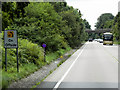
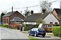
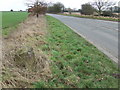
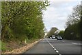
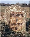
Living in NR19 2LR offers a quiet lifestyle within a defined residential cluster covering 12.4 hectares. This specific postcode serves a population of 1,552 people, creating a neighbourhood where the pace of life moves slower than in larger towns. The area is situated in England, providing a residential setting that balances isolation with practical access to nearby essentials. You will find that daily routines here are shaped by the local housing stock and the proximity to the town of Dereham, which lies within a short travel distance. The density of 44 people per square kilometre suggests a spread-out community rather than a high-rise city environment. Prospective buyers often choose this location for the sense of space they can enjoy without being entirely cut off from services. The area functions as a self-contained pocket of housing where residents value stability and a low-key atmosphere. Understanding the physical layout of this postcode helps you quantify the distances you need to cover for your morning commute or weekend shop.
- Area Type
- Postcode
- Area Size
- 12.4 hectares
- Population
- 1552
- Population Density
- 44 people/km²
The property market in NR19 2LR is dominated by houses, with no flats or apartments available within this 12.4 hectare cluster. Buyers looking here will find a stock consistent with rural or semi-rural living rather than urban density. The figure of 71% home ownership indicates that this area sits firmly in established ownership territory rather than as a hub for private rental investments. You are more likely to purchase a home you intend to live in for many years than to buy for short-term rental yield. The small population of 1,552 means the number of available transactions will be limited compared to larger districts in Norfolk. There are no multi-unit developments, so your options are restricted to single-family properties or detached homes typical of the region. When searching for homes in this area, expect to focus on traditional English housing styles suited to the local climate and landscape. The lack of rental properties for sale means the market is almost entirely composed of owner-occupiers looking to upgrade or move. This creates a stable environment but may reduce the frequency of new listings appearing on the market.
House Prices in NR19 2LR
Showing 23 properties
| Address | Type | Beds | Baths | Last Sale Price | Last Sale Date | |
|---|---|---|---|---|---|---|
| 27 Abbey Close, Wendling, NR19 2LR | house | - | - | £222,500 | Jun 2021 | |
| 28 Abbey Close, Wendling, NR19 2LR | Semi-detached | 3 | 1 | £230,000 | Sep 2020 | |
| 13 Abbey Close, Wendling, NR19 2LR | Bungalow | 3 | 1 | £160,000 | May 2020 | |
| 16 Abbey Close, Wendling, NR19 2LR | Bungalow | - | - | £246,000 | Apr 2020 | |
| 23 Abbey Close, Wendling, NR19 2LR | house | 3 | 1 | £95,000 | Mar 2019 | |
| 17 Abbey Close, Wendling, NR19 2LR | Bungalow | - | - | £180,500 | Apr 2013 | |
| 19 Abbey Close, Wendling, NR19 2LR | house | - | - | £187,500 | Dec 2012 | |
| 26 Abbey Close, Wendling, NR19 2LR | house | - | - | £159,950 | Jul 2012 | |
| 20 Abbey Close, Wendling, NR19 2LR | Bungalow | 3 | 2 | £190,000 | Jan 2012 | |
| 29 Abbey Close, Wendling, NR19 2LR | Semi-detached | 4 | 2 | £94,950 | May 2002 |
Energy Efficiency in NR19 2LR
Your daily life in NR19 2LR revolves around five retail outlets accessible within a practical reach. You can visit the East of England Co-operative Co for groceries or head to Iceland East for other essentials. The presence of a Co-op East provides a local touchstone for residents needing everyday items without travelling far. Beyond shopping, the nearest metro station is located in Dereham, offering a vital link to wider regional networks for your travel requirements. This connection allows you to commute to larger employment centres while maintaining your lifestyle in this quieter postcode. Adults in the area can walk or drive to these five shops for their weekly necessities. The town centre amenities found in Dereham likely complement the smaller retailers located within your immediate neighbourhood. There are no listed parks or leisure centres recorded within the data, but the proximity to Dereham ensures that major recreational facilities are not far away for those who need them. The 12.4 hectares of land give you space, and the nearby transport hub gives you access.
Amenities
Schools
| Rank | School | Type | Entry gender | Ages |
|---|
Explore more schools in this area
Go to Schools tabDemographics
The community in NR19 2LR is characterised by a steady demographic profile where the median age stands at 47 years. Most of the population falls into the adult working age range of 30 to 64 years, painting a picture of a mature, established neighbourhood. You do not find the transient young family demographic dominant here; instead, the residents are likely to be those who have already settled down. Home ownership is exceptionally high, with 71% of households owning their homes outright or with a mortgage. This level of stability typically correlates with families and retirees who value long-term residence over investment speculation. The accommodation type is restricted to houses, so you will not find flats or apartment blocks offered for sale in this postcode. The predominant ethnic group is White, which aligns with the typical demographic make-up of rural Norfolk. Deprivation data is not covered in the provided records, but the high ownership rate suggests financial stability among residents. The population density of 44 people per square kilometre helps explain why many neighbours may know each other through local history rather than shared work.
Household Size
Accommodation Type
Tenure
Ethnic Group
Religion
Household Composition
Age
Household Deprivation
NS-SEC
Explore more demographic insights in this area
Go to Demographics tabPlanning
Planning Constraints
- Flood RiskPremium
- Ramsar Wetland SitesPremium
- Area of Outstanding Natural BeautyPremium
- Protected Nature ReservePremium
- Protected WoodlandPremium