Area Overview for NR18 0YT
Photos of NR18 0YT
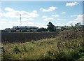
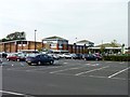
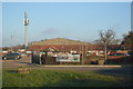

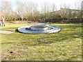
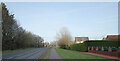
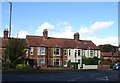
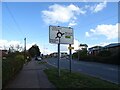
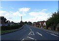
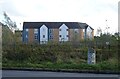
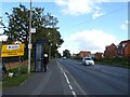
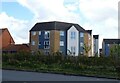
30 photos from this area
Area Information
Key information about the NR18 0YT including its size, population, and administrative classification.
- Area Type
- Postcode
- Area Size
- 1.0 hectares
- Population
- 1452
- Population Density
- 1115 people/km²
House Prices in NR18 0YT
15
Properties
£392,217
Average Sold Price
£266,995
Lowest Price
£515,000
Highest Price
Showing 15 properties
| Address | Type | Beds | Baths | Last Sale Price | Last Sale Date | |
|---|---|---|---|---|---|---|
| 240 Norwich Road, Wymondham, NR18 0YT | Detached | 5 | 3 | £460,000 | Oct 2024 | |
| 258 Norwich Road, Wymondham, NR18 0YT | Detached | 5 | 3 | £515,000 | Jul 2022 | |
| 242 Norwich Road, Wymondham, NR18 0YT | house | - | - | £266,995 | Jan 2020 | |
| 244 Norwich Road, Wymondham, NR18 0YT | house | - | - | £266,995 | Jan 2020 | |
| 246 Norwich Road, Wymondham, NR18 0YT | house | - | - | £350,450 | Nov 2019 | |
| 260 Norwich Road, Wymondham, NR18 0YT | Detached | 5 | 3 | £392,950 | Dec 2016 | |
| 264 Norwich Road, Wymondham, NR18 0YT | house | - | - | £400,000 | Dec 2016 | |
| 266 Norwich Road, Wymondham, NR18 0YT | Detached | 5 | 3 | £397,950 | Nov 2016 | |
| 262 Norwich Road, Wymondham, NR18 0YT | house | - | - | £340,950 | Nov 2016 | |
| 256 Norwich Road, Wymondham, NR18 0YT | house | - | - | £433,950 | Nov 2016 |
Page 1 of 2
Energy Efficiency in NR18 0YT
Amenities
Schools
| Rank | School | Type | Entry gender | Ages |
|---|
Explore more schools in this area
Go to Schools tabDemographics
Household Size
Family (3-5 people)
most common
Accommodation Type
Houses
most common
Tenure
75
majority
Ethnic Group
White
most common
Religion
N/A
most common
Household Composition
N/A
most common
Age
47
median
Adults (30-64 years)
most common
Household Deprivation
N/A
with no deprivation
NS-SEC
44
in Lower managerial occupations
Explore more demographic insights in this area
Go to Demographics tabPlanning
Planning Constraints
- Flood RiskPremium
- Ramsar Wetland SitesPremium
- Area of Outstanding Natural BeautyPremium
- Protected Nature ReservePremium
- Protected WoodlandPremium