Area Overview for NR18 0SR
Photos of NR18 0SR
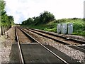
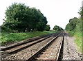
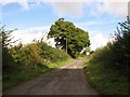
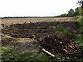
35 photos from this area
Area Information
Key information about the NR18 0SR including its size, population, and administrative classification.
- Area Type
- Postcode
- Area Size
- 12.4 hectares
- Population
- 1452
- Population Density
- 1115 people/km²
House Prices in NR18 0SR
11
Properties
£440,083
Average Sold Price
£132,000
Lowest Price
£750,000
Highest Price
Showing 11 properties
| Address | Type | Beds | Baths | Last Sale Price | Last Sale Date | |
|---|---|---|---|---|---|---|
| Corner Barn, Spinks Lane, Wymondham, NR18 0SR | Semi-detached | 5 | 2 | £750,000 | May 2023 | |
| 3 Spinks Lane, Wymondham, NR18 0SR | Semi-detached | 3 | 3 | £470,000 | Sep 2022 | |
| Tithe Barn, Spinks Lane, Wymondham, NR18 0SR | Semi-detached | 4 | 2 | £580,000 | May 2017 | |
| Bramble Barn, Spinks Lane, Wymondham, NR18 0SR | Bungalow | - | - | £347,500 | Jan 2013 | |
| 5 Spinks Lane, Wymondham, NR18 0SR | Detached | - | - | £361,000 | May 2007 | |
| Field View Barn, Spinks Lane, Wymondham, NR18 0SR | Bungalow | 3 | 3 | £132,000 | Apr 1998 | |
| 2, Milebridge Farm, Spinks Lane, Wymondham, NR18 0SR | Detached | 5 | 3 | - | - | |
| 1 Spinks Lane, Wymondham, NR18 0SR | house | 1 | - | - | - | |
| 9 Spinks Lane, Wymondham, NR18 0SR | Detached | - | - | - | - | |
| 7 Spinks Lane, Wymondham, NR18 0SR | Detached | - | - | - | - |
Page 1 of 2
Energy Efficiency in NR18 0SR
Amenities
Schools
| Rank | School | Type | Entry gender | Ages |
|---|
Explore more schools in this area
Go to Schools tabDemographics
Household Size
Family (3-5 people)
most common
Accommodation Type
Houses
most common
Tenure
75
majority
Ethnic Group
White
most common
Religion
N/A
most common
Household Composition
N/A
most common
Age
47
median
Adults (30-64 years)
most common
Household Deprivation
N/A
with no deprivation
NS-SEC
44
in Lower managerial occupations
Explore more demographic insights in this area
Go to Demographics tabPlanning
Planning Constraints
- Flood RiskPremium
- Ramsar Wetland SitesPremium
- Area of Outstanding Natural BeautyPremium
- Protected Nature ReservePremium
- Protected WoodlandPremium