Area Overview for NR13 6RU
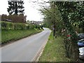
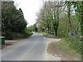
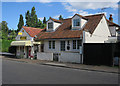
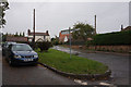
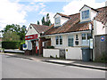
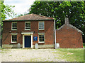
Photos of NR13 6RU
Area Information
Living in NR13 6RU means choosing a specific residential cluster defined by its quiet character and low density. This postcode covers an area of 15.4 hectares and currently houses a population of 1,475 people. With a population density of just 43 people per square kilometre, the environment feels spacious and unburdened by the urban rush found elsewhere. The area consists primarily of houses, creating a setting that avoids the concrete density of flats or apartments. Residents here enjoy a neighbourhood where space is a tangible asset, offering a retreat from larger towns while remaining accessible to local services. The community is established and stable, with long-term settlement evident in the existing infrastructure. Daily life revolves around this small footprint, where neighbouring relationships often stem from shared proximity in a less congested setting. Prospects looking for this specific feel find NR13 6RU to be a settled residential pocket rather than a developing frontier. The location stands as a self-contained unit within the wider region, prioritising a calm environment for those who value quiet over near-metropolitan convenience. ### The community in NR13 6RU reflects a settled demographic profile dominated by adults between the ages of 30 and 64. This adult-focused population correlates with a high level of stability, evidenced by a home ownership rate of 75%. The area is overwhelmingly occupied by houses, distinguishing it from mixed-use or high-density residential zones. The predominant ethnic group is White, mirroring the traditional character often found in established rural or semi-rural clusters. There is no significant youth population driving the local statistics; instead, the age profile suggests families and empty nesters who have put down roots. This demographic composition indicates a neighbourhood where long-term residents manage the housing stock rather than high turnover of renters or students. The concentrated age range means community plans and local services likely cater to working adults and mature families rather than young singles or elderly care needs. Such stability often supports consistent local governance and a predictable social environment for those seeking to settle permanently in the region. ### The property market in NR13 6RU is defined by a stock dominated by houses rather than apartments or flats. With 75% of residents owning their homes, the area functions as a classic owner-occupied community where ownership is the norm rather than the exception. This high ownership figure suggests a market driven by long-term investment and family settlement rather than short-term rental yields. Buyers seeking this specific postcode will find themselves entering a housing market where properties are typically held by families who have chosen to stay for the long term. The prevalence of houses aligns with the low population density and the 15.4 hectares of land available for occupation. This structure avoids the volatility often seen in student rentals or shared housing markets. Potential buyers should expect a competition for family-sized homes within this small cluster. The market dynamics reflect a desire for security and space, as opposed to the liquidity of urban rental sectors. Understanding this profile helps identify that NR13 6RU is less about flipping or renting and more about buying into a stable, house-centric environment. ### Families considering NR13 6RU have access to one school listed in the immediate vicinity: Fairhaven Church of England Voluntary Aided Primary School. This educational facility operates as a primary school and holds an Ofsted rating of good. The presence of this single institution within reach defines the educational landscape for younger children in the area. Parents planning their children's education can rely on a school that has met regulatory standards for quality. The mix of school types is naturally limited to primary education given the primary nature of the available school. This means older children would need to attend schools further away, outside the specific immediate catchment of NR13 6RU. The single primary school option offers a focused environment for early education before children move to secondary settings elsewhere. For residents, this creates a predictable educational journey that begins with established local provision. ### Digital connectivity in NR13 6RU presents a distinct challenge for remote workers and heavy internet users. Mobile network coverage scores 81 out of 100, indicating generally strong signal availability for personal devices and daily communications. However, fixed broadband quality scores only 31 out of 100, which represents a significant limitation for households relying on high-speed internet. This disparity means that while you can likely signal your phone reliably outside, running a video conference or streaming large files may be constrained. Working from home could be difficult during peak hours if your router depends on this fixed line. Daily internet use for downloading or uploading heavy media might face slower speeds compared to denser urban areas. Families streaming entertainment to multiple devices simultaneously might experience buffering issues. Residents using the internet for business purposes must accept these technical constraints before purchase. ### Daily life in NR13 6RU relies on a network of amenities located within practical reach. Residents have access to several railway stations to support travel, including Salhouse, Hoveton & Wroxham, and Brundall Gardens Railway Stations. For those requiring a metro link, Wroxham offers one option. For shopping and groceries, the nearest retail options include Co-op branches located at 122 and 49-53, alongside a Makro at Norwich. These specific venues provide essential supplies without requiring an extension to major city centres. The proximity of these transport hubs and supermarkets means that routine errands remain manageable. You can grocery shop at the Co-op branches or stock up at the Makro without excessive travel time. The availability of these five retail sites and five rail stations ensures that basic lifestyle needs are met efficiently. This balance between isolation and accessibility defines the practical rhythm of life for anyone living in this specific postcode. ### Safety and environmental profiles for NR13 6RU indicate a low-risk living environment across all measured categories. The area passes assessments with top scores, confirming it meets safety and planning standards without constraint. Crime risk is particularly reassuring, with a risk level rated as pass and a score of 93 out of 100. This high score signifies below-average crime rates, making it a safer neighbourhood compared to the broader region. Regarding flooding, the risk is negligible with a score of 0, indicating low flood risk coverage and no immediate threat of water damage. Planning constraints such as Ramsar wetland sites, Areas of Outstanding Natural Beauty, or protected woodlands do not apply here; the score for each is 0. This absence of environmental restrictions simplifies potential future developments or alterations to properties. Residents can sleep soundly knowing the neighbourhood avoids high-risk zones for crime, flooding, or strict nature conservation limits. ### What is the community feel like in NR13 6RU?The area hosts 1,475 residents across 15.4 hectares with a very low density of 43 people per square kilometre. The community is predominantly owner-occupied at 75%, consisting mainly of houses. The demographic is centered on adults aged 30 to 64, creating a stable, settled environment rather than a transient city centre vibe. Which schools are available near NR13 6RU?Families have access to Fairhaven Church of England Voluntary Aided Primary School, which is located nearby. This school is a primary institution holding an Ofsted rating of good. There are no secondary schools listed in the immediate data, meaning older children will attend schools further away. How good is internet connectivity in NR13 6RU?Mobile coverage is strong with a quality score of 81 out of 100. However, fixed broadband is limited, scoring only 31 out of 100. You can communicate reliably, but working from home or downloading large files will be slower than in urban areas. Is NR13 6RU safe and free from environmental risks?Yes, the area has a crime risk score of 93/100, indicating it is safer than average. It also carries zero risk scores for flooding, Ramsar sites, AONB status, and protected woodlands. There are no environmental planning constraints affecting the neighbourhood safety. What amenities are closest to NR13 6RU?You are within practical reach of Salhouse, Hoveton & Wroxham, and Brundall Gardens Railway Stations. For shopping and retail, the nearest options are Co-op branches at 122 and 49-53, plus the Makro Norwich store.
- Area Type
- Postcode
- Area Size
- 15.4 hectares
- Population
- 1475
- Population Density
- 43 people/km²
The property market in NR13 6RU is defined by a stock dominated by houses rather than apartments or flats. With 75% of residents owning their homes, the area functions as a classic owner-occupied community where ownership is the norm rather than the exception. This high ownership figure suggests a market driven by long-term investment and family settlement rather than short-term rental yields. Buyers seeking this specific postcode will find themselves entering a housing market where properties are typically held by families who have chosen to stay for the long term. The prevalence of houses aligns with the low population density and the 15.4 hectares of land available for occupation. This structure avoids the volatility often seen in student rentals or shared housing markets. Potential buyers should expect a competition for family-sized homes within this small cluster. The market dynamics reflect a desire for security and space, as opposed to the liquidity of urban rental sectors. Understanding this profile helps identify that NR13 6RU is less about flipping or renting and more about buying into a stable, house-centric environment. ### Families considering NR13 6RU have access to one school listed in the immediate vicinity: Fairhaven Church of England Voluntary Aided Primary School. This educational facility operates as a primary school and holds an Ofsted rating of good. The presence of this single institution within reach defines the educational landscape for younger children in the area. Parents planning their children's education can rely on a school that has met regulatory standards for quality. The mix of school types is naturally limited to primary education given the primary nature of the available school. This means older children would need to attend schools further away, outside the specific immediate catchment of NR13 6RU. The single primary school option offers a focused environment for early education before children move to secondary settings elsewhere. For residents, this creates a predictable educational journey that begins with established local provision. ### Digital connectivity in NR13 6RU presents a distinct challenge for remote workers and heavy internet users. Mobile network coverage scores 81 out of 100, indicating generally strong signal availability for personal devices and daily communications. However, fixed broadband quality scores only 31 out of 100, which represents a significant limitation for households relying on high-speed internet. This disparity means that while you can likely signal your phone reliably outside, running a video conference or streaming large files may be constrained. Working from home could be difficult during peak hours if your router depends on this fixed line. Daily internet use for downloading or uploading heavy media might face slower speeds compared to denser urban areas. Families streaming entertainment to multiple devices simultaneously might experience buffering issues. Residents using the internet for business purposes must accept these technical constraints before purchase. ### Daily life in NR13 6RU relies on a network of amenities located within practical reach. Residents have access to several railway stations to support travel, including Salhouse, Hoveton & Wroxham, and Brundall Gardens Railway Stations. For those requiring a metro link, Wroxham offers one option. For shopping and groceries, the nearest retail options include Co-op branches located at 122 and 49-53, alongside a Makro at Norwich. These specific venues provide essential supplies without requiring an extension to major city centres. The proximity of these transport hubs and supermarkets means that routine errands remain manageable. You can grocery shop at the Co-op branches or stock up at the Makro without excessive travel time. The availability of these five retail sites and five rail stations ensures that basic lifestyle needs are met efficiently. This balance between isolation and accessibility defines the practical rhythm of life for anyone living in this specific postcode. ### Safety and environmental profiles for NR13 6RU indicate a low-risk living environment across all measured categories. The area passes assessments with top scores, confirming it meets safety and planning standards without constraint. Crime risk is particularly reassuring, with a risk level rated as pass and a score of 93 out of 100. This high score signifies below-average crime rates, making it a safer neighbourhood compared to the broader region. Regarding flooding, the risk is negligible with a score of 0, indicating low flood risk coverage and no immediate threat of water damage. Planning constraints such as Ramsar wetland sites, Areas of Outstanding Natural Beauty, or protected woodlands do not apply here; the score for each is 0. This absence of environmental restrictions simplifies potential future developments or alterations to properties. Residents can sleep soundly knowing the neighbourhood avoids high-risk zones for crime, flooding, or strict nature conservation limits. ### What is the community feel like in NR13 6RU?The area hosts 1,475 residents across 15.4 hectares with a very low density of 43 people per square kilometre. The community is predominantly owner-occupied at 75%, consisting mainly of houses. The demographic is centered on adults aged 30 to 64, creating a stable, settled environment rather than a transient city centre vibe. Which schools are available near NR13 6RU?Families have access to Fairhaven Church of England Voluntary Aided Primary School, which is located nearby. This school is a primary institution holding an Ofsted rating of good. There are no secondary schools listed in the immediate data, meaning older children will attend schools further away. How good is internet connectivity in NR13 6RU?Mobile coverage is strong with a quality score of 81 out of 100. However, fixed broadband is limited, scoring only 31 out of 100. You can communicate reliably, but working from home or downloading large files will be slower than in urban areas. Is NR13 6RU safe and free from environmental risks?Yes, the area has a crime risk score of 93/100, indicating it is safer than average. It also carries zero risk scores for flooding, Ramsar sites, AONB status, and protected woodlands. There are no environmental planning constraints affecting the neighbourhood safety. What amenities are closest to NR13 6RU?You are within practical reach of Salhouse, Hoveton & Wroxham, and Brundall Gardens Railway Stations. For shopping and retail, the nearest options are Co-op branches at 122 and 49-53, plus the Makro Norwich store.
House Prices in NR13 6RU
Showing 6 properties
| Address | Type | Beds | Baths | Last Sale Price | Last Sale Date | |
|---|---|---|---|---|---|---|
| Holly Gate, Mill Hill, Salhouse, NR13 6RU | Detached | 4 | 1 | £370,000 | Jul 2015 | |
| Mill House, Mill Hill, Salhouse, NR13 6RU | Detached | 3 | 2 | £245,000 | Sep 2003 | |
| Hollybank, Mill Hill, Salhouse, NR13 6RU | Flat | 1 | 1 | £217,500 | May 2001 | |
| Mill Hill Cottage, Mill Hill, Salhouse, NR13 6RU | Cottage | 3 | 2 | £146,000 | Dec 1995 | |
| Hillside, 1 Mill Hill, Salhouse, NR13 6RU | Detached | - | - | - | - | |
| Hill Farm, Mill Hill, Salhouse, NR13 6RU | house | - | - | - | - |
Energy Efficiency in NR13 6RU
Daily life in NR13 6RU relies on a network of amenities located within practical reach. Residents have access to several railway stations to support travel, including Salhouse, Hoveton & Wroxham, and Brundall Gardens Railway Stations. For those requiring a metro link, Wroxham offers one option. For shopping and groceries, the nearest retail options include Co-op branches located at 122 and 49-53, alongside a Makro at Norwich. These specific venues provide essential supplies without requiring an extension to major city centres. The proximity of these transport hubs and supermarkets means that routine errands remain manageable. You can grocery shop at the Co-op branches or stock up at the Makro without excessive travel time. The availability of these five retail sites and five rail stations ensures that basic lifestyle needs are met efficiently. This balance between isolation and accessibility defines the practical rhythm of life for anyone living in this specific postcode. ### Safety and environmental profiles for NR13 6RU indicate a low-risk living environment across all measured categories. The area passes assessments with top scores, confirming it meets safety and planning standards without constraint. Crime risk is particularly reassuring, with a risk level rated as pass and a score of 93 out of 100. This high score signifies below-average crime rates, making it a safer neighbourhood compared to the broader region. Regarding flooding, the risk is negligible with a score of 0, indicating low flood risk coverage and no immediate threat of water damage. Planning constraints such as Ramsar wetland sites, Areas of Outstanding Natural Beauty, or protected woodlands do not apply here; the score for each is 0. This absence of environmental restrictions simplifies potential future developments or alterations to properties. Residents can sleep soundly knowing the neighbourhood avoids high-risk zones for crime, flooding, or strict nature conservation limits. ### What is the community feel like in NR13 6RU?The area hosts 1,475 residents across 15.4 hectares with a very low density of 43 people per square kilometre. The community is predominantly owner-occupied at 75%, consisting mainly of houses. The demographic is centered on adults aged 30 to 64, creating a stable, settled environment rather than a transient city centre vibe. Which schools are available near NR13 6RU?Families have access to Fairhaven Church of England Voluntary Aided Primary School, which is located nearby. This school is a primary institution holding an Ofsted rating of good. There are no secondary schools listed in the immediate data, meaning older children will attend schools further away. How good is internet connectivity in NR13 6RU?Mobile coverage is strong with a quality score of 81 out of 100. However, fixed broadband is limited, scoring only 31 out of 100. You can communicate reliably, but working from home or downloading large files will be slower than in urban areas. Is NR13 6RU safe and free from environmental risks?Yes, the area has a crime risk score of 93/100, indicating it is safer than average. It also carries zero risk scores for flooding, Ramsar sites, AONB status, and protected woodlands. There are no environmental planning constraints affecting the neighbourhood safety. What amenities are closest to NR13 6RU?You are within practical reach of Salhouse, Hoveton & Wroxham, and Brundall Gardens Railway Stations. For shopping and retail, the nearest options are Co-op branches at 122 and 49-53, plus the Makro Norwich store.
Amenities
Schools
Families considering NR13 6RU have access to one school listed in the immediate vicinity: Fairhaven Church of England Voluntary Aided Primary School. This educational facility operates as a primary school and holds an Ofsted rating of good. The presence of this single institution within reach defines the educational landscape for younger children in the area. Parents planning their children's education can rely on a school that has met regulatory standards for quality. The mix of school types is naturally limited to primary education given the primary nature of the available school. This means older children would need to attend schools further away, outside the specific immediate catchment of NR13 6RU. The single primary school option offers a focused environment for early education before children move to secondary settings elsewhere. For residents, this creates a predictable educational journey that begins with established local provision. ### Digital connectivity in NR13 6RU presents a distinct challenge for remote workers and heavy internet users. Mobile network coverage scores 81 out of 100, indicating generally strong signal availability for personal devices and daily communications. However, fixed broadband quality scores only 31 out of 100, which represents a significant limitation for households relying on high-speed internet. This disparity means that while you can likely signal your phone reliably outside, running a video conference or streaming large files may be constrained. Working from home could be difficult during peak hours if your router depends on this fixed line. Daily internet use for downloading or uploading heavy media might face slower speeds compared to denser urban areas. Families streaming entertainment to multiple devices simultaneously might experience buffering issues. Residents using the internet for business purposes must accept these technical constraints before purchase. ### Daily life in NR13 6RU relies on a network of amenities located within practical reach. Residents have access to several railway stations to support travel, including Salhouse, Hoveton & Wroxham, and Brundall Gardens Railway Stations. For those requiring a metro link, Wroxham offers one option. For shopping and groceries, the nearest retail options include Co-op branches located at 122 and 49-53, alongside a Makro at Norwich. These specific venues provide essential supplies without requiring an extension to major city centres. The proximity of these transport hubs and supermarkets means that routine errands remain manageable. You can grocery shop at the Co-op branches or stock up at the Makro without excessive travel time. The availability of these five retail sites and five rail stations ensures that basic lifestyle needs are met efficiently. This balance between isolation and accessibility defines the practical rhythm of life for anyone living in this specific postcode. ### Safety and environmental profiles for NR13 6RU indicate a low-risk living environment across all measured categories. The area passes assessments with top scores, confirming it meets safety and planning standards without constraint. Crime risk is particularly reassuring, with a risk level rated as pass and a score of 93 out of 100. This high score signifies below-average crime rates, making it a safer neighbourhood compared to the broader region. Regarding flooding, the risk is negligible with a score of 0, indicating low flood risk coverage and no immediate threat of water damage. Planning constraints such as Ramsar wetland sites, Areas of Outstanding Natural Beauty, or protected woodlands do not apply here; the score for each is 0. This absence of environmental restrictions simplifies potential future developments or alterations to properties. Residents can sleep soundly knowing the neighbourhood avoids high-risk zones for crime, flooding, or strict nature conservation limits. ### What is the community feel like in NR13 6RU?The area hosts 1,475 residents across 15.4 hectares with a very low density of 43 people per square kilometre. The community is predominantly owner-occupied at 75%, consisting mainly of houses. The demographic is centered on adults aged 30 to 64, creating a stable, settled environment rather than a transient city centre vibe. Which schools are available near NR13 6RU?Families have access to Fairhaven Church of England Voluntary Aided Primary School, which is located nearby. This school is a primary institution holding an Ofsted rating of good. There are no secondary schools listed in the immediate data, meaning older children will attend schools further away. How good is internet connectivity in NR13 6RU?Mobile coverage is strong with a quality score of 81 out of 100. However, fixed broadband is limited, scoring only 31 out of 100. You can communicate reliably, but working from home or downloading large files will be slower than in urban areas. Is NR13 6RU safe and free from environmental risks?Yes, the area has a crime risk score of 93/100, indicating it is safer than average. It also carries zero risk scores for flooding, Ramsar sites, AONB status, and protected woodlands. There are no environmental planning constraints affecting the neighbourhood safety. What amenities are closest to NR13 6RU?You are within practical reach of Salhouse, Hoveton & Wroxham, and Brundall Gardens Railway Stations. For shopping and retail, the nearest options are Co-op branches at 122 and 49-53, plus the Makro Norwich store.
| Rank | School | Type | Entry gender | Ages |
|---|
Explore more schools in this area
Go to Schools tabDemographics
The community in NR13 6RU reflects a settled demographic profile dominated by adults between the ages of 30 and 64. This adult-focused population correlates with a high level of stability, evidenced by a home ownership rate of 75%. The area is overwhelmingly occupied by houses, distinguishing it from mixed-use or high-density residential zones. The predominant ethnic group is White, mirroring the traditional character often found in established rural or semi-rural clusters. There is no significant youth population driving the local statistics; instead, the age profile suggests families and empty nesters who have put down roots. This demographic composition indicates a neighbourhood where long-term residents manage the housing stock rather than high turnover of renters or students. The concentrated age range means community plans and local services likely cater to working adults and mature families rather than young singles or elderly care needs. Such stability often supports consistent local governance and a predictable social environment for those seeking to settle permanently in the region. ### The property market in NR13 6RU is defined by a stock dominated by houses rather than apartments or flats. With 75% of residents owning their homes, the area functions as a classic owner-occupied community where ownership is the norm rather than the exception. This high ownership figure suggests a market driven by long-term investment and family settlement rather than short-term rental yields. Buyers seeking this specific postcode will find themselves entering a housing market where properties are typically held by families who have chosen to stay for the long term. The prevalence of houses aligns with the low population density and the 15.4 hectares of land available for occupation. This structure avoids the volatility often seen in student rentals or shared housing markets. Potential buyers should expect a competition for family-sized homes within this small cluster. The market dynamics reflect a desire for security and space, as opposed to the liquidity of urban rental sectors. Understanding this profile helps identify that NR13 6RU is less about flipping or renting and more about buying into a stable, house-centric environment. ### Families considering NR13 6RU have access to one school listed in the immediate vicinity: Fairhaven Church of England Voluntary Aided Primary School. This educational facility operates as a primary school and holds an Ofsted rating of good. The presence of this single institution within reach defines the educational landscape for younger children in the area. Parents planning their children's education can rely on a school that has met regulatory standards for quality. The mix of school types is naturally limited to primary education given the primary nature of the available school. This means older children would need to attend schools further away, outside the specific immediate catchment of NR13 6RU. The single primary school option offers a focused environment for early education before children move to secondary settings elsewhere. For residents, this creates a predictable educational journey that begins with established local provision. ### Digital connectivity in NR13 6RU presents a distinct challenge for remote workers and heavy internet users. Mobile network coverage scores 81 out of 100, indicating generally strong signal availability for personal devices and daily communications. However, fixed broadband quality scores only 31 out of 100, which represents a significant limitation for households relying on high-speed internet. This disparity means that while you can likely signal your phone reliably outside, running a video conference or streaming large files may be constrained. Working from home could be difficult during peak hours if your router depends on this fixed line. Daily internet use for downloading or uploading heavy media might face slower speeds compared to denser urban areas. Families streaming entertainment to multiple devices simultaneously might experience buffering issues. Residents using the internet for business purposes must accept these technical constraints before purchase. ### Daily life in NR13 6RU relies on a network of amenities located within practical reach. Residents have access to several railway stations to support travel, including Salhouse, Hoveton & Wroxham, and Brundall Gardens Railway Stations. For those requiring a metro link, Wroxham offers one option. For shopping and groceries, the nearest retail options include Co-op branches located at 122 and 49-53, alongside a Makro at Norwich. These specific venues provide essential supplies without requiring an extension to major city centres. The proximity of these transport hubs and supermarkets means that routine errands remain manageable. You can grocery shop at the Co-op branches or stock up at the Makro without excessive travel time. The availability of these five retail sites and five rail stations ensures that basic lifestyle needs are met efficiently. This balance between isolation and accessibility defines the practical rhythm of life for anyone living in this specific postcode. ### Safety and environmental profiles for NR13 6RU indicate a low-risk living environment across all measured categories. The area passes assessments with top scores, confirming it meets safety and planning standards without constraint. Crime risk is particularly reassuring, with a risk level rated as pass and a score of 93 out of 100. This high score signifies below-average crime rates, making it a safer neighbourhood compared to the broader region. Regarding flooding, the risk is negligible with a score of 0, indicating low flood risk coverage and no immediate threat of water damage. Planning constraints such as Ramsar wetland sites, Areas of Outstanding Natural Beauty, or protected woodlands do not apply here; the score for each is 0. This absence of environmental restrictions simplifies potential future developments or alterations to properties. Residents can sleep soundly knowing the neighbourhood avoids high-risk zones for crime, flooding, or strict nature conservation limits. ### What is the community feel like in NR13 6RU?The area hosts 1,475 residents across 15.4 hectares with a very low density of 43 people per square kilometre. The community is predominantly owner-occupied at 75%, consisting mainly of houses. The demographic is centered on adults aged 30 to 64, creating a stable, settled environment rather than a transient city centre vibe. Which schools are available near NR13 6RU?Families have access to Fairhaven Church of England Voluntary Aided Primary School, which is located nearby. This school is a primary institution holding an Ofsted rating of good. There are no secondary schools listed in the immediate data, meaning older children will attend schools further away. How good is internet connectivity in NR13 6RU?Mobile coverage is strong with a quality score of 81 out of 100. However, fixed broadband is limited, scoring only 31 out of 100. You can communicate reliably, but working from home or downloading large files will be slower than in urban areas. Is NR13 6RU safe and free from environmental risks?Yes, the area has a crime risk score of 93/100, indicating it is safer than average. It also carries zero risk scores for flooding, Ramsar sites, AONB status, and protected woodlands. There are no environmental planning constraints affecting the neighbourhood safety. What amenities are closest to NR13 6RU?You are within practical reach of Salhouse, Hoveton & Wroxham, and Brundall Gardens Railway Stations. For shopping and retail, the nearest options are Co-op branches at 122 and 49-53, plus the Makro Norwich store.
Household Size
Accommodation Type
Tenure
Ethnic Group
Religion
Household Composition
Age
Household Deprivation
NS-SEC
Explore more demographic insights in this area
Go to Demographics tabPlanning
Planning Constraints
- Flood RiskPremium
- Ramsar Wetland SitesPremium
- Area of Outstanding Natural BeautyPremium
- Protected Nature ReservePremium
- Protected WoodlandPremium