Area Overview for NR13 6QE
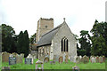
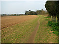
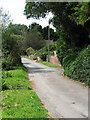
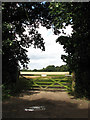
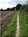
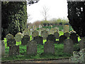
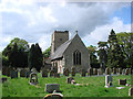
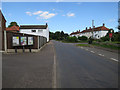
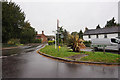
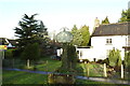
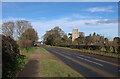
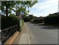
Photos of NR13 6QE
Area Information
Living in NR13 6QE offers a quiet residential experience within a specific cluster covering approximately 7050 square metres. This postcode serves a small local population of 1577 people, creating a distinct sense of scale for those considering a move here. The environment is defined by its compact nature, which fosters a close-knit local atmosphere rather than the anonymity of larger urban developments. You are residing in a space where the community size is significant enough to sustain daily interactions but small enough to maintain a peaceful living rhythm. The area sits comfortably within the broader Norwich context, offering residents a balance between proximity to town facilities and a settled village-style living arrangement. Daily life centres around the immediate neighbourhood, where the limited footprint means amenities and neighbours are never far away. This density allows for efficient use of space while preserving the character typical of established English residential zones. Whether you are assessing this location for a primary residence or a holiday home, the physical boundaries of this postcode provide a clear, contained setting. You gain a property situation that prioritises stability and community over rapid expansion or high-density apartment living.
- Area Type
- Postcode
- Area Size
- 7050 m²
- Population
- 1577
- Population Density
- 177 people/km²
The property market in NR13 6QE is fundamentally defined as an owner-occupied sector, with 84% of accommodations in this category. Houses form the standard form of accommodation for this postcode, meaning you will not find flats or purpose-built apartment blocks within these boundaries. This housing composition targets buyers seeking standalone or semi-detached properties rather than shared living arrangements typical of city centres. The high rate of home ownership signals a market where residents have chosen to settle permanently rather than rent temporarily. For those looking at homes in this area, certainty around tenure is a key feature, alongside the traditional architecture associated with detached or semi-detached structures. This lack of rental density means the street environment is likely populated by people with long-term vested interests in their homes and neighbourhood improvements. Buying property here involves entering a stable market where the local economy relies on resident income rather than the rental yield model. The physical layout of houses supports a suburban community feel, separating this postcode clearly from the high-density developments found near major transport hubs. Your search for specific accommodation types like flats would yield no results within this precise cluster, so focus remains entirely on house options.
House Prices in NR13 6QE
Showing 10 properties
| Address | Type | Beds | Baths | Last Sale Price | Last Sale Date | |
|---|---|---|---|---|---|---|
| 17 Mill Road, Salhouse, NR13 6QE | Semi-detached | 3 | 1 | £230,000 | Oct 2019 | |
| 21 Mill Road, Salhouse, NR13 6QE | Semi-detached | 3 | 1 | £280,000 | Oct 2019 | |
| Swiss Cottage, 12 Mill Road, Salhouse, NR13 6QE | Bungalow | 2 | - | £246,000 | Dec 2013 | |
| Homestead, 18 Mill Road, Salhouse, NR13 6QE | house | - | - | £173,000 | Mar 2007 | |
| Bramblebank, 16 Mill Road, Salhouse, NR13 6QE | Bungalow | 3 | 2 | - | - | |
| 11 Mill Road, Salhouse, NR13 6QE | Semi-detached | 3 | 1 | - | - | |
| Shaldon, 14 Mill Road, Salhouse, NR13 6QE | Semi-detached | 4 | - | - | - | |
| 16A Mill Road, Salhouse, NR13 6QE | Bungalow | 2 | - | - | - | |
| 19 Mill Road, Salhouse, NR13 6QE | Semi-detached | - | - | - | - | |
| 15 Mill Road, Salhouse, NR13 6QE | house | - | - | - | - |
Energy Efficiency in NR13 6QE
Residents of NR13 6QE benefit from convenient access to a practical range of amenities within easy reach. Local shopping needs are met by nearby supermarkets, including Makro Norwich, Lidl Sprowston, and Lidl Poppy, ensuring you can stock up on groceries efficiently. Retail trips do not require long journeys, as these large stores are situated close to the area. Five railway stations provide rail links for commuters, with Salhouse Railway Station, Hoveton & Wroxham Railway Station, and Brundall Gardens Railway Station offering nearby options. One metro-style station is also located nearby at Wroxham, adding further transport flexibility. For business travel, Norwich International Airport is available within a short distance, connecting you to national flights and regional holidays. This mix of rail and air transport options means you can choose between convenient train rides or faster flight times depending on your destination. The presence of multiple large retailers and varied rail access points ensures that daily errands and occasional long-distance travel are handled without hassle.
Amenities
Schools
Families in NR13 6QE have access to Salhouse CofE Primary School, which is located within practical reach for daily school runs. Salhouse CofE Primary School offers an Ofsted rating of satisfactory, indicating that the educational standards meet the required government benchmarks. As a primary institution, the school serves young children and forms the foundational education step for local families with children of school age. The presence of a single primary school listed for this immediate area suggests a clear educational path for youngest residents before they potentially move to secondary options elsewhere. You should expect a straightforward local schooling experience centred round this specific facility. The satisfactory rating confirms the school is functioning effectively within the state framework. There are no secondary schools or special educational needs colleges listed in the immediate vicinity of this postcode, meaning commuting for older children is a likely reality. Parents considering schools near NR13 6QE should factor in the distance to Salhouse CofE Primary School for younger years and plan for subsequent educational transitions beyond the primary phase.
| Rank | School | Type | Entry gender | Ages |
|---|
Explore more schools in this area
Go to Schools tabDemographics
The community in NR13 6QE reflects an older demographic profile, with a median age of 47 years. The largest group of residents falls within the adult bracket of 30 to 64 years, indicating a population in the prime earning and family-raising stages of life. This age distribution suggests a neighbourhood where stability is common and long-term residents form the backbone of the local fabric. Home ownership is exceptionally high at 84%, meaning nearly nine out of ten houses in this area are owned outright or with a mortgage by the occupier. This figure points to a stable housing stock where speculative buying for rental purposes is not the dominant market driver. The predominant ethnic group is White, aligning with the broader national average and contributing to a familiar cultural landscape for many families. Most suitable for owner-occupiers, this area offers few dynamics associated with transient tenant populations. The low population density of 177 people per square kilometre further reinforces a lifestyle characterised by space and calm rather than high-traffic urban bustle. You will find a society defined by permanence and established ties to the locality.
Household Size
Accommodation Type
Tenure
Ethnic Group
Religion
Household Composition
Age
Household Deprivation
NS-SEC
Explore more demographic insights in this area
Go to Demographics tabPlanning
Planning Constraints
- Flood RiskPremium
- Ramsar Wetland SitesPremium
- Area of Outstanding Natural BeautyPremium
- Protected Nature ReservePremium
- Protected WoodlandPremium