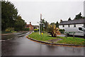
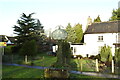
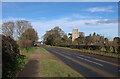
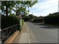
Area Overview for NR13 6QD
Photos of NR13 6QD
Area Information
NR13 6QD is a defined residential cluster covering 1.1 hectares in Norfolk. This small footprint hosts a population of 1577 residents, creating a neighbourhood where community members know one another through close physical proximity. With a density of 177 people per square kilometre, the area maintains a quiet domestic character while remaining accessible to wider facilities. Living in NR13 6QD means residing in an established environment where the immediate surroundings are tightly wound around a small group of households. The postcode captures a specific slice of Norfolk life, distinct for its compact size and concentrated living arrangements. Daily life here revolves around the practicalities of a local community where every resident shares the same immediate landscape. This concentration offers a sense of familiarity that wider, sparser suburbs cannot match.
- Area Type
- Postcode
- Area Size
- 1.1 hectares
- Population
- 1577
- Population Density
- 177 people/km²
The housing stock in NR13 6QD is overwhelmingly characterised by houses rather than flats or bungalows. This physical reality supports the high home ownership rate, which sits at 84% within this postcode sector. The area functions primarily as a family environment where established residents keep their properties for the long term. This concentration of houses means prospective buyers looking for traditional domestic settings will find their needs met here. The lack of flat options suggests that the local market serves families and couples seeking more space than an apartment provides. Living in this postcode reveals a property market shaped by decades of ownership rather than private renting or large-scale developments. The dominance of houses ensures that the built environment caters to children and multi-bedroom requirements.
House Prices in NR13 6QD
Showing 16 properties
| Address | Type | Beds | Baths | Last Sale Price | Last Sale Date | |
|---|---|---|---|---|---|---|
| 2 Farman Close, Salhouse, NR13 6QD | Semi-detached | 2 | 1 | £237,000 | Jan 2025 | |
| 20 Farman Close, Salhouse, NR13 6QD | Semi-detached | 3 | 2 | £260,000 | Jun 2017 | |
| 1 Farman Close, Salhouse, NR13 6QD | Semi-detached | 2 | 1 | £163,000 | Nov 2006 | |
| 6 Farman Close, Salhouse, NR13 6QD | Semi-detached | - | - | £56,750 | Apr 1999 | |
| 4 Farman Close, Salhouse, NR13 6QD | Terraced | - | - | £20,875 | Feb 1996 | |
| Pedestrian Access, Farman Close, Salhouse, NR13 6QD | Semi-detached | - | - | - | - | |
| 22 Farman Close, Salhouse, NR13 6QD | Bungalow | - | - | - | - | |
| 10 Farman Close, Salhouse, NR13 6QD | Terraced | - | - | - | - | |
| 5 Farman Close, Salhouse, NR13 6QD | Semi-detached | - | - | - | - | |
| 14 Farman Close, Salhouse, NR13 6QD | Semi-detached | - | - | - | - |
Energy Efficiency in NR13 6QD
Residents enjoy access to a range of retail and transport options within practical reach. Nearby retail outlets include Makro Norwich, Lidl Sprowston, and Lidl Poppy, providing access to groceries and general merchandise. Transport links connect you to Salhouse Railway Station, Hoveton & Wroxham Railway Station, and Brundall Gardens Railway Station. A metro service also reaches Wroxham. The city airport, Norwich International Airport, sits within reach for occasional travel. Living in NR13 6QD grants direct access to major supermarkets and rail stations without driving long distances. You can manage daily shopping at Lidl or Makro from the area. Rail connectivity offers multiple stations nearby for regional travel. These amenities combine to form a convenient part of daily life for inhabitants of the postcode.
Amenities
Schools
Families considering schools near NR13 6QD have Salhouse CofE Primary School available as a local option. This institution operates as a primary school and currently holds a Satisfactory rating from Ofsted. The name Salhouse CofE Primary School reflects its Christian ethos and religious affiliation, which may appeal to parents seeking faith-based education for their children. Having a satisfactory rating indicates that the school meets the standards required for local provision without higher praise. The presence of a primary school within reach serves the demographic profile of the area, where children constitute a portion of the adult population. This single listed option defines the immediate educational landscape for young residents in the postcode.
| Rank | School | Type | Entry gender | Ages |
|---|
Explore more schools in this area
Go to Schools tabDemographics
The community in NR13 6QD reflects a mature demographic profile. The median age for residents is 47 years, with the majority of the population falling into the adult bracket between 30 and 64 years old. This age distribution suggests a stable population base rather than a transient or student-heavy area. Home ownership stands at 84%, indicating that most households purchased their properties rather than renting. The predominant form of accommodation is houses, which aligns with the higher rate of ownership and the demographic skew towards established adults. Ethnically, the predominant group is White, mirroring the broader pattern for this specific part of Norfolk. These figures paint a picture of a settled neighbourhood where long-term residents are well established in their homes. The high ownership rate combined with the age profile implies a community focused on stability rather than short-term moves.
Household Size
Accommodation Type
Tenure
Ethnic Group
Religion
Household Composition
Age
Household Deprivation
NS-SEC
Explore more demographic insights in this area
Go to Demographics tabPlanning
Planning Constraints
- Flood RiskPremium
- Ramsar Wetland SitesPremium
- Area of Outstanding Natural BeautyPremium
- Protected Nature ReservePremium
- Protected WoodlandPremium