Area Overview for NR13 6NS
Photos of NR13 6NS
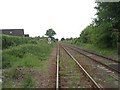
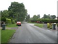
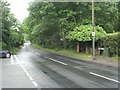
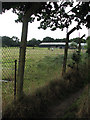
26 photos from this area
Area Information
Key information about the NR13 6NS including its size, population, and administrative classification.
- Area Type
- Postcode
- Area Size
- 4.7 hectares
- Population
- 1577
- Population Density
- 177 people/km²
House Prices in NR13 6NS
30
Properties
£184,443
Average Sold Price
£37,920
Lowest Price
£346,000
Highest Price
Showing 30 properties
| Address | Type | Beds | Baths | Last Sale Price | Last Sale Date | |
|---|---|---|---|---|---|---|
| 18 Wood Green, Salhouse, NR13 6NS | Bungalow | - | - | £270,000 | Sep 2021 | |
| 7 Wood Green, Salhouse, NR13 6NS | Chalet | 4 | 2 | £329,000 | Feb 2021 | |
| Kings Land, 1 Wood Green, Salhouse, NR13 6NS | Bungalow | 3 | - | £256,500 | Jan 2019 | |
| Cleome, Wood Green, Salhouse, NR13 6NS | Detached | 5 | 3 | £346,000 | May 2017 | |
| 14 Wood Green, Salhouse, NR13 6NS | Bungalow | - | - | £190,000 | Sep 2014 | |
| Barnfield, Wood Green, Salhouse, NR13 6NS | Detached | 4 | 2 | £310,000 | Jul 2014 | |
| 19 Wood Green, Salhouse, NR13 6NS | Bungalow | 3 | - | £167,500 | Jan 2014 | |
| 4 Wood Green, Salhouse, NR13 6NS | Detached | - | - | £155,000 | May 2013 | |
| 22 Wood Green, Salhouse, NR13 6NS | Bungalow | 2 | 1 | £139,000 | Apr 2011 | |
| 5 Wood Green, Salhouse, NR13 6NS | Detached | - | - | £225,500 | Jul 2007 |
Page 1 of 3
Energy Efficiency in NR13 6NS
Amenities
Schools
| Rank | School | Type | Entry gender | Ages |
|---|
Explore more schools in this area
Go to Schools tabDemographics
Household Size
Two person
most common
Accommodation Type
Houses
most common
Tenure
84
majority
Ethnic Group
White
most common
Religion
N/A
most common
Household Composition
N/A
most common
Age
47
median
Adults (30-64 years)
most common
Household Deprivation
N/A
with no deprivation
NS-SEC
36
in Lower managerial occupations
Explore more demographic insights in this area
Go to Demographics tabPlanning
Planning Constraints
- Flood RiskPremium
- Ramsar Wetland SitesPremium
- Area of Outstanding Natural BeautyPremium
- Protected Nature ReservePremium
- Protected WoodlandPremium