Area Overview for NR13 5DQ
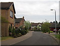
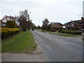
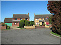
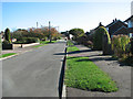
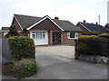
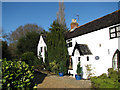
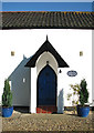
Photos of NR13 5DQ


Area Information
Living in NR13 5DQ offers a distinct experience within the Norwich postcode landscape. This specific postcode covers a small residential cluster containing roughly 1441 people across about 1.3 hectares. With a population density of 270 people per square kilometre, the area feels intimate yet connected to wider urban networks. You will find a community defined by practical proximity to key services rather than isolated rural isolation. Daily life here balances the quiet of a small cluster with the accessibility of major shopping and transport hubs. The area supports everyday routines efficiently, allowing residents to access retail and rail links without extensive travel. Prospective buyers should expect a neighbourhood that prioritises function and reachability. The compact nature of this postcode means you can reach places quickly while remaining in a settled residential environment. It is a space where local needs are met by nearby infrastructure, creating a straightforward living experience. You do not have to choose between convenience and community feel when considering homes in NR13 5DQ.
- Area Type
- Postcode
- Area Size
- 1.3 hectares
- Population
- 1441
- Population Density
- 270 people/km²
The housing market in NR13 5DQ is characterised by significant owner-occupation rates. Approximately 60% of residents own their homes outright, establishing this as a predominantly owner-occupier area rather than a rental market. This statistic indicates that the majority of properties are settled homes with long-term residents who have made substantial investments in the local stock. You will encounter a diverse range of property types suitable for families and empty nesters alike, though specific deed data suggests a broad variety of accommodation. The low population density of 270 people per square kilometre points to properties that offer reasonable space without the congestion of high-density blocks. Buyers looking for stability will find this area appealing, as fewer tenants drive the market compared to student or commuter clusters. The 1441 residents are spread across this 1.3-hectare cluster, suggesting a spread-out yet accessible layout of housing. This market dynamic means you are less likely to face rapid turnover, providing a quieter, more settled environment for purchasing homes in NR13 5DQ.
House Prices in NR13 5DQ
Showing 12 properties
| Address | Type | Beds | Baths | Last Sale Price | Last Sale Date | |
|---|---|---|---|---|---|---|
| 10 Hallgate, Thorpe End, NR13 5DQ | Detached | 4 | 2 | £500,000 | May 2025 | |
| Charton House, 6 Hallgate, Thorpe End, NR13 5DQ | house | - | - | £425,000 | Apr 2014 | |
| 7 Hallgate, Thorpe End, NR13 5DQ | Detached | 5 | 3 | £435,000 | Jun 2010 | |
| 12 Hallgate, Thorpe End, NR13 5DQ | Detached | - | - | £280,000 | Sep 2008 | |
| 1 Hallgate, Thorpe End, NR13 5DQ | house | - | - | £307,500 | May 2006 | |
| 14 Hallgate, Thorpe End, NR13 5DQ | Detached | - | - | £310,000 | Sep 2005 | |
| 4 Hallgate, Thorpe End, NR13 5DQ | Detached | - | - | £263,000 | Sep 2005 | |
| 16 Hallgate, Thorpe End, NR13 5DQ | Detached | - | - | £165,000 | Oct 2000 | |
| 3 Hallgate, Thorpe End, NR13 5DQ | Detached | 5 | 3 | £124,000 | Jul 1997 | |
| 8 Hallgate, Thorpe End, NR13 5DQ | Detached | - | - | £100,000 | May 1996 |
Energy Efficiency in NR13 5DQ
Daily life in NR13 5DQ benefits from a cluster of nearby amenities within practical reach. Residents have access to five retail locations, including Makro Norwich, Tesco Norwich, and Lidl Sprowston, ensuring your grocery and household shopping needs are easily met. You do not need to travel far for weekly essentials, as these supermarkets lie close to the residential cluster. Transport options are equally convenient, with five nearby rail stations such as Salhouse Railway Station and Norwich Railway Station facilitating easy commutes. There is also one metro link to Wroxham available for leisure trips or regional travel. One airport facility serves the area, connecting you to wider destinations for business or holidays. These facilities are integrated into your daily routine, offering a balance of convenience without leaving the comfort of your postcode. The presence of three national chains in retail, combined with good rail connectivity, means you enjoy a lifestyle that feels both local and connected to the wider city network. Homes in NR13 5DQ sit close enough to these services to ensure you rarely feel cut off from urban conveniences.
Amenities
Schools
| Rank | School | Type | Entry gender | Ages |
|---|
Explore more schools in this area
Go to Schools tabDemographics
The community profile in NR13 5DQ reflects a standard residential demographic for the region. With a total population of 1441, the area accommodates a steady number of households focused on stable living arrangements. About 60% of residents own their homes outright, indicating a strong base of owner-occupiers rather than landlords or long-term tenants. This ownership rate suggests residents are likely invested in the local area for the long term. The remaining population includes those with mortgages and occasional renters seeking secure accommodation. You will find a mix of families and individuals living in the housing stock typical of this postcode sector. The population density of 270 people per square kilometre creates a relatively low-pressure environment compared to high-density urban centres. Neighbours in NR13 5DQ likely value the balance between private space and access to communal resources. This demographic structure supports a stable community environment where established homeowners form the majority of the resident profile.
Household Size
Accommodation Type
Tenure
Ethnic Group
Religion
Household Composition
Age
Household Deprivation
NS-SEC
Explore more demographic insights in this area
Go to Demographics tabPlanning
Planning Constraints
- Flood RiskPremium
- Ramsar Wetland SitesPremium
- Area of Outstanding Natural BeautyPremium
- Protected Nature ReservePremium
- Protected WoodlandPremium