Area Overview for NR13 5BQ
Photos of NR13 5BQ
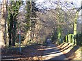
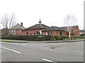
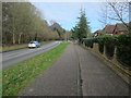
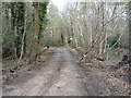
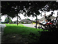
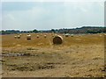
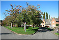
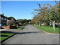
16 photos from this area
Area Information
Key information about the NR13 5BQ including its size, population, and administrative classification.
- Area Type
- Postcode
- Area Size
- 16.8 hectares
- Population
- 1448
- Population Density
- 1437 people/km²
House Prices in NR13 5BQ
26
Properties
£269,762
Average Sold Price
£69,500
Lowest Price
£515,000
Highest Price
Showing 26 properties
| Address | Type | Beds | Baths | Last Sale Price | Last Sale Date | |
|---|---|---|---|---|---|---|
| 22 Heath Road, Thorpe End, NR13 5BQ | Chalet | 3 | 2 | £450,000 | Sep 2025 | |
| 2 Heath Road, Thorpe End, NR13 5BQ | Detached | 3 | 1 | £295,000 | Feb 2020 | |
| The Anchorage, 7 Heath Road, Thorpe End, NR13 5BQ | Detached | 3 | 1 | £329,000 | Sep 2019 | |
| 24 Heath Road, Thorpe End, NR13 5BQ | Detached | 5 | 2 | £515,000 | Aug 2019 | |
| The Marrams, 21 Heath Road, Thorpe End, NR13 5BQ | Detached | 3 | 2 | £437,000 | Feb 2019 | |
| Heathcote, 3 Heath Road, Thorpe End, NR13 5BQ | Bungalow | 2 | - | £220,000 | Sep 2014 | |
| 6 Heath Road, Thorpe End, NR13 5BQ | Detached | 2 | - | £223,000 | Aug 2012 | |
| The Lodge, 1 Heath Road, Thorpe End, NR13 5BQ | Detached | - | - | £327,500 | Nov 2009 | |
| 23 Heath Road, Thorpe End, NR13 5BQ | Detached | 5 | 3 | £295,000 | Aug 2003 | |
| The Hawthorns, 5 Heath Road, Thorpe End, NR13 5BQ | Bungalow | - | - | £163,950 | Nov 2001 |
Page 1 of 3
Energy Efficiency in NR13 5BQ
Amenities
Schools
| Rank | School | Type | Entry gender | Ages |
|---|
Explore more schools in this area
Go to Schools tabDemographics
Household Size
One person
most common
Accommodation Type
Houses
most common
Tenure
68
majority
Ethnic Group
White
most common
Religion
N/A
most common
Household Composition
N/A
most common
Age
47
median
Adults (30-64 years)
most common
Household Deprivation
N/A
with no deprivation
NS-SEC
33
in Lower managerial occupations
Explore more demographic insights in this area
Go to Demographics tabPlanning
Planning Constraints
- Flood RiskPremium
- Ramsar Wetland SitesPremium
- Area of Outstanding Natural BeautyPremium
- Protected Nature ReservePremium
- Protected WoodlandPremium