Area Overview for NR13 6UE
Photos of NR13 6UE
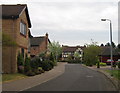
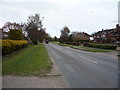
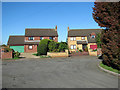
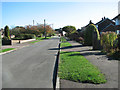
11 photos from this area
Area Information
Key information about the NR13 6UE including its size, population, and administrative classification.
- Area Type
- Postcode
- Area Size
- 7.8 hectares
- Population
- 2259
- Population Density
- 1214 people/km²
House Prices in NR13 6UE
73
Properties
£326,218
Average Sold Price
£226,097
Lowest Price
£443,018
Highest Price
Showing 73 properties
| Address | Type | Beds | Baths | Last Sale Price | Last Sale Date | |
|---|---|---|---|---|---|---|
| 23 Metcalf Road, Sprowston, NR13 6UE | Semi-detached | 4 | 1 | £422,746 | Jun 2024 | |
| 73 Metcalf Road, Sprowston, NR13 6UE | house | - | - | £341,996 | Jun 2024 | |
| 29 Metcalf Road, Sprowston, NR13 6UE | house | - | - | £443,018 | Jun 2024 | |
| 77 Metcalf Road, Sprowston, NR13 6UE | house | - | - | £279,354 | Jun 2024 | |
| 75 Metcalf Road, Sprowston, NR13 6UE | house | - | - | £279,324 | Jun 2024 | |
| 65 Metcalf Road, Sprowston, NR13 6UE | house | - | - | £279,069 | Jun 2024 | |
| 71 Metcalf Road, Sprowston, NR13 6UE | house | - | - | £303,445 | Jun 2024 | |
| 59 Metcalf Road, Sprowston, NR13 6UE | house | - | - | £313,499 | Jun 2024 | |
| 33 Metcalf Road, Sprowston, NR13 6UE | house | - | - | £337,246 | May 2024 | |
| 79 Metcalf Road, Sprowston, NR13 6UE | house | - | - | £380,000 | May 2024 |
Page 1 of 8
Energy Efficiency in NR13 6UE
Amenities
Schools
| Rank | School | Type | Entry gender | Ages |
|---|
Explore more schools in this area
Go to Schools tabDemographics
Household Size
Two person
most common
Accommodation Type
Houses
most common
Tenure
77
majority
Ethnic Group
White
most common
Religion
N/A
most common
Household Composition
N/A
most common
Age
47
median
Adults (30-64 years)
most common
Household Deprivation
N/A
with no deprivation
NS-SEC
33
in Lower managerial occupations
Explore more demographic insights in this area
Go to Demographics tabPlanning
Planning Constraints
- Flood RiskPremium
- Ramsar Wetland SitesPremium
- Area of Outstanding Natural BeautyPremium
- Protected Nature ReservePremium
- Protected WoodlandPremium