Area Overview for NR13 3DY
Photos of NR13 3DY
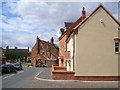
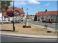
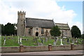
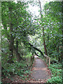
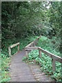
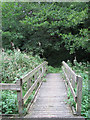
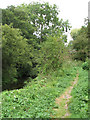
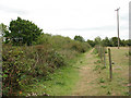


100 photos from this area
Area Information
Key information about the NR13 3DY including its size, population, and administrative classification.
- Area Type
- Postcode
- Area Size
- 1.5 hectares
- Population
- 1326
- Population Density
- 199 people/km²
House Prices in NR13 3DY
15
Properties
£212,750
Average Sold Price
£32,500
Lowest Price
£393,000
Highest Price
Showing 15 properties
| Address | Type | Beds | Baths | Last Sale Price | Last Sale Date | |
|---|---|---|---|---|---|---|
| High House, The Street, Acle, NR13 3DY | Detached | 4 | 3 | £393,000 | Dec 2015 | |
| Cripsey Cottage, The Street, Acle, NR13 3DY | Terraced | - | - | £32,500 | Mar 1999 | |
| Flat, High Grade House, The Street, Acle, NR13 3DY | Flat | 2 | 2 | - | - | |
| Room 3, Old Bank House, The Street, Acle, NR13 3DY | Office | - | - | - | - | |
| The Attic, Office Above, Zen Hair Studio, The Street, Acle, NR13 3DY | Office | - | - | - | - | |
| Savannah Estates, The Street, Acle, NR13 3DY | retail_financial | - | - | - | - | |
| Idea The Village Emporium, High House, The Street, Acle, NR13 3DY | shop | - | - | - | - | |
| Hi Grade House Skin Clinic And Boutique, High Grade House, The Street, Acle, NR13 3DY | retail_financial | - | - | - | - | |
| Acle Parish Council, First Floor Office, Brian Grint Centre, The Street, Acle, NR13 3DY | Office | - | - | - | - | |
| Top Flat, Queens Head House, The Street, Acle, NR13 3DY | Flat | - | - | - | - |
Page 1 of 2
Energy Efficiency in NR13 3DY
Amenities
Schools
| Rank | School | Type | Entry gender | Ages |
|---|
Explore more schools in this area
Go to Schools tabDemographics
Household Size
Two person
most common
Accommodation Type
Houses
most common
Tenure
68
majority
Ethnic Group
White
most common
Religion
N/A
most common
Household Composition
N/A
most common
Age
47
median
Adults (30-64 years)
most common
Household Deprivation
N/A
with no deprivation
NS-SEC
30
in Lower managerial occupations
Explore more demographic insights in this area
Go to Demographics tabPlanning
Planning Constraints
- Flood RiskPremium
- Ramsar Wetland SitesPremium
- Area of Outstanding Natural BeautyPremium
- Protected Nature ReservePremium
- Protected WoodlandPremium