Area Overview for NR13 3DX
Photos of NR13 3DX
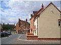
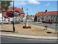
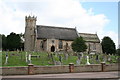
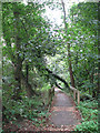
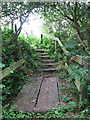

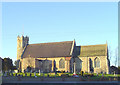

100 photos from this area
Area Information
Key information about the NR13 3DX including its size, population, and administrative classification.
- Area Type
- Postcode
- Area Size
- 8710 m²
- Population
- 1326
- Population Density
- 199 people/km²
House Prices in NR13 3DX
26
Properties
£154,901
Average Sold Price
£41,387
Lowest Price
£485,000
Highest Price
Showing 26 properties
| Address | Type | Beds | Baths | Last Sale Price | Last Sale Date | |
|---|---|---|---|---|---|---|
| Pricot, The Street, Acle, NR13 3DX | house | - | - | £140,027 | Jun 2024 | |
| 6 The Street, Acle, NR13 3DX | Terraced | 3 | 1 | £215,000 | Dec 2023 | |
| Beaconsfield House, The Street, Acle, NR13 3DX | Detached | 5 | 2 | £52,820 | Aug 2023 | |
| 12 The Street, Acle, NR13 3DX | house | - | - | £220,000 | Jun 2022 | |
| 24 The Street, Acle, NR13 3DX | Terraced | 2 | 1 | £220,000 | Apr 2022 | |
| Church View, 2 The Street, Acle, NR13 3DX | Detached | 5 | 3 | £485,000 | Mar 2021 | |
| 14 The Street, Acle, NR13 3DX | house | - | - | £209,500 | Jan 2021 | |
| 10 The Street, Acle, NR13 3DX | Terraced | 3 | 1 | £182,500 | Aug 2018 | |
| 4 The Street, Acle, NR13 3DX | Terraced | 3 | 1 | £200,000 | Nov 2017 | |
| 42 The Street, Acle, NR13 3DX | Flat | 3 | 2 | £160,000 | Aug 2017 |
Page 1 of 3
Energy Efficiency in NR13 3DX
Amenities
Schools
| Rank | School | Type | Entry gender | Ages |
|---|
Explore more schools in this area
Go to Schools tabDemographics
Household Size
Two person
most common
Accommodation Type
Houses
most common
Tenure
68
majority
Ethnic Group
White
most common
Religion
N/A
most common
Household Composition
N/A
most common
Age
47
median
Adults (30-64 years)
most common
Household Deprivation
N/A
with no deprivation
NS-SEC
30
in Lower managerial occupations
Explore more demographic insights in this area
Go to Demographics tabPlanning
Planning Constraints
- Flood RiskPremium
- Ramsar Wetland SitesPremium
- Area of Outstanding Natural BeautyPremium
- Protected Nature ReservePremium
- Protected WoodlandPremium