Area Overview for NR12 8YR
Photos of NR12 8YR

Area Information
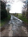
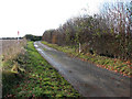
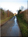
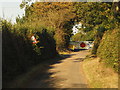
NR12 8YR represents a residential cluster defined by its specific postcode boundaries, covering just 35.7 hectares. This small geographical footprint contains a population of 2,298 people, creating a tightly knit environment where local issues are felt directly. The density of 154 people per square kilometre suggests a settled community rather than a sprawling development. Living in NR12 8YR means residing in a specific, defined slice of the Broads area where every street corner is part of the larger mosaic. The area functions as a quiet residential outpost, distinct for its confined size and stable population base. Prospective buyers here are purchasing into a known quantity rather than an ambiguous rural expanse. You are entering a neighbourhood where the scale of development keeps boundary disputes and land management straightforward. The character of the area is shaped by its modest size, ensuring that residents live in a finite space rather than endless countryside. Daily life revolves around this compact perimeter, offering a sense of closure and community that larger districts often lack. This postcode area serves as a functional residential unit within the wider Norfolk landscape.
- Area Type
- Postcode
- Area Size
- 35.7 hectares
- Population
- 2298
- Population Density
- 154 people/km²
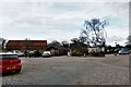
Homes in NR12 8YR are almost exclusively houses, reflecting the area's lack of apartment blocks or flats. This single-property stock type simplifies the search for buyers looking for detached or semi-detached living. The 74 per cent home ownership rate confirms that this is an owner-occupied area rather than a rental hub for university students or transient workers. The housing market here is stable because long-term residents hold the majority of properties. When viewing properties in this postcode, you will be dealing with houses that have likely been in the same family for generations. The absence of private rented sector fats creates a market devoid of short-term lettings and letting agents dominating the streets. Buyers should expect steady property prices driven by local demand among the elderly population. This market structure offers clarity for purchasers who dislike the volatility of student rental districts. Every listing represents a potential buyer rather than a potential tenant.
House Prices in NR12 8YR
Showing 19 properties
| Address | Type | Beds | Baths | Last Sale Price | Last Sale Date | |
|---|---|---|---|---|---|---|
| The Willow, Stone Lane, Ashmanhaugh, NR12 8YR | Bungalow | 3 | 2 | £475,000 | Sep 2022 | |
| Biscayne, Stone Lane, Ashmanhaugh, NR12 8YR | Detached | - | - | £91,330 | Jun 2018 | |
| Girvan, Stone Lane, Ashmanhaugh, NR12 8YR | Bungalow | - | - | £335,000 | Aug 2017 | |
| Hoveton Old Hall, Stone Lane, Ashmanhaugh, NR12 8YR | house | 7 | - | £1,350,000 | Feb 2016 | |
| Reprise, Stone Lane, Ashmanhaugh, NR12 8YR | Detached | - | - | £263,000 | Jan 2006 | |
| Woodlands, Stone Lane, Ashmanhaugh, NR12 8YR | Detached | - | - | £225,000 | Jul 2005 | |
| El Zerka, Stone Lane, Ashmanhaugh, NR12 8YR | Semi-detached | - | - | £114,500 | Apr 2004 | |
| Carousel, Stone Lane, Ashmanhaugh, NR12 8YR | Detached | - | - | £227,500 | Nov 2001 | |
| Viewlands, Stone Lane, Ashmanhaugh, NR12 8YR | Semi-detached | - | - | £59,999 | Jan 2000 | |
| Oak View, Stone Lane, Ashmanhaugh, NR12 8YR | Bungalow | - | - | £35,000 | May 1997 |
Energy Efficiency in NR12 8YR
Living in NR12 8YR places you within practical reach of several key amenities despite the area's small size. Residents can access four railway stations including Hoveton & Wroxham Railway Station, Worstead Railway Station, and Salhouse Railway Station. These rail links provide a direct route to Norwich and London without being directly adjacent to the station itself. For daily shopping needs, five retail options are close by, such as Tesco Norwich, East of England Co-operative Co, and Morrisons Daily. These supermarkets offer everything from fresh produce to household essentials. The nearest significant town is Wroxham, which acts as a social and entertainment hub. This town provides cafes, restaurants, and leisure facilities that are merely a short drive away. You do not need to live in the town to enjoy its benefits while retaining your rural privacy in NR12 8YR. The combination of local supermarkets and nearby rail access ensures that convenience remains within a manageable distance.
Amenities
Schools
Families living near NR12 8YR have access to specific educational institutions that serve the broader local education authority area. You can send your children to St John's Community Primary School and Nursery, which holds a Good Ofsted rating. This primary school offers a reassuring standard of education for younger children in the vicinity. Broadland High School operates as a secondary option providing continuity for older pupils from the same locality. For those requiring academy-style management and curriculum options, Broadland High Ormiston Academy is available within reach of residents. Although NR12 8YR itself is a small residential cluster, these named schools form the backbone of local education provision. The mix of a highly rated community primary and academy secondary schools gives families multiple pathways for their children's education. These institutions are integrated into the daily routine of parents buying homes in this specific postcode.
| Rank | School | Type | Entry gender | Ages |
|---|
Explore more schools in this area
Go to Schools tabDemographics
The community in NR12 8YR reflects an established demographic profile with one of the highest median ages in the country at 47 years. The most common age range comprises elderly residents over 65 years old, which signals a location dominated by retirees. Career-break residents and young families are fewer in number compared to older demographics. Home ownership stands at 74 per cent, indicating that most people living here own their homes outright or with a mortgage. This high rate of ownership contrasts sharply with vibrant rental markets found elsewhere. Houses dominate the accommodation type, meaning you are unlikely to encounter blocks of flats or high-density living. The predominant ethnic group is White, suggesting a traditional, homogenous population structure typical of rural Norfolk. With three quarters of households owned and an ageing population, the area feels permanent and settled. This demographic split means the local shops and services cater to mature tastes rather than trends driven by younger consumers.
Household Size
Accommodation Type
Tenure
Ethnic Group
Religion
Household Composition
Age
Household Deprivation
NS-SEC
Explore more demographic insights in this area
Go to Demographics tabPlanning
Planning Constraints
- Flood RiskPremium
- Ramsar Wetland SitesPremium
- Area of Outstanding Natural BeautyPremium
- Protected Nature ReservePremium
- Protected WoodlandPremium